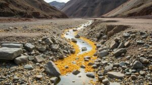
Using Vegetation Patterns to Locate Hidden Placer Deposits
Using Vegetation Patterns to Locate Hidden Placer Deposits
The search for placer deposits, which are valuable minerals and metals concentrated by natural processes, often leads prospectors to examine their surroundings closely. One of the more innovative methods employed in this pursuit is the analysis of vegetation patterns. This article explores how vegetation serves as an indirect indicator of underlying mineral deposits, offering insight into locating hidden placer deposits effectively.
The Relationship Between Vegetation and Geology
Vegetation patterns can provide critical clues about underlying geological features. Plants often thrive in certain soil and environmental conditions, which can be influenced by the geological substrate beneath them. In particular, the presence of certain minerals can alter the soils composition, moisture retention, and overall fertility.
For example, areas rich in gold occasionally exhibit distinct vegetation patterns. Gold-bearing gravel deposits can create less-permeable soils, resulting in a different plant community compared to surrounding areas. When prospectors notice variations in plant growth or species diversity, it may signal the potential presence of placer deposits.
Analyzing Vegetation Indicators
To effectively use vegetation patterns to locate placer deposits, prospectors can focus on several key indicators:
- Species Composition: Certain plant species flourish in mineral-rich soils. For example, the presence of rushes or certain types of grasses can indicate wetland conditions where placers may accumulate.
- Growth Patterns: Areas with stunted or abnormal plant growth can suggest underlying mineralization. These anomalies can be indicative of high metal concentrations in the soil.
- Soil Color and Type: Different minerals affect soil coloration. Red or yellow soil may indicate iron oxide, while darker soils may suggest organic matter influenced by mineral deposits.
Case Studies and Real-World Applications
Numerous case studies illustrate the effectiveness of using vegetation patterns in placer mining. In the Klondike region of Yukon, Canada, gold miners observed that certain low-lying areas, characterized by distinct vegetation, showed promising signs of accumulated placer gold. These observations led to the successful discovery of significant gold deposits, demonstrating the practical application of vegetative clues.
Another example can be drawn from the Sierra Nevada region of California, where the unique flora found in historically mined areas reflects underlying geological processes that concentrate minerals. Miners often utilized botanical observations to direct their exploration efforts during the historic Gold Rush, linking plant types to hidden wealth beneath the earth.
Methodological Approaches to Vegetation Analysis
Prospectors often employ various tools and methodologies to analyze vegetation patterns effectively, which can lead to more targeted exploration efforts.
Remote Sensing and GIS
Remote sensing technology and Geographic Information Systems (GIS) have revolutionized how vegetation patterns are mapped and analyzed. By using satellite imagery and aerial surveys, geologists can identify large-scale vegetation variations and correlate these patterns with geological data. This technological integration allows for a more comprehensive understanding of the landscape and hidden mineral wealth.
Field Surveys and Ground-Truthing
While remote sensing provides valuable information, ground-truthing remains essential. Field surveys enable prospectors to collect soil samples and analyze plant properties directly. This hands-on approach ensures accurate interpretation of the data gathered and provides a clearer link between vegetation and mineral deposits.
Conclusion and Actionable Takeaways
Using vegetation patterns to locate hidden placer deposits is a potent tool in the toolkit of modern prospectors. By understanding the relationship between plant growth and geological conditions, miners can enhance their exploratory strategies, leading to more successful outcomes. Here are some key takeaways for prospectors:
- Study local flora and their typical environmental conditions to identify potential areas for placer deposits.
- Use remote sensing and GIS to analyze broad vegetation patterns over geological maps for efficient targeting.
- Conduct field surveys to verify vegetative indicators, gathering essential data that may lead to successful mining operations.
The successful integration of botanical observation with geological exploration practices can yield significant dividends, enhancing the chances of uncovering valuable placer deposits hidden beneath layers of earth.


