Using Historical Hurricane Paths to Locate Shipwreck Sites
Using Historical Hurricane Paths to Locate Shipwreck Sites
The intersection of maritime history, hydrodynamics, and meteorological data creates a unique opportunity for marine archaeologists and historians interested in locating shipwreck sites. By examining historical hurricane paths, researchers are able to identify potential wreck locations, gaining insight into the events that caused these maritime disasters. This article delves into the methodologies employed in this field, the significance of hurricane data, and case studies illustrating successful shipwreck discoveries.
The Importance of Historical Hurricane Data
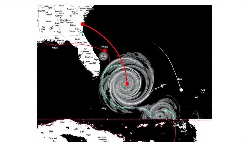
Understanding historical hurricane data is pivotal for several reasons. Firstly, hurricanes are powerful natural events that have historically led to shipwrecks, particularly in regions prone to severe storms. Historical records provide critical information regarding storm trajectories, intensities, and landfall sites. For example, the National Oceanic and Atmospheric Administration (NOAA) maintains a detailed database of hurricane tracks going back to the late 19th century.
Utilizing this extensive historical dataset, researchers can map the past meteorological conditions coinciding with maritime incidents. A significant statistic reveals that between 1492 and 1925, approximately 20 percent of all recorded shipwrecks in the Atlantic Ocean were attributed to hurricanes.
Methodological Approaches
Marine archaeologists employ a multi-faceted approach when utilizing hurricane paths to locate shipwreck sites. This involves several steps:
- Data Collection: Gathering historical hurricane data, shipwreck records, and maritime traffic information.
- Geospatial Analysis: Employing Geographic Information Systems (GIS) to visualize and analyze patterns between hurricane paths and shipwreck occurrences.
- Field Surveys: Conducting underwater surveys in areas highlighted by data analysis, often using sonar technology to detect submerged wrecks.
Each of these methods plays an essential role in increasing the accuracy of predictions regarding shipwreck locations. The integration of advanced technology such as remote sensing and computer modeling enhances the effectiveness of locating wreck sites tied to historical hurricanes.
Case Studies: Successful Shipwreck Discoveries
Numerous successful shipwreck discoveries have been linked to analyses of historical hurricane data:
- The USS San Pedro: In records dating back to 1812, the USS San Pedro was lost near the Florida Keys during a hurricane. By examining storm tracks from the time of the wreck and integrating it with ship traffic data, researchers localized the shipwreck site, leading to successful recovery efforts of artifacts.
- SS Morro Castle: This luxury liner caught fire during a storm in 1934 off the coast of New Jersey. Historical hurricane data indicated that a strong storm coincided with its loss. Analysis of the trajectory of hurricanes during that season directed researchers to vital recovery operations that unearthed artifacts and remnants of the ship.
These case studies exemplify how the application of historical hurricane paths not only sheds light on the circumstances surrounding the maritime disasters but also aids in recovering valuable historical artifacts.
Challenges and Considerations
Despite the potential for success, several challenges exist in this field of research. One major concern is the accuracy of historical data. Meteorological records from centuries ago may lack the precision needed to make definitive conclusions about storm impacts. Also, underwater exploration involves a myriad of logistical and technical obstacles, including difficulty in visibility, unpredictable marine conditions, and the costs involved in such operations.
Also, regulations regarding marine heritage sites often limit excavation activities. Researchers must ensure compliance with legal frameworks designed to protect underwater cultural heritage while balancing the need for discovery and preservation.
Conclusion and Actionable Takeaways
The utilization of historical hurricane paths for locating shipwreck sites represents a convergence of environmental science and archaeology, offering intriguing insights into maritime history. Key takeaways for future research include:
- Invest in comprehensive datasets to increase accuracy in mapping historical hurricane impacts on maritime routes.
- Collaborate with meteorologists and hydrodynamic experts to enhance geospatial analyses.
- Adopt sustainable practices in underwater archaeology to respect and preserve underwater heritage.
By continuing to explore the synergies between historical hurricane data and marine archaeology, researchers can unlock new stories from the maritime past, enriching our understanding of how nature has shaped human endeavors at sea.


