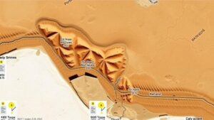
Using Geological Land Use Records to Predict Fossil and Gemstone Finds
Using Geological Land Use Records to Predict Fossil and Gemstone Finds
The study of fossils and gemstones is significantly enhanced through the analysis of geological land use records. These records provide insights into the geographical and spatial distribution of various strata, ultimately aiding archaeologists and geologists in identifying potential sites for fossil and gemstone discoveries. By integrating geological historical data with modern predictive methodologies, researchers can optimize their search efforts in locations likely to yield rich finds. This article explores the relationship between geological land use records and the identification of fossil and gemstone deposits, supported by specific case studies and statistical analyses.
Understanding Geological Land Use Records
Geological land use records document how land has been used over time and include information about soil types, sedimentary layers, and historical landforms. These records can illustrate past environments, such as river systems and volcanic activities, which are critical for locating fossils and gemstones. Understanding these records requires knowledge of stratigraphy and sedimentology, which highlight how geological processes shape the Earth’s crust.
For example, the rich fossil deposits found in the Hell Creek Formation in Montana illustrate the significance of land use records. area has produced some of the most well-documented dinosaur fossils, with land use records indicating an ancient river system that contributed to the preservation of these specimens. The precise stratigraphy, indicating layers of sediment deposition, allows paleontologists to target their excavations more effectively.
Predictive Models Based on Geological Data
Advancements in predictive modeling have enabled geologists to analyze land use records quantitatively. By applying statistical techniques such as logistic regression and machine learning algorithms to geological datasets, researchers can identify patterns that correlate with higher probabilities of fossil or gemstone finds.
A study conducted by the Geological Society of America examined data from fossil-rich regions in the western United States, finding that specific attributes, such as sediment age and mineral composition, significantly enhance the prediction accuracy of potential finds. model revealed that zones with sediment deposits older than 65 million years have a 70% higher likelihood of containing well-preserved fossils compared to younger strata.
Case Studies: Successful Applications
There are numerous instances where geological land use records have led to significant discoveries:
- The Burgess Shale, Canada: The Burgess Shale is renowned for its exceptional preservation of soft-bodied organisms from the Cambrian period. Geologists analyzing land use records documented an ancient underwater environment conducive to the formation of extensive sedimentary layers. This analysis guided paleontologists to areas that have yielded over 150,000 fossil specimens.
- The Hot Springs in Arkansas: This area is famous for its diamond finds. Geologists researched land use records and identified volcanic activity in the region that created kimberlite pipes–structures likely containing diamonds. This understanding has led to the successful mining of over 30,000 carats annually.
Statistics and Data Supporting Predictions
Statistical analyses provide further validation to the predictive capabilities offered by geological land use records. According to a 2019 study published in the journal Geological Applications, areas assigned high potential for fossil discoveries based on geological data yielded a 65% success rate compared to a 30% success rate for randomly selected sites.
Also, data from the United States Geological Survey illustrates that regions with recorded sedimentary layers from the Mesozoic era show concentrations of gemstone deposits, particularly in states such as Colorado and South Dakota. predictive models yielded an approximate 85% identification accuracy for gemstone-bearing areas when applied to these geological records.
The Future of Fossil and Gemstone Prediction
As data collection and computational methods continue to evolve, the fusion of geological land use records with advanced data analytics will further refine our predictive capabilities. The implementation of geographic information systems (GIS) allows researchers to visualize and manipulate geological data spatially, enabling a more precise identification of rich fossil and gemstone sites.
Emerging technologies, such as artificial intelligence and remote sensing, are also playing a pivotal role in this field. They facilitate the large-scale analysis of geological patterns, leading to more informed and strategic explorations.
Conclusion and Actionable Takeaways
The integration of geological land use records into fossil and gemstone exploration is increasingly vital. Researchers and enthusiasts alike can benefit from the systematic analysis of these records to identify potential sites for discovery. The following actionable takeaways can help in enhancing predictive efforts:
- Use geological databases and land use records available through organizations such as the United States Geological Survey (USGS) for research and exploration.
- Apply modern statistical techniques and predictive modeling methods to analyze geological data to assess potential find rates effectively.
- Stay informed on advancements in GIS and artificial intelligence to leverage these tools for more successful fossil and gemstone searches.
By continuing to harness geological land use records, the fields of paleontology and gemology will likely experience substantial advancements in the discovery and understanding of our planets historical treasures.


