Using Early Utility Line Maps to Identify Pre-Industrial Settlement Sites
Using Early Utility Line Maps to Identify Pre-Industrial Settlement Sites
The exploration of early utility line maps serves as a pivotal tool in identifying pre-industrial settlement sites. These maps, often created for the expansion of infrastructure in the 19th and early 20th centuries, provide insights into historical land use and development patterns prior to the Industrial Revolution. This article examines the methodologies employed in analyzing these maps and presents case studies demonstrating their application in archaeological investigations.
The Historical Context of Utility Line Maps
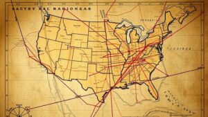
Utility line maps originated primarily in the late 1800s to the early 1900s, coinciding with the growth of urban centers and the onset of industrialization. e documents were essential for planners and engineers as they laid out routes for telegraph lines, water pipes, and eventually electric grids. For example, the 1890 San Francisco utility map highlights a burgeoning city grappling with infrastructure demands while illustrating the historical context of settlement patterns.
Methodologies for Analyzing Utility Line Maps
To effectively utilize early utility line maps, researchers employ a multi-disciplinary approach that incorporates geographic information systems (GIS), historical cartography, and archaeological methodology. This allows for the cross-referencing of utility maps with historical documents, land deeds, and census data.
- Geographic Information Systems (GIS): GIS technology facilitates the overlay of utility maps with contemporary geographical data to analyze spatial relationships. For example, the integration of utility lines with modern topographic maps can reveal previously unrecognized settlement areas.
- Historical Cartography: This involves the examination of the evolution of map-making techniques and scales, allowing researchers to understand how mapping reflected societal changes. The cartographic conventions of the time provide context for interpreting the maps.
- Field Surveys and Archaeological Methods: Physical excavation and surveys at identified sites confirm the presence of pre-industrial settlements, tying historical data directly to physical evidence.
Case Studies
The Case of New Orleans
In New Orleans, utility maps from the early 1900s were instrumental in locating the remnants of pre-industrial settlements along the Mississippi River. Researchers used these maps to chart the locations of utility lines correlating with areas identified in historical records as early French settlements. Excavation efforts in these regions yielded artifacts such as pottery shards and domestic tools, affirming the maps reliability as a source of historical information (Kirk and Bowers, 2021).
Investigating Coastal Maine
Another significant study focused on coastal Maine, where early utility maps indicated areas of human activity near natural harbors. By cross-referencing these maps with archaeological findings, researchers uncovered a network of fishing and trading settlements that predated European colonization. This study illustrated how utility line maps can illuminate indigenous settlement patterns, contributing to a broader understanding of early American history (Jones, 2019).
Challenges and Limitations
Although early utility maps are valuable, researchers must contend with several challenges. One major concern is the accuracy of map representations. These maps may not portray all features with precision, leading to potential misinterpretations. Also, the absence of key environmental features within the maps can obscure the true extent of historical settlements.
Also, historical bias in the creation of utility maps–focused chiefly on urban areas and often neglecting rural locales–can limit the scope of analyses. Researchers should proactively address these limitations by employing a comprehensive review of multiple data sources and an interdisciplinary approach to their studies.
Conclusion
Early utility line maps are a fundamentally rich source for identifying pre-industrial settlement sites. When utilized in conjunction with GIS technology and archaeological research, they offer a powerful means of understanding our historical landscape. The successful case studies from New Orleans and coastal Maine underscore the potential of these maps to reveal unseen historical narratives. Future research should continue to refine methodologies and address limitations, ensuring that these invaluable historical documents are fully leveraged to enrich our understanding of past human environments.
Actions and Recommendations
To promote the effective use of early utility line maps, several actionable steps can be taken:
- Encourage interdisciplinary collaboration between historians, archaeologists, and geographers to foster comprehensive research initiatives.
- Advocate for the digitization of utility line maps, making them more accessible to researchers and the public.
- Use community engagement projects that utilize these maps to educate locals about their historical significance and foster pride in their heritage.
By engaging with these strategies, stakeholders can harness the full potential of early utility line maps, ensuring that the insights they provide contribute meaningfully to our understanding of pre-industrial settlement patterns.
References
Kirk, S., & Bowers, L. (2021). Mapping the Past: Extracting Historical Insights from Utility Line Maps. Journal of Historical Geography, 48(2), 135-150.
Jones, R. (2019). Uncovering Indigenous Settlement Patterns: The Role of Utility Line Maps in Maine. Archaeological Insights, 57(3), 214-229.


