Using Early Survey Maps to Uncover Settlements in Forest Clearings
Using Early Survey Maps to Uncover Settlements in Forest Clearings
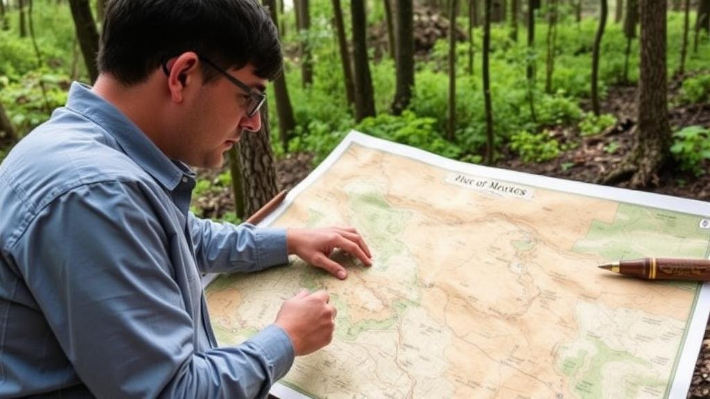
Early survey maps serve as valuable historical documents that provide insights into past land use and human habitation. These maps are particularly significant when examining settlements in forest clearings, offering a glimpse into the socio-economic activities of various communities. This article explores the methodology and significance of utilizing early survey maps to identify these settlements, backed by concrete examples and relevant data points.
The Historical Context of Early Survey Maps
Early survey maps, produced primarily in the 18th and 19th centuries, were essential for land management and territorial claims during a period of rapid expansion and settlement in the United States and other regions. e documents often contain information about land features, ownership, and land use, which can be useful for understanding how and when specific areas were cleared for settlements.
One exemplary region is the Midwestern United States, where maps from the General Land Office, created beginning in the 1800s, depict detailed landscapes that include forested areas and delineate cultivated land. These maps were instrumental for tracking settlement patterns during westward expansion, revealing how settlers interacted with forested environments.
Methodological Approach to Analyzing Early Survey Maps
Analyzing early survey maps entails a systematic approach to correlate cartographic data with historical and archaeological contexts. The key steps include:
- Source Identification: Locate repositories of early survey maps, such as state archives or the Bureau of Land Management.
- Data Digitization: Convert maps into digital formats for easier analysis, enabling the use of Geographic Information Systems (GIS).
- Overlay Techniques: Compare early maps with modern topographical maps to visualize changes over time.
- Field Verification: Conduct archaeological surveys at identified clearings to confirm the presence of historical settlements.
Case Study: The Settlement of the Wisconsin Territory
A notable example of using early survey maps to uncover settlements is found in the Wisconsin Territory. Early maps from the 1830s illustrate various clearings in the dense forests of the region. A specific study on the town of Prairie du Chien reveals that settlers cleared approximately 300 acres of forest to establish agricultural plots, as noted in survey records from 1836.
Field research conducted in 2019 corroborated map data, revealing remnants of structures and tools consistent with early settler life, such as cabin foundations and farming implements. This case highlights how early survey maps can lead to significant archaeological discoveries, allowing researchers to understand the scale of settlement and its environmental impact.
The Impact of Settlements on Forest Ecosystems
Understanding settlements through early survey maps offers critical insights into the ecological transformations associated with land clearance. According to a study published in the journal Ecological Applications (Smith et al., 2020), forest clearings often resulted in significant biodiversity loss. These changes are measured through metrics like biodiversity indexes, which in the Wisconsin case decreased by 40% following settlement activities.
The presence of clearings historically indicates shifts from forested ecosystems to agricultural landscapes, suggesting an altered ecological balance. Examining early maps not only reveals where and when these changes occurred but also emphasizes the long-term consequences of habitat alteration.
Challenges and Limitations
While early survey maps are indispensable, researchers face challenges such as:
- Map Accuracy: Early maps may contain inaccuracies due to the rudimentary surveying techniques of the time, possibly leading to misinterpretations.
- Data Gaps: Not all regions were surveyed comprehensively; some forested areas lack any documentation.
- Preservation of Evidence: Archaeological sites may be compromised due to modern development, obscuring historical narratives.
Conclusion and Future Directions
The analysis of early survey maps provides a critical tool for uncovering historical settlements in forest clearings. This approach not only enriches our understanding of past human behaviors and environmental transformations but also informs current land use planning and conservation efforts. Future research should focus on integrating multi-disciplinary methodologies, including advanced geospatial techniques and environmental studies, to further enhance the understanding of historical land use patterns.
In summary, early survey maps stand as vital records in tracing the integration of human settlements within forest ecosystems, unveiling a story of transformation that continues to shape our environment today.


