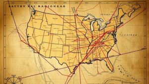
Using Early Settlement Water Rights Records to Locate Forgotten Relics
Using Early Settlement Water Rights Records to Locate Forgotten Relics
The settlement of the American West in the 19th century was not only marked by the expansion of territories but also by the establishment of complex water rights records. These records are invaluable for researchers and historians aiming to understand settlement patterns, agricultural practices, and even the location of forgotten relics from this era. By analyzing these early settlement water rights records, investigators can piece together a geographic and temporal map where forgotten artifacts may be found. This article will explore the importance of these records and how they can be utilized in archaeological efforts.
The Historical Context of Water Rights
Water rights in the United States trace back to the Doctrine of Prior Appropriation, which emerged in the mid-19th century as settlers moved into arid regions. This doctrine established the principle that water rights were obtained by diverting water and applying it to a beneficial use. As settlers laid claim to water sources, they often documented these rights formally, resulting in robust records that include names, dates, and geographic locations.
According to the United States Geological Survey (USGS), by 1890, over 200,000 miles of irrigation ditches had been constructed across the West, indicating an immense reliance on water for agricultural development and settlement. e early water rights documents serve as a unique lens through which we can study not only the utilization of water resources but also associated activities such as farming, trade, and settlement patterns.
Methodology for Utilizing Water Rights Records
Researchers can adopt a multi-faceted approach when using early water rights records to locate forgotten relics:
- Document Analysis: Systematically review early water rights documents, such as decrees and claims, from archives or state records. These documents often provide precise geographic coordinates.
- GIS Mapping: Employ Geographic Information Systems (GIS) to map water rights against known archaeological sites. By layering historical data over modern maps, researchers can identify areas with high potential for relic discovery.
- Field Surveys: Conduct field surveys in identified areas, focusing on locations where water rights were historically concentrated. e surveys can yield artifacts related to settlement activities.
Case Studies
Several studies highlight the effectiveness of using water rights records to locate forgotten relics. One pertinent case involves the Lost River settlement in Idaho. Early water rights documents from 1885 revealed patterns of irrigation that were closely correlated with agricultural development. Upon investigation, archaeologists uncovered remnants of irrigation ditches, farming tools, and other artifacts that provided insight into the settlement’s agricultural practices.
Another example can be found in California, where water rights records from the 1850s helped to identify the location of abandoned mining camps from the Gold Rush era. By analyzing the claims made along waterways, researchers pinpointed sites where miners would have set up operations, leading to the discovery of tools, equipment, and even remnants of encampments.
Challenges and Limitations
While early settlement water rights records are invaluable, researchers must be aware of potential challenges:
- Incompleteness: Some areas may have incomplete records or missing data due to historical events or administrative oversight, making it difficult to form a comprehensive understanding.
- Land Use Changes: Subsequent changes in land use, such as urban development or agriculture, may have altered or destroyed potential relic sites.
- Legal Issues: Current property rights and land ownership can complicate access to areas of interest for archaeological exploration.
Actionable Takeaways
For researchers and historians, the systematic analysis of early settlement water rights records offers a promising avenue for locating forgotten relics. The following steps are recommended:
- Engage with local historical societies and archives to access water rights records.
- Use GIS technology to visualize historical data against contemporary landscapes.
- Propose field survey projects funded through grants aimed at archaeological exploration.
To wrap up, the intersection of water rights and archaeological research exemplifies how historical documentation can facilitate the rediscovery of lost relics, providing a deeper understanding of early settlement dynamics and cultural practices in the West. As research progresses, it will be crucial to share findings and methodologies with the broader academic community to enhance collaboration and foster further discoveries.


