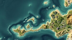
Using AI to Detect Changes in Terrain Over Time from Historical Photos
Using AI to Detect Changes in Terrain Over Time from Historical Photos
The rapid advancement of artificial intelligence (AI) technologies has opened new avenues for analyzing and interpreting historical data, particularly in the field of geography and environmental science. This research article examines the application of AI techniques in detecting changes in terrain over time through the analysis of historical photographs. By leveraging computer vision and machine learning algorithms, researchers can extract meaningful insights from images that were once overlooked, allowing for a deeper understanding of landscape evolution.
The Relevance of Historical Photographs
Historical photographs serve as a rich source of information, capturing landscape features at specific points in time. provide valuable insights into environmental changes, urban development, agriculture expansion, and natural disasters. For example, the Great San Francisco Earthquake of 1906 drastically altered the landscape, and archived photographs from that time provide visual evidence of urban devastation.
AI Techniques Employed in Terrain Analysis
To effectively detect changes in terrain over time, researchers employ various AI techniques, such as:
- Image Processing: This involves algorithms that enhance and transform images to facilitate better analysis. Techniques such as edge detection and color normalization are often utilized.
- Object Detection: Neural networks, specifically Convolutional Neural Networks (CNNs), are trained to identify specific features of interest, such as trees, buildings, or bodies of water, within the photographic data.
- Change Detection Algorithms: Algorithms specifically designed to analyze differences between images taken at different times. e can be used to quantify changes in terrain features.
- Geographic Information System (GIS) Integration: AI results can be integrated into GIS platforms to visualize changes spatially, making it easier to understand the extent and impact of changes over time.
Case Studies and Examples
Several case studies highlight the effectiveness of AI in terrain analysis using historical photographs:
- Yosemite National Park: Researchers utilized a vast collection of historical photographs from various decades to study glacial retreat in Yosemite. By applying image recognition techniques, they were able to correlate glacial size with temperature records, revealing a significant decline in glacier mass.
- New York City Development: Historical images from 1900 to 2020 were analyzed to observe urban sprawl and changes in land use. AI algorithms successfully identified and quantified increased construction activities and green space loss, which were later corroborated with census data.
- Coastal Erosion in California: A study focusing on the coastline utilized aerial photographs from the 1970s to the present. AI-powered algorithms detected patterns of coastal erosion and sediment deposition, helping inform local conservation efforts.
Challenges and Limitations
Despite promising advancements, several challenges and limitations remain when applying AI to analyze historical photographs for terrain changes:
- Image Quality: Many historical photographs suffer from issues such as low resolution, fading, and varying perspectives, making it difficult for algorithms to produce accurate results.
- Data Availability: Comprehensive collections of historical images may not be available for all locations or time periods. Accessing large datasets often requires significant historical research and collaboration with archives.
- Algorithm Training: AI models require extensive training datasets to achieve high accuracy. Gathering labeled data from historical images can be a cumbersome process, requiring expert knowledge in both AI and the specific domain.
Future Implications
As AI continues to evolve, its potential applications in analyzing changes in terrain over time will likely expand. Future research may focus on:
- Developing Advanced Algorithms: Enhancements in deep learning technologies may lead to more sophisticated algorithms capable of handling lower-quality images and achieving better change detection results.
- Citizen Science Initiatives: Engaging the public in contributing historical images can enrich datasets, allowing for broader geographical analysis and participation in environmental studies.
- Longitudinal Studies: Application of AI could lead to ongoing monitoring of terrain changes over extended periods, enabling quicker responses to environmental concerns and policy changes.
Conclusion
The integration of AI techniques in analyzing historical photographs provides a powerful tool for understanding changes in terrain over time. By unlocking valuable insights from archived images, researchers can inform urban planning, environmental conservation, and even disaster preparedness. While challenges remain, advances in technology and collaborative efforts will undoubtedly enhance the capability of AI to document and predict landscape changes in a meaningful and scientifically rigorous manner.
Actionable Takeaways
- Invest in further research to improve algorithms for analyzing lower-quality historical images.
- Establish partnerships with libraries and archives to enhance data collection on historical photographs.
- Encourage community participation to gather datasets that inform climate and urban studies more comprehensively.


