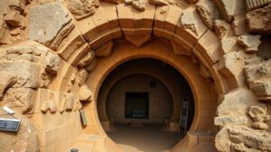
Using advanced LIDAR technology to reveal hidden cities beneath dense jungle canopies in Southeast Asia.
Using Advanced LIDAR Technology to Reveal Hidden Cities Beneath Dense Jungle Canopies in Southeast Asia
In recent years, the realm of archaeology has been revolutionized by the advent of advanced Light Detection and Ranging (LIDAR) technology. This innovative method not only enhances our understanding of ancient civilizations but also unveils hidden cities that lay concealed beneath the dense tropical canopies of Southeast Asia. As researchers delve into this unexplored terrain, they are unearthing remarkable sites that provide insight into the regions rich historical tapestry.
The Significance of LIDAR Technology
LIDAR works by emitting laser pulses from an aircraft that penetrates vegetation to measure the distance between the sensor and the ground. This technology provides high-resolution, three-dimensional data of the terrain, making it an essential tool for archaeological surveys. In Southeast Asia, regions like Cambodia, Thailand, and Vietnam have benefited from LIDAR’s capability to penetrate thick foliage that often obscures ancient structures.
Revelations from Cambodia
One of the most notable applications of LIDAR occurred in Cambodia, where researchers used the technology to examine the area surrounding the famed Angkor Wat temple. In 2015, a LIDAR survey revealed an extensive urban landscape, encompassing more than 1,000 square kilometers that included roads, waterways, and a vast network of temples. previously unknown city of Mahendraparvata emerged, showing evidence of a complex society that thrived in the region from the 7th to the 9th century AD.
- The LIDAR findings suggest that Angkor was part of a much larger urbanized landscape, challenging prior assumptions about its scale.
- Researchers discovered sophisticated irrigation systems that supported agriculture in this densely populated environment.
The Impact of Discoveries in Thailand
In Thailand, LIDAR has unveiled a forgotten city near the ancient site of Si Thep. Officially recognized for its historical significance, LIDAR imaging in 2018 uncovered a sprawling civilization inhabited between the 3rd and 6th centuries AD. This discovery led to the identification of complex networks of structures arranged in a grid pattern, indicating advanced urban planning.
- Artifacts found in the region, including pottery and inscriptions, highlight cultural exchanges between local populations and neighboring empires.
- This newfound city provides context for understanding the economic and social structures of that time period.
Environmental and Archaeological Challenges
While LIDAR technology has remarkably advanced archaeological studies, several challenges remain. dense jungles of Southeast Asia pose significant barriers for traditional excavation methods. Also, the environmental impacts of logging and agriculture threaten the preservation of these newly discovered sites.
Also, the data obtained from LIDAR requires careful interpretation. Researchers must cross-reference LIDAR data with traditional excavation techniques and historical texts to construct a comprehensive understanding of these ancient civilizations.
Future Prospects and Applications
The future of LIDAR technology holds immense promise for archaeological exploration and environmental monitoring. As drones equipped with LIDAR sensors become more accessible, the potential for extensive surveys increases significantly. Researchers anticipate uncovering more hidden cities and features that further illuminate the complex societies that existed in Southeast Asia.
- The integration of LIDAR with Geographic Information Systems (GIS) will enhance spatial analysis, allowing for richer interpretations of the data.
- As conservation efforts grow, LIDAR could play a pivotal role in monitoring land changes and preserving historical sites for future generations.
Conclusion: Actionable Takeaways
The utilization of advanced LIDAR technology to uncover hidden cities in Southeast Asia signifies a transformative moment in the field of archaeology. These findings encourage a broader understanding of ancient civilizations and highlight the importance of preserving our cultural heritage. As the technology continues to develop, it will undoubtedly unveil even more secrets buried beneath the rich jungles of the region, inspiring future research and exploration.
For enthusiasts and researchers alike, this development underscores the necessity of embracing innovative technologies to safeguard our historical narratives. Investing in LIDAR technology not only enriches archaeological prospects but also fosters a greater appreciation for the intricate history of civilizations that shaped our world.


