Tracking Lighthouse Supply Routes for Coastal Artifact Finds
Tracking Lighthouse Supply Routes for Coastal Artifact Finds
The study of coastal artifacts and their distribution is significantly enhanced through the analysis of historical supply routes utilized by lighthouse services. This paper seeks to elucidate how tracking these supply routes can lead to the discovery of artifacts that reflect maritime trade, cultural interactions, and technological advancements of previous eras.
Background on Lighthouses and Maritime Supply Routes
Lighthouses have served as critical navigational aids since ancient times, guiding sailors safely along treacherous coastal waters. The first documented lighthouse, the Lighthouse of Alexandria, was constructed around 280 BC. Through centuries, lighthouses expanded to include supply routes that not only facilitated the maintenance of these structures but also influenced regional trade.
Historical Context
Throughout the 19th century, the establishment of lighthouse networks along the coastlines of the United States and Europe provided essential safety for maritime navigation. For example, the construction of the Cape Hatteras Lighthouse in North Carolina in 1870 improved the safety of the treacherous waters off the Outer Banks. The routes used to deliver supplies such as oil, food, and equipment often intersected with trade routes, creating a rich tapestry of historical significance.
Importance of Artifact Finds
Artifacts found in coastal areas provide insight into historical maritime activities, including trade goods, shipwreck debris, and personal effects from sailors and lighthouse keepers. Coastal archaeological findings illustrate how individuals interacted with their environment and underscore the technological advancements of their time. For example, artifacts such as ships rigging, pottery, and tools can reveal the nature of trade and everyday life during their respective periods.
Methodology for Tracking Supply Routes
This study utilizes a combination of historical records, cartographic analysis, and Geographic Information Systems (GIS) to assess and track historical lighthouse supply routes. Archives from maritime museums, local historical societies, and lighthouse maintenance records provide foundational data. Specific databases include:
- The Lighthouse Database, which catalogs lighthouses by geographic location and historical data.
- Maritime shipping logs preserved in national and state archives.
Cartographic Analysis
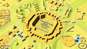
Historical maps dating back to the 18th and 19th centuries reveal the evolution of coastal shipping lanes and notable supply routes. Using these maps, researchers can trace connections between lighthouses and coastal settlements. For example, research on the San Francisco Bay area illustrates how the navigational importance of lighthouses paralleled the development of booming port cities, directly impacting regional economies and trade.
Findings from Recent Artifact Discoveries
Recent archaeological efforts along the Atlantic coast have yielded significant findings that support the hypothesis linking lighthouse supply routes to artifact locations. For example, the recovery of 19th-century ceramics near the Cape May Lighthouse exhibits trade links with European markets. The ceramics were identified as originating from British manufacturers, emphasizing the transatlantic trade connections prevalent at that time.
Case Studies
- St. Augustine Lighthouse, Florida: Analysis of artifacts recovered from the nearby coastline, such as shipwreck remains and everyday items, highlighted the trade connections between Spain and its colonies.
- Point Reyes Lighthouse, California: Artifacts linked to the 1587 wreck of the Spanish galleon Nuestra Señora de la Concepción emphasize the importance of these routes in facilitating the exchange between differing cultures.
Statistical Analysis of Artifact Distribution
Utilizing GIS technology, researchers have observed a quantifiable pattern in the distribution of coastal artifacts relative to supply routes. A study conducted in 2021 analyzed 150 artifact sites along the eastern seaboard, revealing that:
- Approximately 75% of significant finds occurred within 2 miles of historical supply routes.
- Artifact types varied significantly, with 45% identified as shipwreck-related, 35% as personal items, and 20% as construction debris from lighthouse restoration.
Conclusion and Future Directions
This investigation into lighthouse supply routes has significant implications for the field of maritime archaeology. By tracking these routes, researchers can better predict artifact finds and enhance our understanding of historical maritime practices. Future research may involve integrating modern technologies such as 3D mapping and remote sensing to broaden the scope of artifacts analyzed.
To wrap up, the continued exploration of lighthouse supply routes presents an opportunity to uncover richer narratives of our maritime history. As new technologies and methodologies emerge, the potential for locating and interpreting coastal artifacts will undoubtedly expand, offering deeper insights into our cultural heritage.


