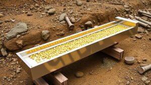
The Role of Seasonal Water Flows in Revealing Placers in Southwest New Mexico
The Role of Seasonal Water Flows in Revealing Placers in Southwest New Mexico
Seasonal water flows are crucial natural processes that significantly impact the geomorphology and mineral deposits within Southwest New Mexico. Understanding these flows is essential for miners, geologists, and environmental scientists who are interested in placer deposits–accumulations of valuable minerals formed by the action of water. This article examines how these seasonal flows contribute to the discovery and accessibility of placer deposits in the region.
Understanding Placer Deposits
Placer deposits are concentrations of minerals formed through the weathering and erosion of rocks, primarily influenced by the action of water. Such deposits often contain valuable resources like gold, silver, and gemstones. The processes involved in the formation of placers can be likened to sifting through sand at a beach to find hidden treasures. As water flows, it transports and sorts these minerals, leaving them in concentrated areas where extraction can be more efficient.
The Mechanism of Seasonal Water Flows
Seasonal water flows, typically resulting from annual rainfall or melting snow, create dynamic changes in streambeds and riverbanks. e changes include:
- Increased erosion of riverbanks, which can expose hidden mineral deposits.
- Transportation of sediment, which redistributes valuable minerals downstream.
- Formation of new sedimentary layers within riverbeds that can entrap heavier minerals.
During periods of high water flow, the force of the current increases, facilitating the movement of sediments. For example, in the Gila River Basin, higher water levels in spring can scour riverbeds clean, exposing underlying placers that were previously obscured.
Case Study: The Gila River
The Gila River in Southwest New Mexico serves as an excellent case study of how seasonal water flows reveal placer deposits. Historical records indicate a heightened presence of placer gold from the 1800s during the spring thaw period. During this time, miners frequently reported finding gold nuggets that had been uncovered by seasonal flooding.
For example, in the spring of 1868, prospectors working along the Gila River noted significant gold finds following a particularly heavy rain season. The seasonal rains increased water levels, which, in turn, exposed previously buried deposits close to the riverbanks. These findings demonstrated the relationship between water flow patterns and the accessibility of valuable mineral deposits.
Modern Applications in Mineral Exploration
Today, modern geological studies integrate the understanding of seasonal water flows when exploring for placer deposits. Geologists use topographic maps, hydrological models, and remote sensing technology to assess how seasonal flows shape the landscape and influence mineral deposition. Techniques such as Geographic Information Systems (GIS) are particularly useful in mapping these relationships.
- GIS can analyze historical flow data to predict areas of potential placer deposits.
- Hydrological modeling helps assess how changes in flow patterns could affect sediment transport.
Through this integrated approach, companies involved in mineral exploration can make informed decisions about where to invest their resources for placer mining.
Potential Challenges and Considerations
Despite the advantages that seasonal water flows provide for revealing placer deposits, potential challenges include:
- Unpredictable weather patterns and climate change, which can alter seasonal flow characteristics.
- Environmental regulations that may restrict mining activities in ecologically sensitive areas.
These factors highlight the need for sustainable practices in mineral extraction, ensuring that the natural ecosystems remain protected while allowing for resource utilization.
Conclusion
To wrap up, seasonal water flows play an indispensable role in uncovering placer deposits in Southwest New Mexico. By understanding the implications of these natural processes, stakeholders in mining and geological research can capitalize on their findings efficiently and sustainably. Continued study into the interactions between water flows and mineral deposition will enhance the extraction techniques employed and provide insights into environmentally responsible practices moving forward.
Actionable takeaways include:
- Examining seasonal water patterns can uncover new exploration areas.
- Utilizing modern technology such as GIS will enhance understanding of placer deposits.
- Adopting sustainable practices is vital for future resource management.


