Techniques for Locating Surface Outcrops of Metal Ores
Techniques for Locating Surface Outcrops of Metal Ores
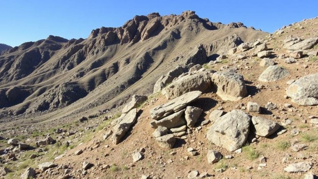
The identification and exploration of metal ores are crucial for the mining industry and significantly impact economic growth. Surface outcrops, which are the exposed portions of mineral deposits, provide essential clues toward locating and assessing metal ores. This article explores various techniques employed in the field to locate these valuable resources, supported by examples and relevant data.
1. Geological Mapping
Geological mapping remains one of the foundational techniques used in identifying surface outcrops of metal ores. Detailed maps highlight the physical characteristics of the terrain, including rock formations that may indicate the presence of specific ore types.
- Examples: The U.S. Geological Survey produces comprehensive geological maps that assist miners in locating gold and copper deposits.
- Application: By interpreting the geological history of a region, exploration geologists can predict where economically viable ore deposits might be located.
2. Remote Sensing Technologies
Remote sensing technologies utilize satellite imagery and aerial photographs to assess large areas for potential ore deposits. This technique is particularly useful in inaccessible regions where ground surveys are challenging.
- Examples: Satellite data can reveal spectral signatures of minerals which might indicate the presence of metal ores such as iron or gold.
- Application: In 2018, a remote sensing study identified lithium-rich outcrops in the Andes, leading to successful extraction projects.
3. Field Surveys and Sampling
Conducting field surveys enables geologists to study visible outcrops closer, allowing for hands-on identification of minerals and collection of rock samples. Through systematic sampling, geologists can analyze the composition and grade of ores.
- Examples: Field surveys in Canada revealed significant surface deposits of nickel that would have been overlooked without direct sampling.
- Application: Using techniques such as grid sampling, geologists can create a comprehensive understanding of ore distribution across a site.
4. Geophysical Methods
Geophysical methods, including magnetic and electromagnetic surveys, enable detection of ore bodies based on physical properties. These techniques can identify subsurface anomalies and guide exploration efforts.
- Examples: Magnetic surveys have successfully located iron ore deposits in the Pilbara region of Australia.
- Application: Geophysical data can help prioritize areas for drilling, reducing costs and time in the exploration phase.
5. Geochemical Analysis
Geochemical analysis involves studying the chemical composition of soil and rock samples to identify trace elements associated with specific metal ores. Anomalous concentrations can indicate nearby ore deposits.
- Examples: High levels of copper found in soil samples can lead to the discovery of nearby copper deposits.
- Application: This technique allows for non-invasive exploration methods, preserving the surrounding environment while assessing potential resources.
6. Community Input and Local Knowledge
Engaging with local communities provides valuable insights into potential outcrops based on historical mining activities or anecdotal evidence from local inhabitants. Indigenous knowledge can uncover forgotten sites rich in metal ores.
- Examples: In several regions across Africa, local miners have guided explorations that led to significant gold ore discoveries.
- Application: Collaboration with local communities fosters trust and enhances the success rate of exploration projects.
Conclusion
Locating surface outcrops of metal ores is a multidimensional process that leverages geological mapping, remote sensing, field surveys, geophysical methods, geochemical analysis, and local knowledge. Each technique provides unique advantages and, when integrated effectively, enhances the overall efficiency of ore exploration. As the demand for metal ores increases, the adoption of innovative technologies and community engagement will play pivotal roles in future exploration successes.
Actionable Takeaways
- Use a combination of geological mapping and remote sensing for a comprehensive exploration strategy.
- Encourage local community involvement to gain insights and historical knowledge on potential ore sites.
- Invest in geophysical and geochemical analysis to increase accuracy in locating economically viable deposits.


