Techniques for Locating Hard Rock Ore Deposits in Remote Areas
Techniques for Locating Hard Rock Ore Deposits in Remote Areas
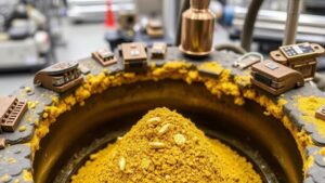
Locating hard rock ore deposits in remote areas is a challenging yet crucial aspect of mining exploration. These deposits often contain valuable minerals such as gold, copper, and nickel. The techniques used to locate these deposits require a combination of geological understanding, technological advancements, and strategic planning. This article outlines various methods employed in the industry, alongside concrete examples and statistical data to reinforce their relevance.
Geological Mapping
Geological mapping is one of the foundational techniques for locating hard rock ore deposits. It involves the systematic study of rock formations and their structures to identify areas with potential mineralization.
For example, detailed geological maps can help identify geological formations that are commonly associated with ore deposits, such as sedimentary basins or volcanic arcs. A notable example is the exploration conducted in the Goldfields of Western Australia, where geological mapping has played a critical role in discovering large gold deposits.
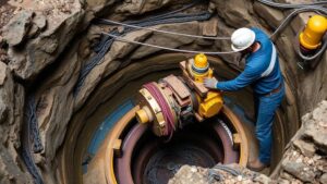
Geophysical Methods
Geophysical methods leverage physical properties of rocks to detect anomalies associated with ore deposits. Common techniques include:
- Magnetic Surveys: Measure variations in Earths magnetic field caused by the presence of magnetite or other magnetic minerals.
- Ground Penetrating Radar (GPR): Uses radar pulses to image the subsurface and identify geological structures.
- Electrical Resistivity: Measures how much the ground resists electrical currents, aiding in distinguishing between ore-bearing and non-ore-bearing formations.
An example of successful application is the use of magnetic surveys in Sudbury, Canada. Here, geophysicists identified a previously unrecognized mineralized zone, leading to the discovery of a significant nickel deposit.
Geochemical Surveys
Geochemical surveys involve analyzing soil and rock samples for trace elements indicative of ore deposits. This method can identify areas that may not expose mineral deposits on the surface.
In the Pilbara region of Australia, geochemical soil sampling has successfully highlighted areas with high concentrations of gold pathfinder elements, prompting further exploration and drilling efforts. According to the Geological Survey of Western Australia, this method has increased discovery rates for new deposits by up to 30% in some regions.
Remote Sensing Technologies
Advancements in satellite and aerial remote sensing technologies have revolutionized the way mining companies explore remote areas. These technologies provide essential data over large areas without the need for physical access.
- Satellite Imagery: High-resolution satellite images can help identify geological features revealing potential ore deposits.
- LiDAR (Light Detection and Ranging): Offers detailed topographical information that can uncover hidden geological formations.
An excellent case study is the use of remote sensing in the Arctic regions, where harsh weather conditions complicate ground access. Companies utilize satellite images to assess land formations and mineral potential, reducing exploration costs significantly.
Semi-Automated Prospecting
With the introduction of artificial intelligence and machine learning, semi-automated prospecting systems have emerged. e systems analyze large datasets, including geological, geochemical, and geophysical data, to predict locations with high mineral potential.
A prominent example is the integration of AI in prospecting efforts by companies like GoldSpot Discoveries. Their AI-driven models can analyze historical data and guide exploration teams to high-potential areas, increasing efficiency and reducing exploration time.
Integration of Techniques
No single method suffices for locating hard rock ore deposits; instead, successful exploration often relies on an integrated approach. Combining geological mapping, geophysical and geochemical analysis, remote sensing, and machine learning creates a comprehensive strategy.
For example, in the early stages of exploration in Northern Ontario, an integrated method was applied where geological mapping led to geochemical surveys, which were then supported by remote sensing data. This multi-faceted approach led to the discovery of new deposits, showcasing the effectiveness of combining various techniques.
Conclusion
Locating hard rock ore deposits in remote areas requires a strategic and multi-disciplinary approach. By employing techniques such as geological mapping, geophysical and geochemical surveys, remote sensing, and semi-automated prospecting, exploration teams can significantly enhance their chances of success. The integration of these methods not only improves discovery rates but also optimizes resource allocation and minimizes environmental impact. As technology advances, the accuracy and efficiency of these techniques will continue to improve, facilitating the exploration of increasingly remote and challenging terrains.
Actionable Takeaways
- Leverage multiple exploratory techniques to gain comprehensive insights into potential mineral deposits.
- Stay updated on technological advancements in remote sensing and AI to enhance exploration efficiency.
- Consider environmental impacts when planning exploration in remote areas to align with sustainable practices.