Techniques for Identifying Buried Paleoplacers Rich in Gold Deposits
Techniques for Identifying Buried Paleoplacers Rich in Gold Deposits
The identification of buried paleoplacers that are rich in gold deposits is a complex yet rewarding aspect of mineral exploration. Histories of gold rushes and economic profitability have shaped geological exploration practices over the years. Paleoplacer deposits are ancient riverbeds that have since been buried and can be rich in gold and other precious metals. This article will explore the various techniques utilized to locate these deposits, presenting both traditional and modern approaches.
Understanding Paleoplacers
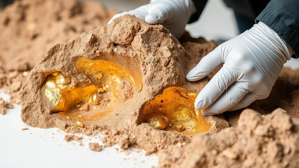
Paleoplacers are sedimentary deposits formed in ancient river systems through the physical processes of erosion and sedimentation. During periods of high energy, heavy minerals like gold can be concentrated in these riverbeds. But, as geology shifts, these deposits can become buried beneath layers of sediment, posing challenges for modern prospectors to locate them.
Geological Surveying
One of the fundamental techniques in identifying potential paleoplacer locations is geological surveying. This process includes scrutinizing geological maps and studying the stratigraphy of regions known for past gold mining activities.
- Geological Maps: Visual representations of the Earth’s surface and subsurface are essential. Maps can reveal historical river paths and geological formations conducive to gold accumulation.
- Stratigraphic Analysis: Examining the layers of rocks and sediments can help in identifying the right age and type of deposits. For example, Late Cretaceous or Early Tertiary aged sediments in certain areas have been linked to higher concentrations of gold.
Remote Sensing Techniques
With technological advancements, remote sensing has become integral in locating buried paleoplacers. Satellite imagery and airborne geophysics allow for broad-area assessments without extensive fieldwork.
- Satellite Imagery: High-resolution images can be analyzed for geomorphological features consistent with ancient rivers, such as meandering patterns which may indicate past streams.
- Electromagnetic Surveys: These surveys measure the conductivity of the ground, helping to identify anomalies that suggest the presence of mineral-rich deposits.
Geochemical Sampling
Geochemical methods involve analyzing soil and sediment samples from surface layers to detect traces of gold and other minerals. This is crucial for determining whether the area has potential for deeper deposits.
- Soil Sampling: Systematic sampling can reveal geochemical anomalies indicating underlying mineralization. For example, studies show that soils with over 20 parts per billion (ppb) of gold can suggest nearby significant deposits.
- Stream Sediment Sampling: Collecting sediment samples from downstream areas can be informative, particularly finding gold in small particles that have traveled from larger, buried deposits.
Geophysical Methods
Geophysical methods offer further insights into subsurface conditions, using physical properties such as magnetic fields, gravity, and electrical resistance. e techniques help locate potential gold-rich areas hidden beneath sediment layers.
- Magnetometry: This method detects magnetic anomalies associated with mineralization. Areas with high magnetic susceptibility can be targets for further exploration.
- Ground Penetrating Radar (GPR): GPR uses radar pulses to map subsurface structures, enabling visualization of sediment layers that may contain buried placers.
Case Studies and Real-World Applications
Several notable case studies emphasize successful techniques for identifying buried paleoplacers. For example, the Klondike Gold Rush, where geologists employed both geological surveying and geochemical sampling, acted as a blueprint for modern exploration. Also, the use of GPR in Western Australia has led to the discovery of significant buried deposits, underscoring the impact of advanced technology in mineral exploration.
Conclusion and Actionable Takeaways
Identifying buried paleoplacers rich in gold requires a multifaceted approach, combining traditional geological methods with modern technology. Successful exploration hinges on understanding geological formations, leveraging remote sensing techniques, and conducting detailed geochemical analysis. For aspiring prospectors and established geologists alike, a balanced application of these techniques can increase the likelihood of discovering valuable mineral deposits.
- Use geological maps and stratigraphic analysis as a starting point for exploration.
- Incorporate remote sensing technologies to widen the search area effectively.
- Conduct thorough geochemical sampling to uncover potential indicators of gold presence.
- Stay updated on advancements in geophysical methods to enhance drilling success rates.


