Spotting High-Yield Gravel Deposits in Dry River Washes
Spotting High-Yield Gravel Deposits in Dry River Washes
Gravel deposits in dry river washes represent an important resource for construction and landscaping industries, providing high-quality aggregate material. Understanding how to identify and assess these deposits can help optimize resource extraction and enhance sustainability. This article delves into the key indicators of high-yield gravel deposits, the processes that create these formations, and practical techniques for locating them.
The Geology of Dry River Washes
Dry river washes, often characterized by intermittent water flow, are formed through the weathering and erosion of surrounding land. Over time, sediment is transported by flowing water and deposited in areas with reduced velocity. The type and quantity of gravel found in these locations largely depend on several geological and hydrological factors.
For example, the composition of the surrounding terrain influences the material being eroded. Areas with significant igneous or metamorphic rock formations may yield finer gravels, while sedimentary regions may produce coarser aggregate materials. particle size distribution typically ranges from fine sand to coarse gravel, with products measuring 0.5 mm to several centimeters in diameter.
Indicators of High-Yield Deposits
Identifying high-yield gravel deposits requires knowledge of specific indicators. Prospective areas are often evaluated based on the following criteria:
- Location: Deposits commonly occur at shallower sections or bends of the wash where water flow slows, allowing gravel to settle.
- Particle Distribution: High-quality deposits exhibit a well-graded mix of particle sizes, enhancing compaction and structural integrity.
- Color and Texture: The color and smoothness of gravel can indicate its geological origin and age, where well-rounded, polished stones often suggest longer transport distances.
- Vegetation Patterns: Areas with sparse vegetation indicate more significant erosion and disturbance, often correlating with exposed gravel deposits.
Techniques for Locating Deposits
Several techniques can advance effective gravel assessment in dry river washes. These include both remote sensing and on-site sampling methods:
- Aerial Surveys: Utilizing drone technology allows for high-resolution imagery of wash terrains, facilitating the identification of promising areas.
- Geological Mapping: Detailed geological maps assist in understanding sedimentary structures and the historical flow patterns of the wash.
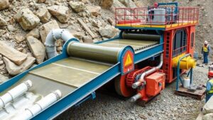
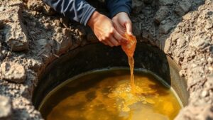
- Sample Testing: Collecting samples from different wash locations and sending them for laboratory analysis helps determine the composition and quality of gravel deposits.
Case Studies and Real-world Applications
Several notable case studies illustrate successful identification and use of gravel deposits in dry river washes. In Arizona, Native American tribes utilize washed gravel for construction purposes, ensuring sustainable practices by monitoring erosion and sediment yield. Similarly, in California, a series of gravel extraction sites along the Mojave River has led to the creation of detailed studies, revealing the patterns of sediment replenishment and sustainable extraction methods.
Conclusion
Spotting high-yield gravel deposits in dry river washes is an essential skill within the field of geology and resource management. With appropriate techniques and a keen eye for geological indicators, industries can exploit these natural resources while implementing sustainable practices. By conducting further research and engaging in modern assessment techniques, we can better understand and manage these valuable deposits.
Actionable Takeaways
- Study geological maps of your target area to predict and assess gravel deposits effectively.
- Incorporate drone surveys as part of your initial exploration strategy to visualize deposit layouts.
- Perform regular sampling and testing to guarantee material quality meets industry standards.