Spotting Areas of Natural Erosion That Reveal Gold in River Systems
Understanding Natural Erosion and Gold Deposits in River Systems
Natural erosion plays a critical role in the geologic processes that contribute to the formation and distribution of gold within river systems. By analyzing how erosion affects riverbank formations, sediment transport, and gold deposition, prospectors can identify potential gold-rich areas. This article explores the mechanisms of erosion that expose gold deposits and provides insights into effective identification strategies.
The Mechanisms of Natural Erosion
Erosion is a natural process whereby soil and rock are worn away and transported by wind, water, and ice. In river systems, erosion can lead to the exposure of gold materials held within the bedrock or sediment layers. The following factors influence the erosion process:
- Water flow velocity: Higher flow rates can increase erosion and transport of material.
- Gradient: Steeper gradients in rivers can accelerate erosion.
- Type of substrate: Softer substrates erode faster compared to harder bedrock.
Knowledge of these factors helps prospectors focus on specific river sections that could reveal gold deposits.
Identifying Areas of Erosion
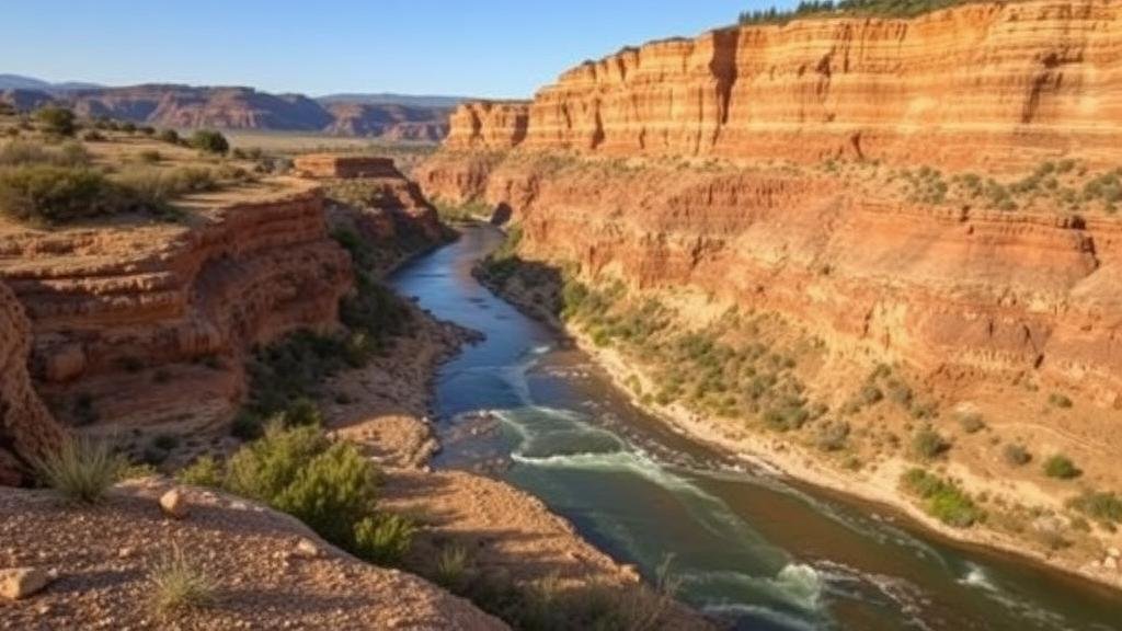
Spotting areas of erosion in river systems can be accomplished through careful observation and landscape analysis. The following features are indicative of erosion zones likely to contain gold:
- Under-cut banks: Areas where water has eroded the base of the riverbank may expose bedrock or concentrated sediments where gold can accumulate.
- River bends: Inside bends of a river may accumulate gold due to slower water velocity, allowing heavier materials to settle.
- Rocky outcrops: Exposed rocky surfaces can indicate areas of natural weathering and erosion, leading to gold deposits.
Expert prospectors often use topographic maps and satellite imagery to identify these features upstream and downstream of known gold-bearing rivers.
Case Study: The Klondike River, Canada
The Klondike River is a notable example where natural erosion has revealed substantial gold deposits. During the late 19th century, prospectors discovered that major areas of erosion along the riverbanks uncovered rich placer deposits. By understanding the rivers flow patterns and erosion zones, they were able to yield significant quantities of gold. In fact, estimates suggest that over 12 million ounces of gold were extracted from the Klondike region during the gold rush.
This successful identification of erosion areas in the Klondike serves as a template for modern prospectors, who can apply similar methodologies to find gold in recent sediment deposits in other river systems.
Utilizing Modern Tools for Erosion Analysis
Advancements in technology provide new opportunities for prospectors to analyze erosion areas effectively. Tools and methods that can enhance gold discovery include:
- Geographic Information Systems (GIS): GIS can be used to analyze landforms and hydrological data for potential erosion sites.
- Sediment sampling: Collecting and analyzing sediment samples helps investigate the gold content in various river locations.
- Drone imagery: Drones facilitate aerial surveys of river systems, helping to identify erosion features that are difficult to access.
Leveraging these technologies can increase efficiency in locating gold-rich areas by providing precise, large-scale surveys of river systems.
Conclusion: Effective Strategies for Prospectors
Finding gold in river systems is a multifaceted endeavor that requires a solid understanding of natural erosion processes and the geology of the area. Recognizing the signs of erosion, analyzing historical data and employing modern technological tools can significantly enhance the likelihood of uncovering valuable gold deposits. By paying attention to eroded zones and understanding their characteristics, prospectors can effectively strategize their efforts in the quest for gold.
Key takeaways for prospectors include:
- Analyze flow patterns and river characteristics to identify erosion zones.
- Use modern technology such as GIS and drones for effective surveys.
- Study historical cases like the Klondike River to inform current practices.
To wrap up, informed and strategic methods for spotting areas of natural erosion can yield fruitful results in the pursuit of gold within river systems.


