Recognizing Sacred Symbols on Maps Linked to Hidden Religious Relics
Recognizing Sacred Symbols on Maps Linked to Hidden Religious Relics
The intersection of cartography, archaeology, and religion has always fascinated scholars and enthusiasts alike. Ancient maps often contain sacred symbols intended for guiding believers or secretive societies towards hidden religious relics. This article explores how these symbols can be recognized, their significance, and how they have been linked to historical and contemporary quests for religious artifacts.
The Importance of Sacred Symbols in Cartography
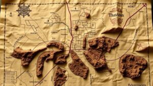
Throughout history, maps have served not only as navigational tools but also as sacred texts that speak to the spiritual beliefs of a culture. inclusion of sacred symbols on maps can provide rich insights into the religious landscape of a geographical area.
For example, the Christian cross may appear on historical maps of Europe, signifying the presence of churches or sites of pilgrimage. Similarly, Islamic symbols, such as the crescent moon and star, indicate areas of cultural and religious significance in Muslim-majority countries. These symbols often served to guide worshippers or treasure hunters alike towards locations deemed holy or significant.
Types of Sacred Symbols Found on Maps
Sacred symbols can be categorized into various types based on the religions they represent. Some common examples include:
- Christianity: The cross, chi-rho, and fish (Ichthys) are often found on maps indicating Christian sanctuaries or pilgrimage routes.
- Judaism: The Star of David may mark locations of synagogues, while menorah symbols might indicate historical sites of significance.
- Islam: The crescent and star are common symbols that signify mosques and centers of Islamic scholarship.
- Indigenous Religions: Various tribal symbols can denote sacred sites, such as totem poles or animal figures linked to myths and legends.
Decoding the Symbols: Techniques and Tools
Recognizing and interpreting these sacred symbols requires a multidisciplinary approach, leveraging both historical analysis and modern technology.
Geographic Information Systems (GIS) play a crucial role in the analysis of ancient maps. By layering historical data with contemporary satellite imagery, researchers can locate hidden sites associated with sacred symbols. For example, GIS has been used to uncover lost Christian relics in parts of Europe where layers of architectural and environmental data intersect with historical records.
Case Study: The Search for the Holy Grail
The legend of the Holy Grail illustrates how sacred symbols on maps have led to the pursuit of hidden religious relics. Various texts, such as the Chronicles of the Holy Grail, reference locations like Glastonbury and Montsalvat as potential resting places for the Grail.
In the early 20th century, teams of archaeologists and enthusiasts utilized ancient maps that contained illustrations of sacred symbols associated with the Grail legend. Though many searches ended without definitive discoveries, findings such as the Glastonbury Abbey relics reiterated the importance of sacred symbols on historical maps and their link to legendary artifacts.
Modern Implications and Real-World Applications
Understanding the role of sacred symbols in mapping has significant implications not only for archaeology but also for contemporary spiritual practice and tourism. Religious pilgrimage routes worldwide are often based on these symbols, drawing believers and tourists alike to significant historical locations.
For example, the Camino de Santiago pilgrimage in Spain leverages symbols such as the scallop shell as markers guiding travelers to the shrine of Saint James. This integration of ancient cartography with modern spirituality demonstrates that sacred symbols continue to play an essential role in guiding peoples journeys today.
Conclusion: The Continued Relevance of Sacred Symbols
Recognizing sacred symbols on maps provides insights into the rich tapestry of religious beliefs that have shaped human civilization. These symbols serve as both historical markers and spiritual guides, linking people to their past and their faith. As technology advances, the ability to decode and analyze ancient maps will grow, further enhancing our understanding of the connection between sacred symbols and hidden religious relics.
For researchers and enthusiasts alike, continuing to explore these symbols offers profound implications for both historical inquiry and spiritual understanding, opening new avenues for exploration in our increasingly interconnected world.


