Recognizing Geological Indicators That Enhance Dowsing Accuracy
Recognizing Geological Indicators That Enhance Dowsing Accuracy
Dowsing, often referred to as water divining or witching, is a practice that involves locating underground resources such as water, minerals, or even buried objects using a forked stick, rods, or other tools. While many view dowsing as pseudoscience, advocates assert that successful dowsing can be enhanced by recognizing specific geological indicators. This article explores these indicators, their significance, and how they can improve dowsing accuracy.
The Role of Geological Indicators in Dowsing
Geological indicators are features in the landscape or subsurface that signify the presence of resources like water or minerals. Understanding these indicators can significantly influence a dowsers effectiveness. Dowsers often rely on their intuition and tools, but integrating knowledge of geology can provide a more objective framework.
- Soil Composition: Variances in soil types can signal the presence of water. Clay soils, for example, tend to retain moisture, indicating proximity to groundwater sources.
- Topographical Features: Valleys, hills, and contours can affect water flow. Dowsers often focus on low-lying areas where water naturally accumulates.
- Vegetation Patterns: Certain plants thrive in wet conditions. The presence of lush, green vegetation can indicate higher moisture levels in the soil.
Understanding Soil Composition
The composition of soil is crucial in understanding groundwater sources. Different soil types possess varying water retention capabilities. For example, sandy soils allow rapid water drainage, while clay soils can retain water for extended periods, often serving as an indicator of nearby water. Dowsers should therefore familiarize themselves with local geology to recognize these patterns.
Interpreting Topographical Features
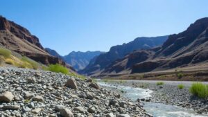
Topography plays a significant role in hydrology. Low areas or depressions in the landscape are more likely to collect water than higher elevations. For example, dowsers often find success in valleys or near riverbeds where water is more likely to pool. Understanding the lay of the land allows dowsers to make informed decisions on where to locate their efforts.
Recognizing Vegetation Patterns
Plants serve as excellent indicators of subsurface moisture. Certain species thrive in wetter environments, such as willows and ferns, which can signal the presence of groundwater. A dowser observing these plants can mark areas for potential water sources. This reliance on natural indicators helps dowsers bolster their intuitive practices with scientific reasoning.
Case Studies: Enhancing Dowsing with Geological Indicators
Numerous case studies illustrate the effectiveness of combining geological knowledge with dowsing practices. In one instance, a dowser in the arid regions of New Mexico successfully located a water source by identifying a depression in the landscape coupled with signs of moisture-retaining clay soils. This integration of experience and geological understanding not only resulted in the discovery of water but also validated the methodology against geophysical surveys.
Another case involved dowsers working in regions riddled with mining activity. By studying mineralization patterns and previous excavation sites, they were able to predict potential mineral deposits effectively, leading to successful prospecting endeavors.
Actionable Takeaways
To enhance dowsing accuracy through geological indicators, practitioners should consider the following:
- Become familiar with local soil types and their moisture retention properties.
- Study the topography and seek out depressions or valleys as potential water sources.
- Observe vegetation patterns to identify plants that indicate the presence of water.
- Combine intuitive dowsing techniques with scientific observations to improve outcomes.
To wrap up, while dowsing remains a controversial practice, recognizing and understanding geological indicators significantly enhances its accuracy. By merging traditional methods with a scientific approach to geology, dowsers can improve their success rates in locating underground resources.


