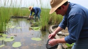
Mapping Historical Orchard Locations for Early Agricultural Tool Finds
Mapping Historical Orchard Locations for Early Agricultural Tool Finds
The study of early agricultural tools and their associated environments offers invaluable insights into the evolution of farming practices. By mapping historical orchard locations, researchers can uncover relationships between specific agricultural tools and the landscapes they were designed to manipulate. This article examines methods for identifying these orchard sites and highlights notable discoveries of tools in relation to historical agricultural practices, particularly in regions like Mesopotamia and the Mediterranean basin.
Historical Context of Agricultural Practices
The advent of agriculture around 10,000 BCE marked a significant shift in human civilization. Early societies transitioned from nomadic lifestyles to settled farming practices, which necessitated the development of specialized tools. In regions such as the Fertile Crescent, early farmers cultivated a variety of species including barley, wheat, and various fruits, establishing orchards that became integral to their subsistence.
The significance of orchards in ancient agricultural systems is underscored by archaeological findings. For example, in ancient Mesopotamia, excavations have revealed remains of fruit trees like dates and olives, illustrating the agricultural diversity of the era. Recent studies suggest that the cultivation of these orchards was closely linked to the development of agricultural tools such as the sickle, which allowed for efficient harvesting of crops.
Methodologies for Mapping Historical Orchard Locations
Identifying and mapping historical orchard locations involves a multi-disciplinary approach, combining archaeological evidence, geospatial analysis, and historical texts. Key methodologies include:
- Archaeobotanical Analysis: Examination of plant remains found at excavation sites assists in identifying specific crops and associated orchards. Pollen analysis can further reveal the types of fruits grown.
- Remote Sensing Technologies: Aerial photography and satellite imagery help scientists locate ancient agricultural landscapes. e technologies can reveal patterns in soil types and vegetation indicative of former orchards.
- Historical Document Examination: Ancient texts and agricultural manuals provide contextual information regarding orchard management practices and tool use, crucial for establishing connections between tools and orchard sites.
Case Studies of Early Agricultural Tool Finds
One of the most notable regions for studying historical orchards and agricultural tools is the Mediterranean region. In Greece, for instance, archaeological digs in Crete have uncovered numerous stone tools dating back to 3000 BCE, which correlate with evidence of olive and grape cultivation. The presence of grinding stones and mortars suggests a sophisticated understanding of food processing at that time.
In the Near East, excavations at sites such as Tell Abu Hureya in Syria reveal a timeline of agricultural development from 11,000 to 8,000 BCE, with findings of early sickles and grinding tools, indicating advanced harvesting and processing techniques. e tools reflect the importance of orchards in the diets and economies of these early societies.
Implications of Mapping Historical Orchard Locations
The mapping of historical orchard locations has several implications for our understanding of early agricultural societies:
- Cultural Insights: Understanding the layout and management of orchards provides insights into social structures, trade networks, and dietary practices of ancient cultures.
- Tool Development: Analyzing where and how tools were used within orchard settings can inform the evolution of agricultural technologies.
- Conservation Efforts: Identifying ancient orchards may aid in contemporary conservation efforts, promoting biodiversity and sustainable agriculture based on historical practices.
Conclusion
Mapping historical orchard locations is crucial for unraveling the complexities of early agricultural practices and the tools that supported them. As these methodologies continue to evolve, the ability to correlate archaeological finds with accurate historical contexts will enhance our comprehension of agricultural development throughout history. Continued interdisciplinary collaboration and technological advancements will further propel this field of study, ensuring that agricultural heritage is preserved for future generations.
Actionable Takeaways: For researchers and historians, leveraging archaeological methods and modern technology to investigate ancient orchards can yield significant insights. Engaging with local historical societies and utilizing digital tools for mapping can facilitate deeper understanding and preservation of agricultural history.


