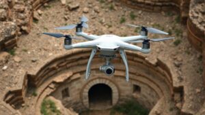
Mapping historical earthquake zones to locate cities buried under landslides or tectonic shifts.
Mapping Historical Earthquake Zones: Uncovering Cities Buried Under Landslides and Tectonic Shifts
The study of historical earthquake zones serves as a crucial tool for understanding the impacts of seismic activities on urban landscapes. By analyzing the geological history of certain regions, researchers can locate cities that have been buried or significantly altered due to landslides or tectonic shifts triggered by earthquakes. This article explores the methodologies used in mapping these historical zones, the significance of identifying buried cities, and real-world applications of this knowledge.
The Importance of Historical Data
Historical earthquake data provides insight into seismic patterns and the geological evolution of areas prone to tectonic activity. By examining historical records, including seismic activity logs and archaeological findings, researchers can piece together the sequences of earthquakes that have occurred over centuries. For example, the 1906 San Francisco earthquake, which registered a magnitude of 7.9, devastated vast stretches of the city and caused extensive ground shaking that triggered landslides and fires.
Also, studies indicate that California has experienced over 200 notable seismic events in the last 150 years, with varying magnitudes and consequences. Understanding these patterns allows geologists to create models predicting future seismic activity, thereby contributing to urban planning and disaster preparedness.
Techniques for Mapping Earthquake Zones
The mapping of historical earthquake zones employs several advanced techniques that combine geological surveys with modern technology:
- Geological Surveys: Physical examinations of the land include assessing soil composition, slope stability, and erosion patterns to identify areas at risk of landslides.
- Seismic Imaging: Technologies such as ground-penetrating radar (GPR) and LiDAR (Light Detection and Ranging) help visualize underground structures, revealing buried cities or remnants of former settlements.
- Remote Sensing: Satellite imaging allows scientists to monitor changes in landform and vegetation, aiding in recognizing regions affected by past seismic activities.
Real-World Examples of Buried Cities
Various cities around the world serve as critical case studies for the impact of seismic activity:
- Port Royal, Jamaica: Once a bustling city in the 17th century, Port Royal was largely submerged after a massive earthquake in 1692. event, which triggered landslides and tsunamis, led to the loss of thousands of lives and the city being buried beneath water and debris.
- Herculaneum, Italy: Alongside Pompeii, Herculaneum was buried under volcanic ash and landslides following the eruption of Mount Vesuvius in AD 79. Recent excavations have revealed extensive findings, showcasing well-preserved ruins and remnants of pastoral life.
- The Lost City of Akrotiri, Santorini: This Minoan Bronze Age settlement was preserved under volcanic ash from the eruption around 1627 BC. The discovery has aided understanding of seismic activities and societal impacts on this Aegean island.
Challenges and Opportunities
Mapping historical earthquake zones is not without its challenges. Uncertainties in the geological record, as well as the dynamic nature of erosion and tectonic shifts, can complicate efforts. Plus, the integration of historical data with newly acquired geological information can be complex, requiring advanced analytical techniques.
Nonetheless, the opportunities presented by these efforts are vast. For example, improved mapping techniques can assist urban planners in creating more resilient cities. By acknowledging historical precedents, cities can reduce the risk of future disasters, create safer buildings, and implement effective evacuation strategies.
Actionable Takeaways
Understanding and mapping historical earthquake zones is vital for urban safety and risk management. Here are some actionable takeaways for researchers, urban planners, and policymakers:
- Invest in advanced technologies such as LiDAR and GPR for better mapping of geological changes.
- Encourage interdisciplinary collaboration among geologists, urban planners, and local governments to develop comprehensive disaster preparedness plans.
- Promote public awareness about the history of seismic activity in their regions to foster community readiness.
To wrap up, the exploration of historical earthquake zones not only uncovers buried cities but also equips us with essential knowledge for future urban resilience. By leveraging past geological data and modern technologies, we can better prepare for unexpected seismic events, ultimately saving lives and preserving cultural heritage.


