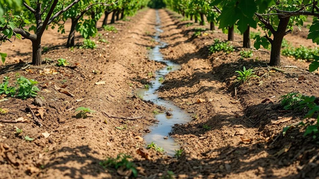
Mapping Forgotten Orchard Irrigation Channels for Agricultural Tool Relics
Mapping Forgotten Orchard Irrigation Channels for Agricultural Tool Relics
In contemporary agricultural studies, understanding the historical landscape and the evolution of irrigation practices plays a crucial role in sustainable farming methods. This article focuses on the mapping of forgotten orchard irrigation channels, which not only reflects past agricultural practices but also serves as a repository for agricultural tool relics. By examining specific case studies, this research highlights the significance of these irrigation channels, the techniques employed in their mapping, and the implications for modern agriculture.
Historical Background
Irrigation channels have been integral to agricultural practices since the development of farming in ancient civilizations. In particular, orchards have utilized these channels to ensure adequate water supply, thus enhancing yield and sustainability. Historical records, such as those of the Mesopotamian and Egyptian civilizations, illustrate how effective irrigation techniques contributed to agricultural prosperity. For example, the earliest documented irrigation systems date back to around 6000 BC in Mesopotamia, showcasing the crucial role of water management in cultivating fruit-bearing trees.
Significance of Orchard Irrigation Channels
The remnants of orchard irrigation channels offer valuable insights into the technological advancements and agricultural strategies of past societies. e channels not only supported local ecosystems but also provided the necessary conditions for diverse agricultural practices. As agriculture shifted towards industrialization in the 19th century, many traditional irrigation systems became neglected and forgotten.
- Preservation of Biodiversity: Historically, these irrigation channels facilitated the growth of various tree species, contributing to rich biodiversity.
- Cultural Heritage: The channels serve as a testament to the agricultural innovations of previous generations and reflect cultural practices related to land and resource management.
Mapping Techniques
The process of mapping forgotten irrigation channels involves a combination of historical research, modern technology, and field surveys. In the past decade, Geographic Information Systems (GIS) have emerged as a valuable tool for researchers, allowing for precise mapping and analysis of these channels. Also, airborne remote sensing technologies such as LiDAR (Light Detection and Ranging) and satellite imagery can reveal subtle topographical changes indicative of old irrigation pathways.
For example, a study conducted in the Central Valley of California utilized LiDAR technology to successfully identify over 150 miles of forgotten irrigation ditches that had not been documented in any historical records. These findings not only enriched the understanding of the local agricultural landscape but also offered opportunities for revitalizing sustainable irrigation practices in the area.
Challenges in Preservation
Despite the promising methodologies for mapping orchard irrigation channels, several challenges persist. Chief among them is the urbanization and agricultural intensification that have led to the obliteration of many historical channels. Also, the lack of funding and support for cultural heritage projects often results in underrepresentation of these significant agricultural landscapes.
- Urban Encroachment: Rapid urban development often leads to the destruction of historical irrigation systems.
- Funding Gaps: Many local governments and institutions lack the necessary funding to conduct comprehensive studies and preservation efforts.
Real-World Applications
The study of forgotten orchard irrigation channels has practical applications in today’s agricultural environment. By reconstructing and utilizing these historical water management systems, modern farmers can enhance water efficiency and reduce dependency on groundwater sources. For example, in Israel, farmers have successfully revived ancient irrigation techniques, resulting in increased crop yields while conserving water resources.
Conclusion and Future Directions
Mapping forgotten orchard irrigation channels serves as a vital link between past agricultural practices and contemporary sustainability efforts. By embracing historical knowledge, today’s agricultural practices can innovate while embedding respect for historical practices. Future research should aim to integrate technological advancements in remote sensing with community-driven preservation efforts to ensure that these vital agricultural channels continue to inform sustainable practices. Collaborative efforts between historians, agronomists, and environmentalists will be essential to achieve a balanced and productive agricultural landscape.
Actionable Takeaways
- Encourage local initiatives to document and preserve historical irrigation systems.
- Use technology such as GIS and LiDAR for mapping and analysis of agricultural landscapes.
- Advocate for funding and resources dedicated to the study and restoration of forgotten irrigation channels.
Through the understanding and revitalization of these channels, farmers can learn from historical practices and apply sustainable methods that honor the ecosystem and heritage of agricultural landscapes.


