Mapping Early Canal Lock Keeper Residences for Waterway Relic Discoveries
Mapping Early Canal Lock Keeper Residences for Waterway Relic Discoveries
The study of early canal lock keeper residences offers valuable insights into the socio-economic and architectural history surrounding waterway infrastructure development. By mapping these residences, researchers can uncover relics that reflect the daily lives of individuals who operated and maintained these critical waterways. This article explores historical contexts, methodologies, and implications of mapping early canal lock keeper residences, with a particular focus on the canals established in the United Kingdom and their influence on society during the Industrial Revolution.
Historical Context of Canal Development
The advent of the Industrial Revolution in the late 18th century marked a significant transformation in transportation and trade practices in England. Canals became essential conduits for moving goods between industrial cities. The Bridgewater Canal, opened in 1761, is often cited as the first successful canal in the UK, directly facilitating coal transport from mines to cotton mills. The operation of these canals relied heavily on lock systems, managed by lock keepers whose residences were strategically positioned alongside the waterways.
Lock Keeper Residences: A Socio-Economic Overview
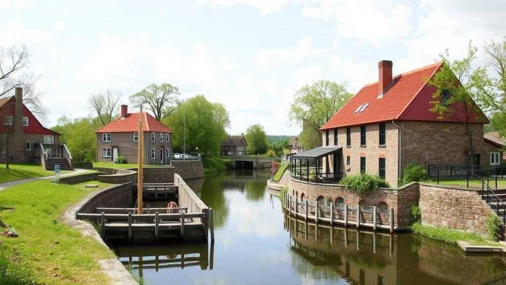
Lock keeper residences served not only as homes but also as administrative hubs for waterway operations. e residences were typically located near locks, ensuring that the lock keepers could promptly manage the passage of boats, which was crucial for maintaining the flow of commerce. The role of a lock keeper often included overseeing the maintenance of the canal, ensuring proper water levels, and collecting tolls. For example, the role of a lock keeper on the Yorkshire canals, operational since the 1770s, required close collaboration with boating companies and local merchants, underscoring their importance in early industrial economies.
Methodology for Mapping Residences
The methodology for mapping early canal lock keeper residences involves a multi-faceted approach, integrating historical research, geographical information systems (GIS), and archaeological surveys. Key steps include:
- Archival Research: Examining historical records, maps, and documents from local archives to locate residences.
- GIS Technology: Utilizing software to analyze spatial relationships and visualize data regarding the locations of residences along canal routes.
- Field Surveys: Conducting on-site investigations to identify any physical remnants of residences or features related to lock operations.
Case Study: The Grand Union Canal
One notable example is the Grand Union Canal, which was constructed between 1793 and 1805. The residences of lock keepers along this canal have been documented in various local surveys. The mapping project incorporated both historical cartographic sources and contemporary GPS technology to trace the locations of these residences.
Data collected from the Grand Union Canal indicate that lock keeper residences were strategically positioned at major lock sites, such as the Blisworth Tunnel, which features a significant number of locks within close proximity. This reveals not only the physical structure of waterways but also the broader network of waterway-related occupations and community interactions. Analysis also showed that many of these residences were constructed using locally sourced materials, reflecting both architectural trends and economic considerations of the time.
Relics and Their Significance
Mapping the residences has facilitated the discovery of relics that provide tangible links to the past. Artifacts such as tools used by lock keepers, personal items, and remnants of domestic life have been uncovered. For example, during excavations near the lock keeper’s residence at the Stoke Bruerne locks, several items ranging from pottery to old oil lamps were discovered, shedding light on the daily lives of these essential workers.
Such discoveries are crucial for understanding the socio-economic dynamics of canal operations. Also, they reveal how these workers integrated with their communities, often establishing relationships with traders, artisans, and the commuting public that frequented the canals.
Implications for Future Research
Mapping early canal lock keeper residences has critical implications for future research in industrial archaeology and historical geography. Such studies can:
- Enhance understanding of Industrial Revolution development: Provide insights into how industrialization altered local economies and communities.
- Promote heritage conservation: Assist in the preservation of canal-related structures as part of the industrial heritage.
- Encourage interdisciplinary collaboration: Foster partnerships between historians, archaeologists, and environmental scientists.
Conclusion
Mapping early canal lock keeper residences constitutes a valuable avenue for uncovering historical truths about the operation and impact of early canals in the UK. By utilizing a combination of historical research and modern mapping technology, researchers can retrieve relics that not only reflect the past but also educate future generations about the significant role of waterways in shaping both industry and society during the transformative period of the Industrial Revolution.
Future studies should continue to focus on both the physical and social aspects of these waterway communities to fully appreciate their contributions to regional development.


