Mapping Disused Quarry Equipment Yards for Forgotten Mining Relics
Mapping Disused Quarry Equipment Yards for Forgotten Mining Relics
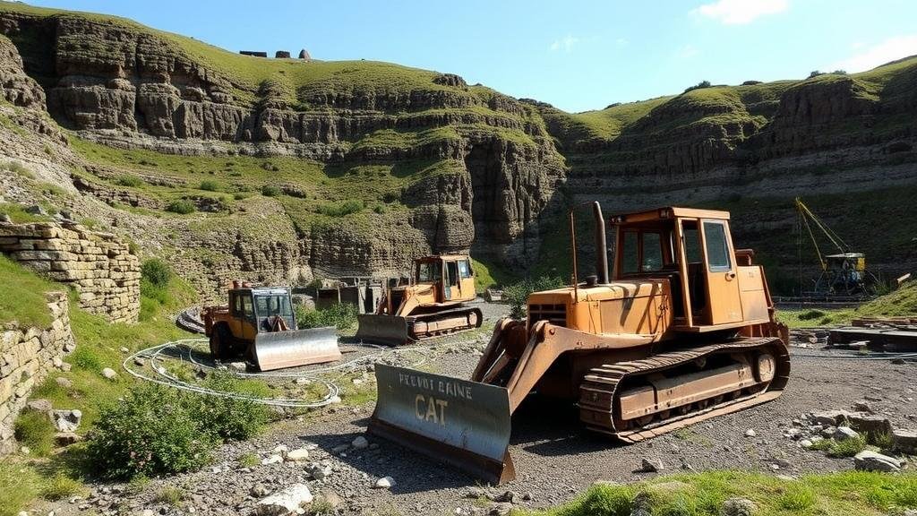
The exploration and documentation of disused quarry equipment yards provide a fascinating glimpse into the history of industrial activity and resource extraction. These abandoned locations often serve as repositories of forgotten mining machinery and tools that played vital roles in various geological and economic environments. This article aims to distill information about how to effectively map these quarry equipment yards, uncover their historical significance, and promote their preservation.
Historical Context of Quarrying
Quarrying has been a pivotal activity since ancient times, allowing societies to extract materials like stone, gravel, and minerals to support infrastructure development. According to the United States Geological Survey, the quarrying industry contributed approximately $8 billion to the U.S. economy in 2020 alone (USGS, 2021). But, many quarry sites have transitioned from productive facilities to forgotten landscapes filled with rusting machinery and desolate worksites.
The Importance of Mapping
Mapping disused quarry equipment yards is essential for several reasons:
- Preservation of historical artifacts
- Promotion of educational outreach and public awareness
- Support for environmental rehabilitation efforts
By utilizing modern mapping technologies such as Geographic Information Systems (GIS), researchers can overlay historical data with current geographical layouts. This allows for a more comprehensive understanding of both the physical and sociocultural landscapes these quarries once occupied.
Methodology for Mapping Quarry Equipment Yards
Effective mapping involves a multi-disciplinary approach combining historical research, field surveys, and advanced technology. Here, we outline a step-by-step methodology for achieving comprehensive results:
- Historical Research: Start by investigating local archives, libraries, and historical societies. Documents such as mining reports from the late 19th to early 20th centuries can provide insights into the types of machinery used.
- Field Surveys: Conduct systematic field surveys using both walk-through approaches and drone technology. This method allows for a first-hand assessment of the current state of equipment and the surrounding ecological environment.
- Data Collection: Use GIS tools to collect coordinates of different pieces of machinery and create layers that categorize the equipment according to function (e.g., extraction, transport, processing).
- Analysis and Reporting: Analyze the gathered data to assess the preservation state of the relics and report findings through academic journals or local history publications.
Case Study: The Abandoned Quarries of the Appalachian Region
The Appalachian Region serves as an illustrative case in understanding the dynamics of abandoned quarry sites. Once a hub for coal mining and stone quarrying, the region is now dotted with equipment yards containing relics from its industrial past. A study conducted by the Appalachian Regional Commission (ARC) in 2022 highlighted that there are over 150 documented disused quarry sites in West Virginia alone (ARC, 2022).
Researchers found that many machines, such as steam shovels and conveyor belts, are still intact, though they suffer from weathering and neglect. Mapping efforts at these sites yielded significant insights into the regions economic history, correlating machinery types with their peak operational periods.
Challenges and Concerns
While mapping disused quarry equipment yards is beneficial, it is not without its challenges:
- Safety Hazards: Many sites are dangerous due to structural instabilities. Proper safety protocols must be established before conducting field surveys.
- Legal and Ethical Considerations: Researchers must obtain permission from landowners before accessing private property and ensure compliance with local and federal regulations regarding historical preservation.
Real-World Applications
The insights gained from mapping disused quarry equipment yards have applications in various fields, such as:
- Heritage Conservation: Identifying key machinery can inform conservation efforts, ensuring that historical artifacts are preserved for future generations.
- Academic Research: Providing a physical context for studies in industrial archaeology, environmental science, and regional history.
- Public Education: Engaging the community in understanding its industrial heritage through exhibitions, guided tours, and educational programs.
Conclusion
Mapping disused quarry equipment yards is a rewarding endeavor that opens doors to understanding our industrial past. By employing meticulous research methodologies and advanced mapping technologies, we can uncover and preserve the relics that shape our knowledge of historical quarrying practices. Ongoing efforts in this domain will not only serve to protect these valuable artifacts but will also enrich our cultural heritage.
For those interested in delving deeper into the study, consider reaching out to local historical societies and universities involved in industrial archaeology, as well as utilizing GIS mapping resources available through academic institutions.
References
United States Geological Survey (USGS). (2021). 2020 Mineral Commodity Summaries. U.S. Department of the Interior.
Appalachian Regional Commission (ARC). (2022). A Study of Historical Quarries in the Appalachian Region.


