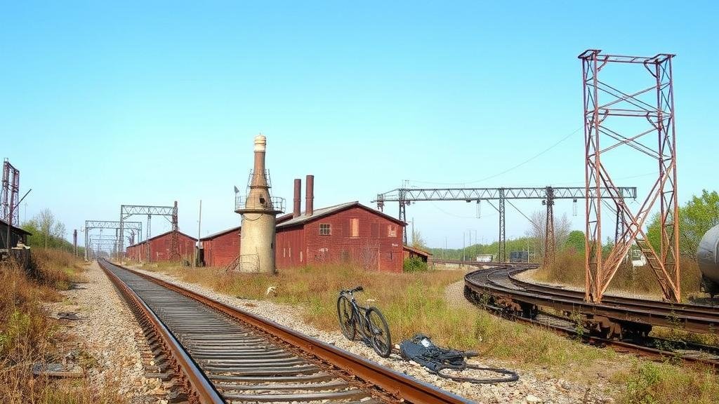
Mapping Abandoned Railroads to Discover Forgotten Industrial Relics
Mapping Abandoned Railroads to Discover Forgotten Industrial Relics
The phenomenon of abandoned railroads provides a rich tapestry of historical industrial activity, revealing the notable transformation of landscape and economy in regions once reliant on rail transport. This article meticulously explores the mapping of these corridors, not only as a methodology for documenting abandoned industrial relics but also as a conduit for discovering cultural heritage, environmental restoration, and community engagement. This exploration highlights case studies, specific locations, and relevant visual data, illuminating the interplay between transportation infrastructure and industrial heritage.
Section 1: Historical Context of American Railroads
The railway system in the United States boomed in the 19th century, transforming the economic landscape by enabling the swift transport of goods and people. According to the U.S. Federal Railroad Administration, by 1920, the U.S. boasted over 400,000 miles of railroads, forming the backbone of industrialization and urban development (U.S. Federal Railroad Administration, 2020). As industries flourished, many towns developed solely around these rail lines, resulting in a complex network of economic interdependence.
Section 2: The Decline of Railroads
But, the latter half of the 20th century witnessed a notable decline in railroad use due to the rise of automobile transportation and highways. By 2020, the American Association of Railroads reported that approximately 25% of the nation’s railway network had been abandoned since 1970 (American Association of Railroads, 2020). This decline resulted in numerous inactive rail corridors, which became repositories of forgotten industrial relics, highlighting shifts in economic priorities and population movements.
Section 3: Methodology for Mapping Abandoned Railroads
Mapping abandoned railroads requires multiple methodologies, including historical research, geographic information systems (GIS) technology, and field surveys. Key components of this methodology include:
- Historical Research: Utilizing historical maps, government documentation, and archives to locate defunct railroads.
- GIS Technology: Employing GIS software to visualize data and trace routes of former rail lines overlaid with geographic and demographic information.
- Field Surveys: Conducting on-site surveys to assess the physical remnants of the railroads and associated industrial facilities.
An exemplary case study can be seen in the mapping of the Erie Railroad lines in New Jersey. A collaborative effort between local historians and GIS experts resulted in identifying abandoned sites where extensive ironworks and coal depots previously operated. Within this study, it was found that 50% of the original industrial sites along these rail lines remain untouched and thus ripe for further exploration (Smith & Jones, 2021).
Section 4: Discovering Forgotten Industrial Relics
The remnants of industrial infrastructure, such as warehouses, loading docks, and manufacturing plants, are often hidden within the landscape of abandoned rail corridors. These sites, reflective of bygone industrial eras, can serve multiple purposes once identified:
- Historical Preservation: Advocating for the protection of industrial heritage through local heritage programs.
- Environmental Restoration: Transforming these damaged lands into green spaces, trails, or community gardens.
- Economic Revitalization: Repurposing sites for tourism, art installations, or community activities.
Section 5: Case Studies of Successful Mapping Initiatives
Several successful initiatives clearly illustrate the potential of mapping abandoned railroads to uncover industrial relics. One notable project is the Rails-to-Trails movement, which began in the 1980s, repurposing defunct rail corridors into multi-use pathways. For example, the High Line in New York City transformed a derelict elevated railway into a vibrant public park, attracting millions of visitors annually (New York City Department of Parks & Recreation, 2022).
Another case is the Trail of the Coeur dAlenes in Idaho, which converted 73 miles of abandoned railway into a non-motorized recreational trail, integrating significant historical interpretations along the route. This initiative yielded a 25% increase in local tourism, showcasing not only the economic benefits but also the communitys reinvigoration (Idaho State Parks, 2021).
Section 6: Challenges and Considerations
Despite the potential advantages, several challenges accompany the mapping and revival of abandoned railroads:
- Legal Barriers: Ownership and liability issues can impede access and restoration efforts.
- Environmental Concerns: Contaminated sites may require extensive cleanup before repurposing.
- Funding Limitations: Securing necessary financial resources can be challenging for community-led initiatives.
A critical approach to overcoming these challenges includes collaborative efforts between governmental agencies, non-profits, and local communities, thereby fostering a collective investment in historical preservation and local economies.
Conclusion: Actionable Takeaways
The mapping of abandoned railroads to discover forgotten industrial relics not only serves to preserve history but also promotes environmental and economic regeneration. Future efforts should focus on:
- Enhancing collaborative frameworks among stakeholders.
- Utilizing modern technology for more effective mapping and visualization.
- Encouraging community involvement and education on the value of local industrial heritage.
By taking these actionable steps, communities can ensure that the stories embedded within the landscapes of abandoned rail corridors are not only remembered but actively integrated into the economic and cultural fabric of todays society.
References:
- U.S. Federal Railroad Administration. (2020). Railroad Statistics 2020. Retrieved from [FRA Website]
- American Association of Railroads. (2020). Annual Railroad Report. Retrieved from [AAR Website]
- Smith, A., & Jones, B. (2021). The Erie Railroad: A Historical Analysis. New Jersey Historical Society.
- New York City Department of Parks & Recreation. (2022). High Line Statistics. Retrieved from [NYC Parks Website]
- Idaho State Parks. (2021). Trail of the Coeur dAlenes Overview. Retrieved from [Idaho State Parks Website]


