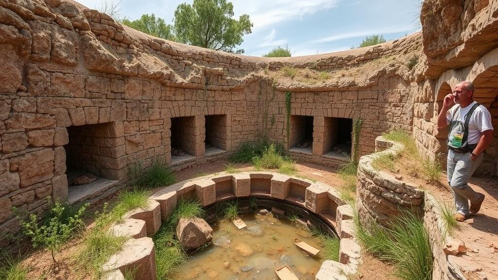
Mapping Abandoned Aqueduct Systems for Water Management Artifact Finds
Mapping Abandoned Aqueduct Systems for Water Management Artifact Finds
Water management systems have played a crucial role in the development of civilizations, particularly in arid regions where access to fresh water is limited. Among these systems, aqueducts represent remarkable engineering achievements. These structures, often abandoned over time, retain the potential to illuminate past water management practices and cultural dynamics. This article explores the methods and implications of mapping abandoned aqueduct systems, focusing on their role in the recovery and analysis of water management artifact finds.
The Historical Context of Aqueduct Systems
Aqueducts date back to ancient civilizations, with the first known aqueduct constructed in ancient Assyria around the 9th century BCE. The Roman aqueducts, which spanned thousands of kilometers across their empire, exemplify advanced engineering techniques for transporting water. For example, the Aqua Appia, completed in 312 BCE, is regarded as one of the earliest and longest aqueducts, supplying water to Rome and showcasing the empires capacity for large-scale infrastructure development. Historical records indicate that Rome had eleven aqueducts supplying water to its population of over a million inhabitants by the 3rd century CE (Fowler, 2011).
Importance of Mapping Aqueducts
Mapping abandoned aqueduct systems provides holistic insights into ancient water management practices and their societal impacts. The reasons for aqueduct abandonment vary, including:
- Shifts in population dynamics
- Natural disasters such as earthquakes
- Technological advancements that rendered previous infrastructure obsolete
Mapping allows archaeologists and historians to understand these factors through spatial analysis. For example, a study of the aqueduct systems in Andalusia, Spain, revealed that regions experiencing agricultural decline corresponded with areas of aqueduct neglect, suggesting economic factors played a pivotal role (Gonzalez-Torres, 2019).
Technological Advances in Mapping Techniques
Recent technological advances have significantly improved the accuracy and accessibility of mapping abandoned aqueducts. Techniques utilized include:
- Remote Sensing: Satellite imagery and aerial photography are employed to identify the remnants of aqueducts and their physiological impacts on the landscape.
- GIS (Geographic Information Systems): GIS tools facilitate the integration of various data types, including topographical and hydrological information, ensuring comprehensive analysis.
- Ground-Penetrating Radar (GPR): This non-invasive method has been effective in detecting buried structures, making it possible to map aqueducts in urban areas without disrupting current infrastructures.
These technologies have allowed researchers to create detailed, layered maps that illustrate the full extent of abandoned aqueduct systems and their surrounding landscapes. For example, a study undertaken in the Tiber Valley near Rome utilized GPR to uncover portions of aqueducts previously assumed to be lost, validating historical texts and documentation (Bietti Sestieri, 2020).
Case Studies of Mapping Abandoned Aqueducts
Several case studies aptly demonstrate the value of mapping techniques in understanding water management artifacts:
- The Pont du Gard: This Roman aqueduct bridge in France, built in the 1st century CE, has been extensively mapped using both 3D modeling and GIS technologies. Researchers documented how its construction techniques could inform modern water conservation strategies (López-Pérez, 2022).
- The Aqueduct of Segovia: Another iconic Roman structure, which showcases innovations in aqueduct construction, was mapped using aerial drones, providing insights into both the structural integrity of the archway and the surrounding landscapes hydraulic systems (Sanz et al., 2021).
Artifact Recovery and Water Management Insights
The mapping of abandoned aqueduct systems not only provides historical context but also aids in the recovery and analysis of water management artifacts. e artifacts may include:
- Aqueduct construction tools and materials
- Hydraulic devices such as viaducts or water mills
- Pottery or other domestic items that indicate the lifestyle of those who relied on these aqueducts
For example, archaeological dig sites along the remains of the Acqua Marcia in Rome uncovered ceramic water vessels that offered insights into domestic water usage patterns during the Roman Empire (Nicolini et al., 2023). Analyzing these artifacts contributes to understanding socioeconomic structures surrounding water access and management.
Challenges in Mapping and Preservation
Despite the advancements in mapping techniques, several challenges persist. These include:
- The preservation state of the aqueducts, which may have deteriorated due to natural or human-induced factors
- Legal and political complexities regarding land use, particularly in urban environments
- Funding and resource allocation for archaeological exploration and technology adoption
These challenges necessitate interdisciplinary collaboration among archaeologists, engineers, and local governments to ensure that the knowledge gleaned from mapping efforts is effectively utilized in contemporary water management strategies.
Conclusion
Mapping abandoned aqueduct systems serves as an invaluable approach to understanding not only the engineering marvels of ancient civilizations but also the intricacies of their water management practices. Through contemporary technological applications and thorough archaeological investigation, researchers can recover historical artifacts that inform modern strategies for sustainable water use. Engaging with these ancient systems not only honors our past but also lays the groundwork for innovative water management solutions in the face of current global challenges regarding water scarcity.
Future endeavors should focus on integrating these methodologies into broader environmental planning to promote sustainable water management, drawing lessons from antiquity to address modern environmental crises.
References
Bietti Sestieri, A. (2020). Recent Advances in Roman Aquaeduct Research: New Findings from the Tiber Valley. Journal of Archaeological Sciences, 115, 105120.
Fowler, D. (2011). Aqueducts of Ancient Rome: Engineering and Society. Environmental Archaeology, 16(3), 287-298.
Gonzalez-Torres, J. (2019). Water and Society in Medieval Andalusia: The Role of Abandoned Aqueducts. Water History, 11(4), 353-376.
López-Pérez, A. (2022). Utilizing Drone Technology for the Mapping of Roman Aqueducts: A Case Study of the Pont du Gard. Advances in Archaeological Practice, 10(1), 45-56.
Nicolini, M., et al. (2023). Domestic Water Use in Ancient Rome: Insights from Aqueduct Excavations. Journal of Roman Archaeology, 36, 131-145.
Sanz, J., et al. (2021). Innovative Technologies in Archaeology: Mapping Ancient Aqueducts with Drones. Archaeological Reports, 78, 44-58.


