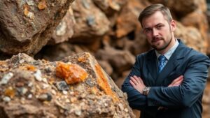
Locating Silver Deposits in High-Altitude Areas With Surface Mapping
Locating Silver Deposits in High-Altitude Areas With Surface Mapping
The search for silver deposits in high-altitude regions presents unique challenges and opportunities for geologists and mining companies. Silver is a precious metal that plays a vital role in various industries, including electronics, solar energy, and jewelry. Understanding how to locate these deposits effectively is crucial for sustainable mining practices and economic viability. This article explores the methodology of surface mapping in high-altitude areas, highlighting techniques, tools, and real-world applications.
Understanding Surface Mapping
Surface mapping is a geospatial technique used to identify the characteristics and features of the earths surface. In the context of mineral exploration, this method entails the detailed study of geological formations, soil types, and mineral occurrences to locate potential deposits. Surface mapping is particularly important in high-altitude areas where accessibility is limited and geological features may be obscured by snow, vegetation, or steep terrain.
Importance of High-Altitude Areas for Silver Deposits
High-altitude areas are often considered geologically favorable for silver deposits due to various factors, including:
- Tectonic Activity: The collision of tectonic plates can create favorable conditions for hydrothermal systems, which are known to concentrate silver.
- Weathering Processes: Erosion and weathering can expose mineral veins, making them more accessible for exploration.
- Geological Composition: Many high-altitude regions host rock types, such as volcanic and sedimentary formations, that are associated with silver mineralization.
Key Techniques for Surface Mapping
Several techniques are employed in surface mapping to identify and evaluate potential silver deposits in high-altitude areas:
- Geological Mapping: This involves creating detailed maps that depict the distribution and relationship of rock types and structures. Geologists classify the areas according to age, composition, and mineral content.
- Geochemical Surveys: Collecting soil and rock samples for chemical analysis can determine the presence of silver and related metals. For example, stream sediment sampling has been effective in tracing metal deposits upstream to their source.
- Geophysical Methods: Techniques such as resistivity, magnetic, and induced polarization surveys provide insights into subsurface structures, helping identify areas with the potential for silver mineralization.
Tools and Equipment
The effectiveness of surface mapping relies heavily on the availability of sophisticated tools and equipment, which include:
- Gps Devices: Accurate positioning is crucial in challenging terrains, thus GPS devices help geologists mark specific locations of interest on their maps.
- Drones: Unmanned aerial vehicles enable high-resolution aerial surveys, contributing to the mapping of large and inaccessible areas quickly.
- Portable Analyzers: Handheld X-ray fluorescence (XRF) analyzers provide immediate on-site analyses of soil samples, facilitating rapid decision-making.
Case Study: The Andes Mountain Range
The Andes Mountains exemplify a high-altitude area rich in silver deposits. A successful exploration project undertaken in Perus polymetallic regions utilized an integrated approach of geological and geochemical surveys, combined with remote sensing technology. This project identified several promising areas for drilling based on the surface mapping data collected, resulting in a significant find of silver-rich ore. Such projects highlight the importance of thorough surface mapping in locating economically viable deposits.
Challenges in High-Altitude Surface Mapping
Despite its benefits, locating silver deposits in high-altitude mandates addressing specific challenges:
- Accessibility: High altitudes often mean difficult terrain and extreme weather conditions, which can impede extensive mapping efforts.
- Investment Costs: The initial cost of exploratory mapping, including equipment and manpower, can be substantial.
- Environmental Considerations: Increasing awareness regarding environmental impacts necessitate careful planning and execution of exploration activities to minimize ecological disruption.
Actionable Takeaways
Locating silver deposits in high-altitude regions through surface mapping requires a multifaceted approach, leveraging modern technology and methodologies. Key takeaways include:
- Use integrated geological and geochemical surveys to comprehensively understand the terrain.
- Use advanced tools such as drones and portable analyzers for efficient data collection.
- Be prepared to navigate and mitigate challenges related to accessibility, costs, and environmental impact.
In summary, effective surface mapping in high-altitude areas can uncover valuable silver deposits, ultimately contributing to sustainable mineral exploration and economic development in these regions.


