Leveraging AI to Overlay Historical and Modern Maps for Relic Discovery
Leveraging AI to Overlay Historical and Modern Maps for Relic Discovery
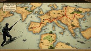
The intersection of artificial intelligence (AI) and historical cartography has opened new avenues for archaeological exploration and relic discovery. By employing sophisticated algorithms to overlay modern geospatial data with historical maps, researchers can uncover hidden artifacts and enrich our understanding of ancient civilizations. This article discusses the methodologies, applications, and implications of utilizing AI in overlaying these maps for successful relic discovery.
Historical Context and Importance of Cartography
The history of cartography dates back to ancient civilizations where maps served not only as navigational tools but also as social documents capturing the essence of cultural identity. For example, the Tabula Rogeriana, created by the Arab geographer Muhammad al-Idrisi in 1154, provides invaluable insight into the medieval world as understood by that eras scholars. These historical maps often contain valuable information that corresponds to contemporary geographic references.
According to a study published by the National Geographic Society, maps from historical contexts can reveal settlements, trade routes, and agricultural practices that have been lost to time due to urbanization and natural disasters. The overlay of these maps onto modern satellite imagery enhances the potential for locating relics that may otherwise remain undiscovered.
Methodologies for Map Overlay using AI
The process of overlaying historical and modern maps involves a series of technological and methodological steps:
- Data Collection: The initial phase includes gathering historical maps from various archives and digitizing them into a usable format.
- Georeferencing: Historical maps must be aligned with current geographical coordinates, a process that often entails the identification of key landmarks still present today.
- AI Algorithms: Utilizing machine learning algorithms, particularly convolutional neural networks (CNN), researchers can identify patterns and similarities between the two datasets. This analysis helps to detect potential locations of interest for field studies.
- Visualization: The final step involves creating layered visualizations that allow archaeologists to interact with the data seamlessly, often using GIS (Geographic Information System) software for enhanced functionality.
Case Studies in Relic Discovery
Several notable case studies highlight the effectiveness of AI in relic discovery through map overlay techniques. One such example is the work conducted in the region of Petra, Jordan. Researchers used historical maps from the 19th century alongside modern satellite imagery to identify previously overlooked structures. r findings illustrate how advanced algorithms can assist in pinpointing locations of ancient ruins that align with historical descriptions.
Another significant case study is in the region surrounding the ancient city of Angkor Wat, Cambodia. A collaborative project involving drones and AI facilitated the identification of new temple sites by comparing ancient Khmer maps with contemporary aerial surveys. Preliminary reports indicate an increase in mapped relics by over 40% due to this advanced analytical approach, demonstrating tangible outcomes for archaeological research.
Potential Challenges and Considerations
Despite its promising applications, several challenges accompany the use of AI in map overlays:
- Data Quality: Historical maps may contain inaccuracies due to the methods of their creation, which can mislead AI algorithms during analysis.
- Technological Barriers: Access to advanced AI tools and geopolitical restrictions may limit research in certain regions.
- Ethical Considerations: The discovery of relics raises questions regarding cultural heritage preservation and the responsibilities associated with archaeological findings.
Real-World Applications and Future Directions
The practical applications of AI and historical map overlay extend beyond academia. Governments and private organizations can utilize these methodologies to plan infrastructure development while preserving archaeological sites. For example, in Italy, local authorities have begun employing these techniques to ensure that construction projects do not disrupt significant historical areas.
Looking forward, advancements in AI technology will likely lead to even more sophisticated algorithms that can analyze vast datasets rapidly, improving efficiency and accuracy. As we continue to refine these methodologies, interdisciplinary collaboration will be essential to harnessing the full potential of cartographic data for archaeological discovery.
Conclusion and Actionable Takeaways
The intersection of AI and cartographic practice presents a paradigm shift in how archaeological research is conducted. By overlaying historical maps with modern geospatial data, researchers can unlock the hidden narratives of past civilizations, thereby enriching our collective heritage. As these techniques continue to evolve, organizations should consider investing in AI tools and interdisciplinary teams to fully leverage the benefits of these innovations.
In summary, stakeholders involved in archaeological research should:
- Invest in training for AI methodologies applicable to cartography.
- Encourage the digitization of historical maps for broader accessibility.
- Foster collaborations between historians, geographers, and AI experts to enhance research outcomes.


