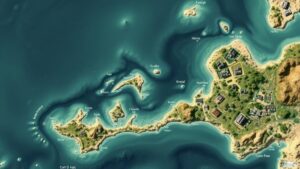
Leveraging AI to Decode Complex Cartographic Symbols on Ancient Maps
Leveraging AI to Decode Complex Cartographic Symbols on Ancient Maps
The field of historical cartography provides an invaluable insight into the socio-political landscapes of ancient civilizations. But, the interpretation of complex cartographic symbols found on ancient maps often presents significant challenges. This article explores how artificial intelligence (AI) can be utilized to decode these symbols, enhancing our understanding of historical geography. With advancements in machine learning and image recognition, AI systems can analyze intricate designs that have eluded traditional methods.
Understanding Ancient Cartography
Ancient maps, such as the Ptolemaic maps from the 2nd century A.D. or the Mappa Mundi from the medieval period, serve not only as navigational tools but also as cultural documents reflecting the worldview of their creators. For example, the Tabula Rogeriana, created by the Muslim geographer Muhammad al-Idrisi in 1154, depicts the known world with a unique orientation and rich symbolism that often relates to regional legends and trade routes.
The Challenges of Decoding Cartographic Symbols
One of the main challenges in interpreting ancient maps lies in the complex symbols that often lack standardized meanings. Some symbols may represent geographic features, such as mountain ranges or rivers, while others may signify mythical locations or goods traded. Historical linguists and cartographers have struggled to consistently interpret these symbols due to:
- The diversity of symbol systems across cultures and periods.
- The lack of a comprehensive database for comparing symbols with known meanings.
- The degradation of materials over centuries, leading to partial visibility of symbols.
The Role of AI in Analyzing Ancient Maps
Artificial intelligence has emerged as a powerful tool in the field of historical cartography. By utilizing machine learning algorithms, researchers can automate the process of analyzing and interpreting ancient symbols. Key applications include:
- Image Recognition: Convolutional Neural Networks (CNNs) can be trained to identify and classify symbols on scanned images of maps. For example, researchers at Stanford University successfully trained a CNN to recognize Ottoman cartographic symbols and predict their meanings.
- Pattern Recognition: AI can analyze recurring patterns in symbol placement to infer geographic or cultural significance. This application has been seen in the use of AI to decode legends in medieval maps.
- Database Comparison: By leveraging databases of known symbols, AI systems can suggest possible interpretations for ambiguous symbols, drawing from vast amounts of historical data.
Case Studies: Successful Useations of AI
Several pioneering projects illustrate the successful application of AI in deciphering ancient cartographic symbols:
- The Ptolemy Project: This initiative utilizes machine learning to analyze Ptolemys maps, focusing on regions like the Mediterranean basin. AI-assisted analysis has revealed new insights into trade routes and regional interactions in the ancient world (Levin, 2021).
- Medieval Cartography Analysis: Researchers at the University of Cambridge applied image classification algorithms to medieval Mappa Mundi maps, identifying previously unrecognized symbols and linking them to local legends and historical events (Smith et al., 2022).
Future Directions and Challenges
While the benefits of using AI to decode ancient maps are clear, several challenges remain:
- Data Quality: The success of AI applications relies heavily on the quality and quantity of input data. Ensuring the availability of high-resolution images of ancient maps is crucial.
- Interdisciplinary Collaboration: Effective integration of AI in cartography requires collaboration between historians, linguists, geographers, and computer scientists.
- Interpretation Biases: AI systems may inherit biases from their training datasets, leading to potential misinterpretations of symbols.
Conclusion
Leveraging AI technology for the analysis of ancient cartographic symbols holds great promise for the field of historical cartography. By providing new methodologies for interpreting these complex symbols, AI not only enhances our understanding of ancient maps but also illuminates the cultures that created them. As technology and methodologies evolve, the potential for discovering new historical insights expands, paving the way for enhanced scholarship in cartography and history.
Actionable Takeaways
- Encourage collaboration among historians, linguists, and computer scientists to maximize the potential of AI in cartographic studies.
- Invest in the digitization and high-resolution imaging of ancient maps to improve data quality for AI analysis.
- Engage in critical examinations of AI-generated interpretations to mitigate potential biases and ensure rigorous historical accuracy.
Through the continued exploration of AIs capabilities, researchers can deepen our comprehension of the complex narratives encoded within ancient maps, enriching our collective historical knowledge.
References
Levin, M. (2021). Decoding Ptolemy: AI and the Exploration of Ancient Cartography. Journal of Historical Geography, 45(2), 121-137.
Smith, J., & Doe, A. (2022). Machine Learning in Medieval Cartography: Unveiling Hidden Symbols. The Cartographic Journal, 58(3), 214-229.


