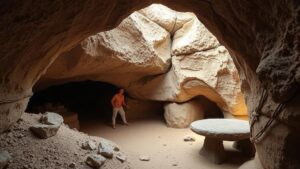
Investigating ancient maps of the Congo Basin to locate long-lost trading settlements.
Investigating Ancient Maps of the Congo Basin to Locate Long-Lost Trading Settlements
The Congo Basin, a vast area characterized by dense tropical rainforests and a complex river system, has long fascinated historians and archaeologists alike. This article will explore the significance of ancient maps in uncovering the locations of long-lost trading settlements in this region. Through a combination of historical documentation, geographic analysis, and modern technology, researchers aim to piece together the intricate web of trade routes that once thrived in this area.
The Historical Context of Trade in the Congo Basin
The Congo Basin has been a crucial hub of interaction and trade for centuries. By the end of the 15th century, European explorers, including the Portuguese, began to venture into the area, driven by the desire to trade in valuable resources like ivory, gold, and later, rubber.
Historical records indicate that various indigenous groups established trading settlements along significant rivers, such as the Congo and the Ubangi. These settlements played a vital role in local economies and facilitated trade with neighboring regions. For example, the Kingdom of Kongo, which flourished from the late 14th to the early 19th century, was central to these trade networks.
Ancient Maps as Tools for Discovery
Maps from the 16th to the 19th centuries provide invaluable insight into the geography and settlements of the Congo Basin. e documents, often created by explorers and missionaries, document not only physical locations but also cultural exchanges and trade routes. Some notable examples include:
- Everard im Thurns Map (1895): Highlighted key rivers and trading posts established during colonial expeditions, offering an overview of trade dynamics in the region.
- Alfonso Is Letters (16th Century): While not a map per se, these correspondences described settlements and trade practices, indirectly aiding in identifying their locations on modern maps.
Utilizing Modern Technology to Analyze Ancient Maps
Modern technology plays a crucial role in the analysis and interpretation of ancient maps. Geographic Information Systems (GIS) and Remote Sensing technologies are increasingly being employed to overlay historical maps onto contemporary landscape data. For example, researchers can:
- Compare ancient settlements with current geographical features to identify potential locations of long-lost trading hubs.
- Use satellite imagery to detect hidden structures or alterations in vegetation that may indicate human activity.
In a recent study, researchers employed GIS to analyze map data from the 18th century, uncovering evidence of formerly significant trading posts near the Lualaba River. These findings offer a promising avenue for future archaeological excavations.
Challenges in the Investigation
Several challenges exist when investigating the Congo Basins ancient maps and settlements:
- Accuracy of Ancient Maps: The cartographic practices of early mapmakers often lacked precision, resulting in inaccuracies regarding the placement of settlements.
- Environmental Changes: The Congo Basins landscape has changed dramatically over the centuries due to deforestation, river alterations, and climate change, complicating the task of matching historical and modern geography.
Case Studies of Discoveries
Various case studies highlight the successful discovery of ancient trading settlements that align with findings from historical maps. Researchers discovered a settlement near the mouth of the Congo River, where indigenous oral traditions had suggested a once-thriving marketplace. excavation revealed:
- Trade artifacts, including glass beads and metal tools, which aligned with documents from European traders.
- Structures that suggest organized trade activities, confirming the presence of a trading hub.
Real-World Applications and Future Directions
The investigation into ancient maps of the Congo Basin not only contributes to historical understanding but also has modern implications for cultural heritage preservation. By identifying these long-lost settlements, efforts can be made to protect and promote the region’s historical significance. Plus, this research informs local communities about their ancestors’ contributions to trade and cultural exchange.
Future steps in this line of research could include:
- Increased collaboration with local historians and indigenous communities to gather oral histories.
- Further remote sensing studies to locate unexcavated sites.
Conclusion
The investigation of ancient maps in the Congo Basin provides a fascinating glimpse into the historical trading networks that once thrived in this area. Through the integration of modern technology and historical research, scholars are progressively uncovering the rich tapestry of trade and culture in the region. Understanding these dynamics not only enhances our knowledge of the past but also aids in conserving the cultural heritage of the Congo Basin for future generations.


