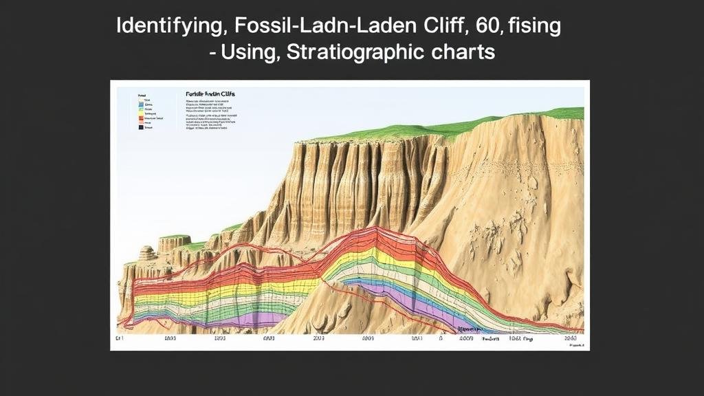
Identifying Fossil-Laden Cliffs Using Stratigraphic Charts
Identifying Fossil-Laden Cliffs Using Stratigraphic Charts
The identification of fossil-laden cliffs is a critical component of paleontological research and geological studies. Stratigraphic charts serve as indispensable tools in this identification process, by providing a visual representation of geological formations and their chronological relationships. This article explores the mechanism of utilizing stratigraphic charts to locate and characterize cliffs that contain significant fossil deposits.
The Importance of Fossil-Laden Cliffs
Fossil-laden cliffs are vital to understanding Earths historical biodiversity and the evolutionary processes that shaped current life forms. Notable sites such as the Badlands National Park in South Dakota and the White Cliffs of Dover in England are rich in fossil records, providing invaluable insights into past ecosystems. These areas serve as natural laboratories for geologists and paleontologists.
Understanding Stratigraphy
Stratigraphy is the branch of geology that studies rock layers (strata) and layering (stratification). The principles of stratigraphy are anchored on several key concepts:
- Law of Superposition: In undeformed sedimentary sequences, the oldest layers are at the bottom, and the youngest are at the top.
- Principle of Original Horizontality: Layers of sediment are originally deposited horizontally under the action of gravity.
- Principle of Lateral Continuity: Layers initially extend laterally in all directions; thus, they may be laterally equivalent over distances.
These principles allow geologists to reconstruct historical geographies and determine the age of rock formations, which is essential for identifying fossil-rich areas.
Constructing Stratigraphic Charts
Stratigraphic charts are graphical representations of geological strata, illustrating the relationship and temporal sequence of rock layers. To construct a stratigraphic chart, geologists typically gather data from various locations through fieldwork, boreholes, and previous geological surveys. This data is then analyzed and represented visually.
Field Studies and Data Collection
Field studies are often the first step in identifying fossil-laden cliffs. Data collection involves the following steps:
- Locating potential sites by reviewing existing geological maps and literature.
- Conducting systematic sampling to measure thickness, composition, and fossil content of the rock layers.
- Documenting findings using photography and detailed notes to support later analysis.
Chart Interpretation
The interpretation of stratigraphic charts includes analyzing the vertical arrangement of fossils and their relative ages. For example, a layer containing trilobite fossils–dated approximately 520 million years–would sit below a layer with dinosaur footprints, which are much younger, dating back around 150 million years. This chronological layering aids in understanding the evolutionary timeline.
Case Studies
Case studies illustrate the efficacy of stratigraphic charts in identifying significant fossil deposits:
Badlands National Park
Located in South Dakota, Badlands National Park features striking fossil-rich formations known for their rich record of ancient life. By utilizing stratigraphic charts, scientists have been able to correlate rock types and fossils to specific time periods, which has led to extensive discoveries of fossils such as ancient mammals and marine reptiles. layering observed has revealed a sequence of environmental changes over millions of years, reflecting shifts from marine to terrestrial settings.
White Cliffs of Dover
The White Cliffs of Dover are a prime example of chalk formations that reveal a wealth of fossil evidence. Stratigraphic analysis here demonstrates the presence of coccolithophores–single-celled algae–indicative of a warm, shallow sea environment during the Cretaceous period. The insights gained from this stratigraphic interpretation have significant implications for understanding past climate conditions and marine biodiversity.
Challenges and Future Directions
While stratigraphic charts are powerful tools, challenges persist in fossil identification due to erosion, climate change, and anthropogenic disturbances. Also, the need for high-resolution stratigraphic studies has become increasingly critical as many fossil sites face imminent threats.
Advances in Technology
Technological advancements, such as Geographic Information Systems (GIS) and remote sensing, are redefining stratigraphic research. These tools offer new methodologies for analyzing geological data over vast areas, potentially uncovering new fossil locations.
Conclusion and Actionable Takeaways
To wrap up, stratigraphic charts play an essential role in identifying fossil-laden cliffs. Their capacity to visually convey the chronological relationships between rock formations allows geologists and paleontologists to pinpoint areas rich in fossil evidence. Researchers should:
- Continue to integrate new technologies to improve data collection and analysis.
- Use conservation measures to protect fossil-rich sites from erosion and human impact.
- Share findings to enhance public awareness of the importance of fossils in understanding Earth’s history.
By leveraging these strategies, the scientific community can safeguard and further uncover the rich tapestry of lifes history engraved in fossil-laden cliffs.


