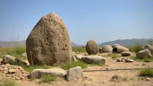
How to Use Natural River Confluences to Predict High-Value Artifact Zones
How to Use Natural River Confluences to Predict High-Value Artifact Zones
The study of river confluences provides critical insight into archaeological site prediction and landscape interpretation. A river confluence, where two or more rivers merge, creates a dynamic environment that has long attracted human activity. Understanding the properties and implications of these regions can significantly enhance the efficacy of archaeological reconnaissance and artifact recovery efforts. This article will explore the mechanisms underlying river confluences, their historical significance, and provide practical guidelines for identifying high-value artifact zones associated with these geographical features.
Understanding River Confluences
River confluences present unique ecological and hydrological conditions. When two rivers meet, the interaction creates differing water flow patterns, sediment transport dynamics, and various habitat types. These multi-faceted environments are characterized by:
- Hydrological diversity: Varying flow velocities contribute to distinct sedimentation patterns, which can affect artifact preservation.
- Biodiversity hotspots: Confluences often serve as critical habitats for diverse flora and fauna, which can signal rich ecological resources historically utilized by human populations.
- Historical transportation routes: The confluence often marked strategic locations for trade and travel, which amplifies their archaeological significance.
Historical Significance of River Confluences
Throughout history, human populations have congregated around river confluences, largely due to the abundant resources and strategic locations they provide. For example, the confluence of the Mississippi and Missouri Rivers has been pivotal in the expansion of trade networks and settlement patterns in North America. Archaeological studies have revealed significant habitation sites around this confluence, where artifacts ranging from pottery to tools have been found.
Similarly, in the Indus Valley, the confluences of major rivers led to the flourishing of the Harappan civilization, illustrating how access to water resources directly influenced human settlement and cultural development. The artifacts related to trade, agriculture, and daily life have been unearthed in abundance in these areas.
Predictive Modeling for Artifact Zones
To leverage river confluences for predicting high-value artifact zones, one can employ a combination of geographic information systems (GIS), hydrological modeling, and ethnographic studies. Here are key steps to develop a predictive model:
- Data Collection: Gather historical records, paleoclimate data, and archaeological surveys from existing literature.
- GIS Analysis: Use GIS tools to map river confluences and analyze their surrounding landscapes. Overlay historical settlement patterns with current environmental data to identify potential archaeological hotspots.
- Hydrologic Modeling: Simulate water flow and sediment transport patterns to evaluate areas likely to yield artifacts. For example, modeling studies have shown that sediment deposition rates significantly affect artifact preservation, leading researchers to hone in on high-priority excavation sites.
- Ethnographic Insights: Engage with local histories and oral traditions to gain understanding about past utilization of specific confluences by indigenous peoples.
Case Studies
Case studies around river confluences have demonstrated the efficacy of this predictive methodology. One noteworthy example is the confluence of the Tigris and Euphrates rivers in Mesopotamia. Archaeological excavations in this area have yielded numerous artifacts linked to the ancient Sumerians, underscoring the confluence as a focal point of trade and culture, resulting in the emergence of one of the worlds earliest civilizations.
Another relevant case is the confluence of the Ganges and Yamuna rivers in India. This site not only has historical religious significance but has also revealed a plethora of artifacts from various historical periods, corroborating the importance of river confluences as centers of human activity throughout history.
Potential Challenges and Considerations
While the study of river confluences is promising for artifact recovery, it is not without its challenges. Erosion, flooding, and modern development can obscure or destroy archaeological layers. So, archaeologists must be prepared to encounter:
- Erosion and sediment displacement: Changes in river dynamics can alter the landscape unpredictably, potentially displacing artifacts.
- Legal and ethical considerations: Archaeological work must comply with local regulations and ethical standards, particularly when working in culturally sensitive areas.
- Access limitations: Some confluences may be in remote or protected areas, posing logistical challenges for fieldwork.
Actionable Takeaways
Utilizing river confluences to predict high-value artifact zones is both an art and a science. Researchers and archaeologists can leverage this methodology by:
- Conducting thorough reconnaissance of historical river confluence sites in collaboration with local communities.
- Employing modern technological tools, such as GIS and hydrological models, to tailor predictive models based on site-specific characteristics.
- Adopting a multidisciplinary approach that combines archaeological, environmental, and social data to enhance understanding of human behavior in relation to river systems.
To wrap up, natural river confluences serve as critical junctions of human activity, and by harnessing scientific techniques and historical insights, archaeologists can unlock new potential in artifact recovery efforts. Understanding these geographical features paves the way for identifying high-value zones, thus enriching our historical narrative and cultural heritage.


