How to Use Aerial Thermal Imaging to Detect Buried Structures
Introduction
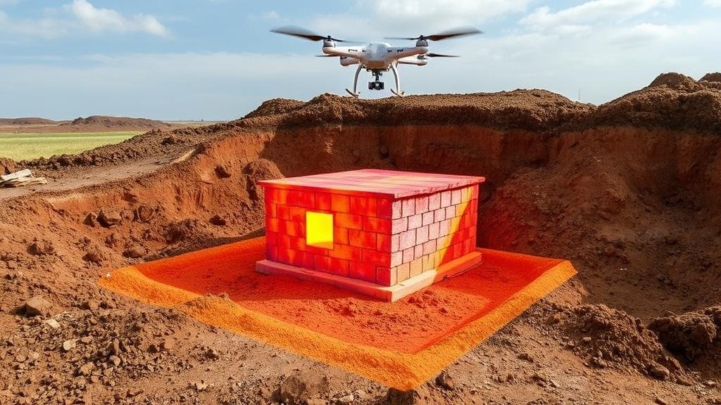
Aerial thermal imaging has emerged as a transformative technology for detecting buried structures, offering an unparalleled method in archaeological survey, civil engineering, and environmental studies. By utilizing thermal infrared cameras mounted on UAVs (unmanned aerial vehicles), researchers can identify subsurface anomalies that indicate the presence of structures from a distance. This article explores the principles, methods, applications, and potential challenges of using aerial thermal imaging to locate buried structures.
Principles of Aerial Thermal Imaging
Aerial thermal imaging operates on the principle of capturing infrared radiation emitted by objects based on their temperature. Different materials and subsurface structures retain heat or cool differently, creating discernible thermal patterns.
Physics Behind Thermal Imaging
Thermal imaging devices detect infrared radiation, which comprises wavelengths longer than visible light (approximately 0.7 to 14 micrometers). When examining buried structures, the temperature difference between the ground and the structures is crucial. For example, bricks or concrete may retain heat longer than the surrounding soil, thus creating distinct thermal signatures detectable from the air.
Thermal Response and Ground Conditions
The effectiveness of thermal imaging heavily relies on environmental factors such as soil type, moisture content, and ambient temperature. During morning or late afternoon, the ground retains heat accumulated during the day, making it an ideal time to conduct aerial surveys. Studies indicate that thermal anomalies can remain detectable for several hours after sunset, further enhancing the methods utility.
Methodology
The process of using aerial thermal imaging to detect buried structures comprises several systematic steps, ranging from planning and execution to analysis and interpretation.
Planning and Preparation
Effective planning is vital to the successful application of aerial thermal imaging. Factors such as the flight path, altitude, and camera specifications must be considered. For example, a typical UAV equipped with a thermal camera flies at altitudes ranging from 100 to 300 meters, depending on the area size and the resolution required. The sensors calibration is equally important, as the radiometric accuracy directly impacts the interpretation of thermal data.
Data Acquisition
During data acquisition, thermal images are captured in conjunction with standard visual imagery to create a comprehensive dataset for analysis. UAVs can cover vast areas rapidly, which is particularly advantageous during archaeological surveys or infrastructure inspections. A notable case is the use of thermal imaging in the discovery of ancient Roman structures in Silchester, UK, where thermal anomalies indicated walls and foundations that had been buried for centuries.
Data Analysis and Interpretation
Post-flight analysis involves image processing techniques to enhance thermal signatures. Software such as FLIR Tools or QGIS are commonly used to analyze and visualize the data. The interpretation relies on recognizing patterns, such as temperature differences that correlate with known structures. Researchers should consider potential sources of heat, including biological activity or geothermal sources, that may complicate analysis.
Applications
Aerial thermal imaging has diverse applications across various fields, including archaeology, urban development, and environmental monitoring.
Archaeology
Thermal imaging has revolutionized archaeological methodologies by facilitating the non-invasive exploration of historical sites. For example, in 2016, a team conducted aerial thermal imaging across the ancient city of Angkor in Cambodia, revealing numerous previously unknown architectural features hidden beneath dense vegetation.
Urban Development
Urban planners utilize aerial thermal imaging for effective land use management, particularly in locating aging infrastructure such as pipelines and sewers. A comprehensive survey of an urban area can yield significant deviations in thermal signatures corresponding to buried utilities, allowing for efficient planning and maintenance strategies.
Environmental Monitoring
In environmental studies, thermal imaging is employed for monitoring soil moisture content and detecting subsurface drainage systems. visibility of these systems can help in the assessment of water management practices, thereby aiding sustainable agricultural practices. A study conducted in the Central Valley of California revealed thermal imagings efficacy in diagnosing irrigation inefficiencies, allowing for targeted remediation strategies.
Challenges and Limitations
While aerial thermal imaging holds significant promise, several challenges persist that might hinder its application.
Environmental Influences
Factors such as weather conditions, vegetation cover, and seasonal changes can obscure thermal anomalies. For example, dense foliage in warmer months limits the capabilities of thermal cameras due to consistent temperature readings across ground materials.
Data Interpretation Complexity
The interpretation of thermal images requires trained personnel adept in distinguishing between anomalies caused by natural variations and those indicative of buried structures. Establishing a reference database of thermal signatures for various materials is essential to enhancing accuracy.
Conclusion
Aerial thermal imaging presents a groundbreaking technique for the detection of buried structures, combining advancements in technology with practical applications across several disciplines. Despite challenges related to data interpretation and environmental factors, the methodologys numerous successes in archaeological and urban surveys affirm its potential. As research continues and technological innovations emerge, the efficiency and accuracy of aerial thermal imaging are expected to improve, further solidifying its role as a key tool in contemporary fieldwork and development strategies.
Actionable Takeaways
- Consider scheduling aerial thermal surveys at optimal times for heat detection to maximize visibility.
- Invest in proper training for personnel responsible for data interpretation to leverage the technology effectively.
- Collaborate with environmental scientists to address and account for influencing factors that may skew results.


