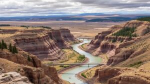
How to Spot Historical Mining Areas Using Satellite Imagery
How to Spot Historical Mining Areas Using Satellite Imagery
Identifying historical mining areas has become increasingly feasible due to advancements in satellite imagery technology. Satellite images offer a bird’s eye view of the Earths surface, allowing researchers and environmentalists to detect changes and anomalies that may signify past mining activities. This article delves into the methods and tools available for spotting these areas, their implications, and case studies that demonstrate the effectiveness of this technique.
The Importance of Identifying Historical Mining Areas
Identifying these regions is crucial for several reasons:
- Environmental Protection: Many abandoned mines pose serious environmental hazards, including toxic runoff and habitat destruction.
- Land Use Planning: Understanding historical mining activities can aid in land reclamation and future urban planning.
- Cultural Heritage: Old mining sites often hold significant historical value, offering insights into past economies and lifestyles.
Understanding Satellite Imagery
Satellite imagery refers to images of Earth collected by satellites. e images can be captured in different spectral bands, providing various insights. The two major types of satellite imagery relevant to spotting historical mining areas are:
- Optical Imagery: Useful for visual assessment, these images are captured in the visible spectrum and can reveal signs of vegetation loss, soil erosion, and land disturbance.
- Multispectral and Hyperspectral Imagery: These images capture data across multiple wavelengths, enabling precision in detecting minerals and contaminants often associated with mining activities.
Key Indicators of Historical Mining Sites
Successful identification of historical mining areas relies on recognizing certain indicators observable in satellite imagery. Key indicators include:
- Altered Landscape: Look for unusual landforms, such as pits or tailing piles, which may not naturally occur in the area.
- Vegetation Patterns: Historical mining often leads to changes in local vegetation; areas may show bare soil or unusual clustering of plant life due to contamination.
- Water Discoloration: Bodies of water near mining sites may exhibit discoloration due to mineral runoff, which can often be detected through satellite images.
Tools and Methods for Analysis
To effectively analyze historical mining areas using satellite imagery, researchers can employ various tools and methods:
- GIS Software: Geographic Information Systems (GIS) allow users to layer different data types and analyze spatial relationships between them. Programs like ArcGIS and QGIS are widely used.
- Remote Sensing Techniques: These techniques involve analyzing satellite images and identifying target features using algorithms. Methods include change detection algorithms which highlight alterations in land use over time.
- Machine Learning: Advanced algorithms can classify land use and detect mining signatures with increasing accuracy, improving the ability to find historical sites.
Case Studies in Historical Mining Detection
Real-world examples underscore the utility of satellite imagery in locating historical mining sites:
- Rothwell, England: In a study conducted by the University of Leeds, old mining sites were identified using high-resolution aerial imagery and showed significant correlation with environmental degradation markers.
- California Gold Rush Areas: Researchers successfully mapped out mining regions from the California Gold Rush period using multispectral images that revealed land disturbance and water pollution signatures.
Challenges and Limitations
While satellite imagery is a powerful tool, there are challenges and limitations to consider:
- Image Resolution: Lower resolution images may obscure fine details, making it difficult to identify smaller sites.
- Atmospheric Interference: Weather conditions can affect image quality, leading to misinterpretations of the data.
- Historical Data Availability: The absence of historical images may limit retrospective analysis of certain areas.
Actionable Takeaways
To wrap up, satellite imagery proves to be an invaluable resource in identifying historical mining areas. Those interested in leveraging this technology should focus on:
- Utilizing high-resolution optical and multispectral satellite imagery for detailed analysis.
- Employing GIS and remote sensing techniques to analyze land use changes over time effectively.
- Collaborating with geological and environmental experts to validate findings and address environmental concerns.
By understanding how to interpret these images and utilizing the right tools, stakeholders can meaningfully contribute to environmental conservation and heritage preservation efforts surrounding historical mining activities.


