How to Locate Rich Alluvial Deposits Near Natural Springs
How to Locate Rich Alluvial Deposits Near Natural Springs
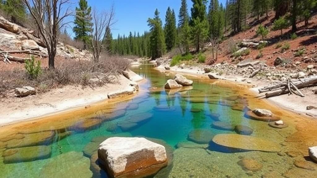
Alluvial deposits, characterized by sediment washed from upstream sources, are crucial for various geological studies and resource exploration. These deposits can often be found in proximity to natural springs, which serve as indicators of groundwater flow patterns and sediment transport. Understanding the methods for locating these rich deposits can be invaluable to geologists, miners, and environmental scientists. This article outlines key techniques for locating alluvial deposits associated with natural springs, presenting practical applications and relevant case studies.
Understanding Alluvial Deposits
Alluvial deposits form as a result of the erosion, transport, and deposition of materials by flowing water. They typically consist of a mixture of soil, clay, silt, sand, gravel, and other minerals. These deposits can contain economically valuable resources such as gold, diamonds, and other gemstones. composition and richness of alluvial deposits depend significantly on the environment of their formation, which can vary greatly from one region to another.
Geological Indicators of Alluvial Deposits
To effectively locate alluvial deposits, practitioners must be familiar with geological indicators that point to the presence of these resources. Key indicators include:
- Topography: Alluvial deposits typically accumulate in low-lying areas, valleys, and riverbanks. A detailed geological map can help identify these regions.
- Soil Composition: The composition of the soil can offer clues. Soils rich in fine particles like clay and silt often signal proximity to alluvial deposits.
- Vegetation Patterns: Certain plants thrive in mineral-rich soils, serving as biological markers for locating alluvial findings.
Using Hydrological Maps
Hydrological maps play a crucial role in determining the locations of natural springs and their associated drainage areas. These maps illustrate the flow of surface water and groundwater and can help identify areas where alluvial deposits are likely to be found.
For example, in regions like the Sacramento Valley in California, hydrological studies have shown a strong correlation between natural spring locations and alluvial gold deposits. Understanding watershed boundaries can help direct searches for alluvial resources in areas with known spring activity.
Geophysical Surveys
Geophysical surveys employ techniques such as seismic reflection and ground-penetrating radar (GPR) to map subsurface geological structures. e surveys can pinpoint areas with significant alluvial deposits by identifying changes in material density and composition.
A case study in Australia demonstrated the use of GPR in locating alluvial gold deposits. By mapping subsurface features related to ancient riverbeds, geologists could predict the locations of enriched sediment accumulations associated with historical water flow.
Field Sampling and Analysis
Once prospective sites are identified, collecting soil and sediment samples for analysis is essential to confirm the presence and richness of alluvial deposits. Techniques include:
- Grab Sampling: Collecting random samples from various locations allows for an initial assessment of the area.
- Systematic Grid Sampling: Establishing a grid of sampling locations helps in identifying patterns in mineral distribution.
In Nevada, systematic grid sampling conducted near natural springs has revealed significant concentrations of silver and gold, prompting further exploration in those areas.
Considerations for Sustainable Exploration
While locating and exploiting alluvial deposits can yield valuable resources, it is essential to approach this exploration sustainably. Environmental considerations must include:
- Minimizing Land Disturbance: Employing techniques that leave the ecosystem intact helps preserve local flora and fauna.
- Restoration Efforts: After exploration, restoring the natural landscape is crucial for maintaining ecological balance.
For example, initiatives in the Amazon Basin focus on responsible mining practices, ensuring that alluvial mining operations do not significantly disrupt the surrounding environment while still allowing for resource recovery.
Conclusion
Locating rich alluvial deposits near natural springs requires a multifaceted approach that includes an understanding of geological indicators, the use of hydrological maps, geophysical surveys, and thorough field sampling. By applying these techniques responsibly, explorers can contribute to the sustainable extraction of valuable resources while preserving the integrity of the environment. Continuous advancements in technology and methodology will further enhance the ability to locate and evaluate these deposits effectively.
As you embark on your exploration journey, remember to approach the task with care and environmental consideration, which will ultimately benefit both your objectives and the surrounding ecosystem.


