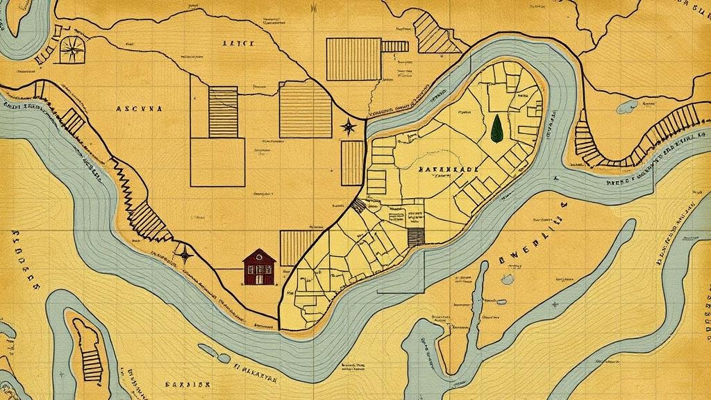
How Historic Water Rights Maps Reveal Early Farmstead Relics
How Historic Water Rights Maps Reveal Early Farmstead Relics
The intersection of water rights and agricultural development has long been a topic of significant importance in the study of historical farming practices. Water rights maps provide an invaluable resource for understanding the spatial distribution of agricultural activity, specifically in the context of early American farmsteads. This article examines how these maps can elucidate the locations and characteristics of early farmstead relics, highlighting critical connections between water access and farming practices from the 19th century onward.
The Significance of Water Rights in Agriculture
Water rights have been foundational to agricultural success in arid and semi-arid regions, necessitating the establishment of legal frameworks governing the allocation and use of water resources. Historically, the West in the United States presented challenges, as the natural availability of water was limited. In this context, the appropriation doctrine emerged, which allowed users to claim water rights based on beneficial use, a principle established in the late 19th century.
According to the U.S. Geological Survey, over 80% of water in the Western United States is utilized for irrigation, pinpointing the critical role water allocation has played in farming operations. Maps depicting these rights can be analyzed to identify areas of significant agricultural activity, revealing early farming settlements and the relics they left behind.
Analyzing Historic Water Rights Maps
Historic water rights maps are often housed in local archives, state departments of natural resources, or university libraries. These maps can include various information layers that indicate water source locations, irrigation routes, and property boundaries. A prime example can be observed in maps dating back to the 1870s for Riverside County, California, where irrigation channels were meticulously documented.
By examining these maps, researchers can trace the establishment of farmsteads relative to the proximity of water sources. For example, in the early 1900s, many homesteaders in the San Joaquin Valley settled near rivers and streams to secure a consistent water supply. As a result, areas illustrated on the maps often correspond with the emergence of specific agricultural practices, such as cotton and grape farming, evident in surviving agricultural relics like old irrigation ditches and abandoned farm buildings.
Case Studies: Discovering Farmstead Relics
Several case studies illustrate the effectiveness of utilizing historic water rights maps for revealing early farmstead relics. Noteworthy examples include:
- Riverside County, California (1870s): Analysis of water rights maps shows a correlation between irrigation infrastructure and the remnants of cotton plantations, demonstrating how water access shaped farming choices.
- Willamette Valley, Oregon (1890s): Maps reveal that early settlers strategically selected homesteading locations adjacent to rivers, resulting in the discovery of artifacts such as old farm machinery and structural foundations.
In each case, the integration of map data with archaeological findings supports the idea that the locations of historic farmsteads were heavily influenced by water availability, underscoring the maps role as a research tool in historical agriculture.
Implications for Current Agricultural Practices
The insights gained from historic water rights maps are not only significant for understanding agricultural history but also carry implications for contemporary farming practices. As water scarcity issues become increasingly prevalent, studying past water allocation and usage can inform modern decisions regarding irrigation and farm management.
For example, understanding how early settlers adapted to their environments can illuminate sustainable practices that may benefit current farmers facing drought conditions. Also, the importance of preserving aging water management infrastructures can be reaffirmed as current agricultural policies navigate issues related to climate change and water conservation.
Actionable Takeaways
For researchers and practitioners alike, leveraging historic water rights maps can be a powerful approach to uncovering insights about early agricultural systems. Key takeaways include:
- Investigate local archives to find historic water rights maps to better understand the agricultural landscape of your area.
- Use Geographic Information System (GIS) technology to overlay historic maps with current land use data, facilitating deeper analysis.
- Engage with local agricultural extension services to explore how historical practices can inform modern sustainability efforts.
Ultimately, the study of historic water rights maps not only unveils the stories of early farmsteads but also positions historical knowledge as a vital component of future-ready agricultural practices.


