How Historic Trade Route Maps Reveal Forgotten Relic Hotspots
How Historic Trade Route Maps Reveal Forgotten Relic Hotspots
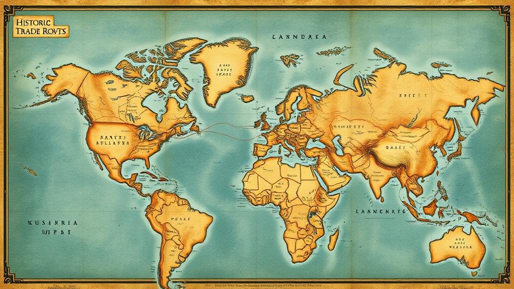
The study of historic trade routes provides invaluable insights into ancient economies, cultural exchanges, and the movement of artifacts. As scholars analyze these routes, they uncover hotspots where forgotten relics may lie, awaiting rediscovery. This article explores how historic trade route maps serve as crucial tools in identifying these hotspots, supported by concrete examples from various regions around the globe.
The Historical Context of Trade Routes
Trade routes have been essential veins of commerce and interaction throughout history. From the Silk Road in Asia to the Trans-Saharan routes in Africa, these pathways facilitated not only the exchange of goods but also ideas, technologies, and cultures. The significance of trade routes can be illustrated by the following examples:
- The Silk Road, which operated from roughly 130 BCE to the late 14th century, linked Asia to Europe, allowing for the trade of silk, spices, and other precious items.
- The Incense Route, flourishing from 3 BCE to the 2nd century CE, connected Arabia to the Mediterranean, emphasizing the transport of frankincense and myrrh, which were highly sought after.
By mapping these trade routes, researchers can understand historical trade patterns, geographic relationships, and potential locations for undiscovered relics.
Trade Route Maps as Archaeological Resources
Historic trade route maps are invaluable for researchers aiming to locate forgotten artifacts. These maps provide geographic context, indicating where goods were exchanged and where traders may have established settlements. Specific examples highlight the effectiveness of these maps:
- The Roman Empires road networks, meticulously documented, have helped archaeologists discover myriad artifacts related to trade, administration, and daily life in antiquity.
- Recent explorations along the routes of the Spice Trade have uncovered previously hidden archaeological sites in Southeast Asia, revealing the cultural significance of this trade on local civilizations.
Plus, the examination of shipping routes during the Age of Discovery has also yielded significant archaeological findings, illustrating how maritime trade influenced coastal settlements.
Case Studies: Relics Discovered Along Historic Routes
History provides us with several noteworthy case studies that underscore the importance of trade route maps in uncovering relic hotspots. One prominent example is the discovery of the ancient city of Pompeii, which, despite being located near Rome, remained hidden under volcanic ash until excavations began in 1748. The trade routes leading to Pompeii were crucial for understanding its economic and social dynamics.
Another significant case study is the excavation of a shipwreck along the Maritime Silk Road near China’s Fujian Province. Artifacts recovered from this site–including pottery, silk, and metalwork–provide evidence of the trade that occurred between China and the Arab world. These findings were made possible through the utilization of historic maps that charted ancient sea lanes.
Methodologies for Uncovering Relic Hotspots
Current archaeological methodologies increasingly integrate historic trade route maps to identify potential excavation sites. Geospatial technology, including Geographic Information Systems (GIS), plays a pivotal role in this process. Scholars are now able to:
- Analyze historical trade routes against modern topographic maps to identify possible site locations.
- Use remote sensing techniques to identify anomalies on the ground that may indicate buried structures or artifacts.
In essence, combining historic trade route data with modern technology enhances the precision and efficiency of archaeological surveys.
Challenges and Considerations
While historic trade route maps are invaluable, several challenges must be acknowledged. Maps from antiquity are often incomplete or subject to misinterpretation. Scholars must be cautious in extrapolating direct connections from these maps. For example, the interpretation of vague route indications might lead to misidentified hotspot areas.
Also, the preservation of artifacts poses another challenge. Many sites identified through trade routes may have been subjected to modern development, alteration, or looting, complicating recovery efforts. Hence, ethical considerations surrounding excavation and artifact recovery are paramount.
Conclusion and Actionable Takeaways
To wrap up, historic trade route maps serve as essential tools for archaeologists seeking to uncover forgotten relic hotspots. integration of these maps into modern methodologies, including GIS and remote sensing, can significantly enhance archaeological efforts. As scholars continue to explore these routes, further discoveries are likely to reshape our understanding of historical trade, culture, and civilization.
Actionable takeaways for researchers and institutions include:
- Incorporate historic trade route data into archaeological survey protocols.
- Use GIS technology for spatial analysis of trade routes and associated relic hotspots.
- Maintain ethical guidelines in excavation practices to ensure the protection of cultural heritage.
By leveraging the insights provided by historic trade route maps, we can open new avenues for archaeological research and deepen our understanding of the past.


