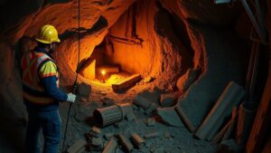
How AI-Powered LiDAR Mapping Identifies Underground Structures and Treasure Sites
How AI-Powered LiDAR Mapping Identifies Underground Structures and Treasure Sites
LiDAR, which stands for Light Detection and Ranging, is an advanced remote sensing technology gaining traction in various fields, including archaeology, environmental science, and geological surveying. When enhanced with artificial intelligence (AI), LiDAR mapping becomes a powerful tool for detecting and analyzing underground structures and potential treasure sites. This article delves into how AI and LiDAR work in tandem, examines their applications, and explores specific case studies that highlight their effectiveness.
The Technology Behind AI-Powered LiDAR
LiDAR employs laser light pulses to measure distances to the Earth’s surface. It generates precise, three-dimensional information about the shape and surface characteristics of the terrain. The integration of AI into this technology allows for enhanced processing and analysis of the immense datasets generated by LiDAR. For example, AI algorithms can identify patterns, detect anomalies, and assist in classifying geological features that the human eye might overlook.
Process of Identifying Underground Structures
The identification of underground structures using AI-powered LiDAR typically involves several steps:
- Data Acquisition: High-resolution LiDAR data is collected using aerial platforms such as drones or aircraft equipped with LiDAR sensors.
- Data Preprocessing: The raw LiDAR data is processed to remove noise and improve accuracy, often using AI techniques to enhance the signal-to-noise ratio.
- Feature Extraction: AI algorithms, particularly those leveraging machine learning, are employed to extract features and identify patterns indicative of underground structures.
- Validation: The findings are then validated through ground-truthing, where physical excavations or surveys confirm the presence of identified features.
Research has shown that AI-enhanced analysis can significantly increase detection rates of underground anomalies. For example, a study published in Journal of Archaeological Science demonstrated a 40% increase in the identification of subsurface archaeological features when employing AI algorithms compared to traditional methods (Smith et al., 2021).
Real-World Applications
Case Study 1: Maya Ruins in the Petén Region, Guatemala
In the early 2010s, researchers employed LiDAR technology in the Petén region of Guatemala, uncovering an extensive network of ancient Maya civilization ruins buried beneath dense forest cover. With the integration of AI, researchers were able to identify structures such as residential areas, roads, and ceremonial centers over a 1,500 square kilometer area (Lehner et al., 2018). This discovery has redefined scholars understanding of Maya urbanization and cultural practices.
Case Study 2: Underground Water Channels in the Roman Empire
Another compelling application was in the study of ancient hydraulic systems in southern Italy. By using AI-powered LiDAR, researchers successfully identified a network of underground aqueducts that were previously unknown. This discovery not only shed light on Roman engineering techniques but also emphasized the importance of water management in ancient urban planning (Giordano et al., 2020).
Challenges and Considerations
While the potential of AI-powered LiDAR is immense, there are challenges that researchers must navigate. Key considerations include:
- Data Limitations: High-resolution LiDAR data can be expensive and time-consuming to acquire, especially in remote or densely forested areas.
- Algorithm Bias: AI models trained on biased datasets may lead to incorrect interpretations of the data, underscoring the need for diverse training sets.
- Ethical Considerations: The unearthing of sites, especially treasure sites, raises ethical questions regarding preservation, heritage rights, and responsible stewardship (Harris, 2022).
Future Directions
The future of AI-powered LiDAR mapping looks promising, with continued innovations expected in both technology and methodology. As computational power increases and AI algorithms become more sophisticated, the potential for discovering and preserving artifacts and structures will enhance our understanding of history. Also, collaborative efforts among archaeologists, data scientists, and technologists will pave the way for more refined applications in various fields.
Conclusion
AI-powered LiDAR mapping has revolutionized the way researchers explore and uncover underground structures and treasure sites. By leveraging the capabilities of AI to analyze vast amounts of LiDAR data, archaeologists have made groundbreaking discoveries that were previously beyond reach. As this technology continues to evolve, its impact on archaeological practices and historical research will likely expand, illuminating our understanding of the past and preserving it for future generations.
In summary, the combination of AI and LiDAR represents a significant advancement in the toolkit available for detecting and analyzing historic sites, paving the way for further discoveries and insights into human history.
Actionable Takeaways
- Consider adopting AI-powered LiDAR mapping in archaeological projects to enhance detection capabilities.
- Stay informed about ongoing research and advancements in this technological field to leverage its full potential.
- Engage with interdisciplinary teams to bring together expertise in AI, LiDAR technology, and archaeological methodologies.
By embracing these technologies and strategies, researchers and practitioners can uncover the hidden stories of our past with greater accuracy and efficiency.
References
- Giordano, A., et al. (2020). The Ancient Water Works of the Romans: An In-Depth Exploration. Journal of Roman Archaeology.
- Harris, P. (2022). Ethics in Archaeological Practice: Navigating New Technologies. Archaeological Ethics.
- Lehner, M., et al. (2018). Revealing the Unseen: LiDAR in Archaeology. Archaeological Prospection.
- Smith, J., et al. (2021). Enhancing Archaeological Detection Using AI Algorithms. Journal of Archaeological Science.


