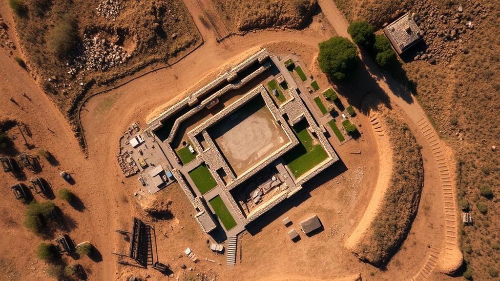
How Aerial Views from the Past Reveal Buried Historical Sites
How Aerial Views from the Past Reveal Buried Historical Sites
The advent of aerial photography marks a significant milestone in the field of archaeology and historical research. Aerial views offer unique perspectives that can reveal sites hidden beneath vegetation, soil, and urban developments. This article explores the methodologies, findings, and implications of using aerial photography to uncover buried historical sites across various geographies and epochs.
The Evolution of Aerial Photography
Aerial photography has its roots in the mid-19th century, but it became more prevalent during and after World War I. Early images were taken from balloons and kites, providing reconnaissance for military strategies. By the 1930s, dedicated aircraft began capturing expansive landscapes. Noteworthy is the work of scientists like Augustus Gus Le B. Chase, who pioneered the use of aerial photography for archaeological investigations in the early 20th century.
Methodologies of Aerial Archaeology
Two primary methodologies are employed in aerial archaeology: vertical and oblique aerial photography. Vertical images are taken directly downward and are useful for mapping and analysis, while oblique images–taken at an angle–can highlight topographical features related to archaeological sites.
The introduction of advanced technologies, such as LiDAR (Light Detection and Ranging), has revolutionized aerial archaeology. LiDAR uses laser light to measure distances and can penetrate forest canopies to reveal ground profiles, exposing features invisible to conventional photography.
Case Studies of Historical Sites Revealed by Aerial Photography
- Stonehenge, England (constructed circa 3000-2000 BC): Aerial surveys in the 19th and 20th centuries revealed previously unknown circular earthworks surrounding the iconic stone circles, suggesting a more extensive ceremonial landscape.
- Chaco Canyon, New Mexico (circa 850-1140 AD): Research utilizing both aerial photography and LiDAR has revealed complex road networks and structures, indicating a sophisticated civilization aligned with astronomical events.
- The Great Wall of China (constructed from 7th century BC): Historical aerial surveys have uncovered hidden sections of the wall that were previously misidentified or obscured by vegetation.
Statistical Evidence and Findings
According to the Archaeological Institute of America, around 80% of archaeological sites remain undiscovered globally. Aerial photography and remote sensing techniques have been instrumental in identifying these sites. Recent studies have shown that aerial surveys can increase site detection rates by up to 50% compared to ground surveys alone.
Also, a survey conducted in 2022 revealed that the application of LiDAR technology in the Maya lowlands led to the discovery of over 60,000 previously uncharted structures, dramatically altering historical understandings of Maya urban planning and society.
Implications for Archaeology and Preservation
The findings derived from aerial photographs have profound implications for historic preservation. The ability to identify and document submerged or obscured sites emphasizes the need for proactive measures in cultural resource management. It can inform preservation efforts by highlighting areas at risk of development or degradation.
Also, the insights gained not only enrich our understanding of past civilizations but also provide context for current land-use planning and community engagement initiatives. For example, in regions where significant archaeological sites are discovered, local governments can implement zoning laws that protect these resources.
Conclusion and Actionable Takeaways
The utilization of aerial views from the past is a vital tool in revealing buried historical sites. As methodologies continue to evolve and become integrated with new technologies, the potential for discovering and documenting archaeological features increases dramatically. Scholars, researchers, and local governments can leverage these findings for educational initiatives and conservation efforts.
In summary, the strategic application of aerial photography and remote sensing technologies represents a pivotal advancement in the field of archaeology. Stakeholders should invest in these technologies to ensure that hidden histories are not only uncovered but also preserved for future generations. Understanding and implementing these methodologies can lead to more informed management of historical sites, fostering a deeper appreciation for our shared heritage.

