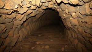
How advanced imaging techniques are reshaping the study of subterranean worlds.
How Advanced Imaging Techniques Are Reshaping the Study of Subterranean Worlds
The exploration of subterranean environments has historically been challenging due to the inherent complexities and constraints associated with accessing these hidden realms. But, with the advent of advanced imaging techniques, researchers are now able to unveil the secrets of underground ecosystems, geological formations, and even archaeological sites with unprecedented clarity. This article delves into the innovative imaging technologies that are transforming the study of subterranean worlds, highlighting their applications, benefits, and future potentials.
Emerging Imaging Technologies
Several advanced imaging technologies have emerged in recent years, enabling scientists to study subterranean worlds more effectively than ever before. most noteworthy of these include:
- Ground-Penetrating Radar (GPR)
- Electrical Resistivity Tomography (ERT)
- Magnetometry
- Computed Tomography (CT) Scanning
Ground-Penetrating Radar (GPR)
Ground-Penetrating Radar is a non-invasive geophysical method that uses radar pulses to image the subsurface. Developed in the 1970s, GPR has since found applications across various fields, including geology, archaeology, and civil engineering. GPR is particularly useful for detecting and mapping subsurface features such as rocks, sediments, and even archaeological artifacts.
For example, a project conducted in 2019 at the ancient city of Pompeii, Italy, utilized GPR to discover previously hidden structures beneath the volcanic ash. By processing the radar data, researchers uncovered a network of houses and roads, providing valuable insights into the urban planning of this Roman city.
Electrical Resistivity Tomography (ERT)
ERT is another advanced imaging technique that helps to visualize the subsurface by measuring the electrical resistivity of the ground. Different materials exhibit different resistivities, which allows researchers to infer the composition of underground layers.
A notable application of ERT was witnessed in the study of the Castel del Monte archaeological site in Italy. In 2020, researchers employed ERT to map the ancient structures beneath the surface, revealing the existence of previously unknown structures that date back to the 13th century. This deployment of ERT not only enhanced archaeological understanding but also aided in the conservation of the site.
Magnetometry
Magnetometry involves measuring magnetic fields to identify subsurface anomalies. This technique is particularly valuable in archaeology as it helps to identify human-made structures without excavation. The use of magnetometers can help locate foundations, walls, and other features that might otherwise remain hidden.
In 2021, a study employing magnetometry took place in the Mayan ruins of Tikal, Guatemala. Researchers were able to generate detailed maps of ancient structures and road systems, revealing insights into the civilizations complex urban layout and contributing to a better understanding of Mayan society.
Computed Tomography (CT) Scanning
Computed Tomography, or CT scanning, has traditionally been used in medical imaging but has increasingly found its way into the study of geology and paleontology. By producing cross-sectional images of objects, CT scanning allows researchers to visualize internal structures without the need for destructive sampling.
A significant application of CT scanning was demonstrated in 2018 when scientists scanned fossilized dinosaur eggs from the Late Cretaceous period in Mongolia. The imaging revealed the embryos within, providing insights into the growth and development of these ancient species.
The Benefits of Advanced Imaging Techniques
The application of advanced imaging technologies brings numerous benefits to the study of subterranean worlds:
- Non-invasive exploration: These techniques reduce the need for excavation, preserving the integrity of the site.
- Enhanced data collection: They provide high-resolution images and detailed data about subsurface conditions.
- Cost-effective strategies: These methods can be more economical compared to traditional exploratory techniques.
- Interdisciplinary applications: They serve various fields including geology, archaeology, and environmental science.
Real-World Applications and Future Directions
As advanced imaging techniques continue to evolve, their applications are expected to expand even further. e imaging technologies not only aid in scientific research but also play a crucial role in various industries, including construction, mining, and environmental monitoring.
For example, in the realm of urban planning, GPR utilized to assess the condition of underground utilities prior to construction, thereby avoiding costly disruptions. Similarly, ERT is applied in environmental studies to monitor groundwater contamination and assess soil conditions.
Plus, ongoing advancements, such as the integration of artificial intelligence with these imaging techniques, promise to enhance data analysis, allowing for more comprehensive interpretations of subterranean conditions.
Actionable Takeaways
As we stand at the forefront of technological advancements in subterranean studies, several key takeaways emerge:
- Invest in training and resources related to advanced imaging technologies to stay competitive in research.
- Consider interdisciplinary approaches by collaborating with experts across various fields.
- Stay informed of emerging trends and advancements to leverage them effectively in both research and practical applications.
The transformation brought about by advanced imaging technologies is merely the beginning of a new era in the study of underground worlds. As researchers continue to innovate, the potential for groundbreaking discoveries grows, leading to a deeper understanding of Earths hidden treasures.


