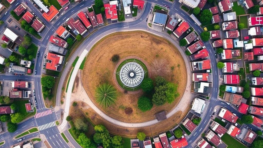
Harnessing Aerial and Ground Photography to Spot Hidden Landmarks
Harnessing Aerial and Ground Photography to Spot Hidden Landmarks
The evolution of photography has transformed the fields of archaeology, conservation, and urban planning, enabling professionals to spot hidden landmarks that might otherwise go unnoticed. Aerial and ground photography serve as powerful tools in this pursuit, providing distinct advantages and capabilities that contribute to comprehensive landscape analysis.
Overview of Aerial Photography Technologies
Aerial photography refers to the capturing of images from an elevated position, typically using drones or aircraft. Since its inception in the mid-19th century with the use of hot air balloons, aerial photography has dramatically advanced, particularly with the advent of digital imaging technology. As of 2020, the global drone market for commercial purposes was valued at over $13 billion and is projected to grow significantly by 2025 (Mordor Intelligence, 2021). This burgeoning sector has enabled the collection of high-resolution images that reveal previously obscured cultural and historical sites.
Ground Photography: A Complementary Approach
Ground photography includes the use of standard cameras to document existing landscapes and structures from ground level. Utilizing advanced techniques such as photogrammetry, which converts images into three-dimensional models, researchers can analyze, assess, and digitally reconstruct landmarks that may be vital to understanding a site’s historical significance.
Identifying Hidden Landmarks Through Integrated Techniques
The combination of aerial and ground photography creates a synergistic effect that enhances the identification and study of hidden landmarks. following methodologies illustrate this integration:
- Image Overlays: By overlaying historical aerial images with current ground photography, researchers can identify changes in the landscape that might indicate the existence of buried structures.
- Multi-Spectral Imaging: This advanced photographic method utilizes different wavelengths of light to detect anomalies in the terrain, revealing potential archaeological sites that are invisible to the naked eye.
Case Study: The Lost City of Manoa
A notable example of harnessing aerial and ground photography is the case of Manoa, the legendary city often associated with tales of El Dorado. In 2019, aerial surveys of the Amazon rainforest utilizing drone technology uncovered geometric shapes and patterns indicative of human-made structures, suggesting the existence of significant archaeological sites beneath the dense vegetation. Related on-ground explorations supported these findings by revealing remnants of streets and buildings consistent with urban planning in pre-Columbian cultures (Smithsonian Institution, 2020).
Applications in Modern Urban Planning and Conservation
The application of aerial and ground photography transcends archaeology and history, playing a crucial role in urban planning and conservation efforts. By allowing city planners to visualize and analyze landscapes, these technologies can inform decisions about sustainable development, resource management, and conservation measures.
Urban Expansion Monitoring
In urban settings, aerial photography is instrumental in monitoring land use changes. According to the American Planning Association, cities like Chicago and Los Angeles successfully implemented aerial photography to document urban growth and to combat urban sprawl by conserving green spaces. For example, comprehensive aerial surveys in Chicago revealed effective zoning strategies that preserved significant landmark areas while enabling responsible development (APA, 2021).
Challenges and Considerations
While the potential of aerial and ground photography is immense, several challenges must be addressed:
- Data Management: The large volume of data generated necessitates advanced software for analysis and storage, which can be resource-intensive.
- Privacy and Ethical Concerns: The use of drones for aerial photography raises questions about privacy violations and the ethical dimensions of surveillance.
Conclusion: The Future of Landmark Detection
To wrap up, the integration of aerial and ground photography presents a groundbreaking approach to discovering and preserving hidden landmarks. As technology continues to evolve, its applications in archaeology, urban planning, and environmental conservation will expand further, potentially unveiling countless historical treasures while ensuring a careful stewardship of our cultural heritage. To maximize the benefits of such techniques, ongoing research, training, and ethical guidelines will be essential for researchers and practitioners alike.
Actionable Takeaways
- Professionals should consider adopting aerial photography tools, including drones, to enhance survey capabilities.
- Collaboration between archaeologists, urban planners, and technology experts can improve methodologies for identifying hidden landmarks.
- Continued education on legal frameworks governing aerial photography is critical to addressing privacy and ethical concerns.
References
- Mordor Intelligence. (2021). Global Drone Market – Growth, Trends, and Forecasts (2020 – 2025).
- Smithsonian Institution. (2020). Aerial Surveys Reveal Pre-Columbian Urban Planning in the Amazon.
- American Planning Association. (2021). Utilizing Aerial Photography for Urban Growth Management.


