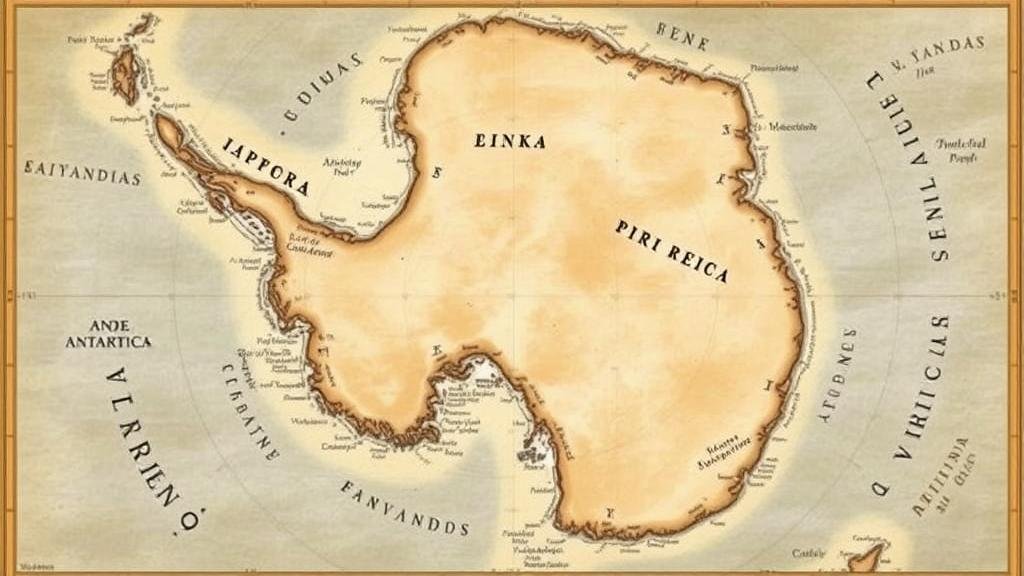
Exploring the mystery of the “Piri Reis Map,” which depicts Antarctica long before its official discovery.
Exploring the Mystery of the Piri Reis Map
The Piri Reis Map, created in 1513 by the Ottoman admiral and cartographer Piri Reis, has fascinated historians, geographers, and even conspiracy theorists for centuries. This remarkable map not only represents a significant achievement in cartography but also raises intriguing questions regarding the knowledge of Antarctic geography long before its official discovery in 1820. In this article, we will delve into the maps origins, its depiction of Antarctica, and the ongoing debates surrounding its accuracy and implications.
The Origins of the Piri Reis Map
The Piri Reis Map is part of a larger world map created by Piri Reis, who was known for his knowledge of navigation and cartography. Compiled primarily from earlier maps, one of which is believed to be based on the works of Christopher Columbus, the Piri Reis Map combines elements from various sources, including Arab, Greek, and contemporary European maps. The original map was drawn on a piece of worn parchment that measures approximately 36.5 inches by 26.5 inches.
Piri Reis meticulously annotated the map, noting significant geographical details and providing insights into the known world of the early 16th century. Remarkably, the map includes parts of South America, the coast of Africa, and much of Europe, suggesting a wealth of navigational knowledge during this period.
Depiction of Antarctica
One of the most captivating aspects of the Piri Reis Map is its portrayal of what some believe to be the northern coast of Antarctica, specifically the landmass now known as Queen Maud Land. This depiction has sparked considerable debate among researchers who question how such detailed knowledge of Antarctica could have existed at a time when it had not yet been discovered by modern explorers.
While the section that potentially represents Antarctica is drawn without the ice cover now present, its geographical features bear similarities to actual Antarctic coastlines. This has led to theories suggesting that ancient civilizations may have had advanced knowledge of the Antarctic region long before its official discovery, or that prior maps which Piri Reis used may have depicted locations based on now-lost explorations.
Debate and Controversy
The Piri Reis Map has prompted various interpretations and theories regarding its accuracy. Skeptics argue that the resemblance to Antarctica could be coincidental or the result of artistic liberty taken by Piri Reis. Others point to the possibility that ancient civilizations, equipped with advanced navigational skills, could have charted these regions. Main arguments include:
- The lack of any definitive evidence that ancient civilizations explored Antarctica.
- The likelihood that the map was compiled using earlier sources, which may have contained inaccuracies.
- The discussion surrounding the significance of the map as a reflection of 16th-century knowledge rather than a literal representation of the erroneous geography.
Real-World Applications and Lessons
The Piri Reis Map serves not only as a historical artifact but also as a testament to the ingenuity of human exploration and cartography. It highlights how ancient societies compiled knowledge from various sources and paved the way for future explorations. From a modern perspective, there are several actionable takeaways to consider:
- Encouraging interdisciplinary research that examines the intersections of geography, history, and technology.
- Utilizing historical maps to inspire interest in contemporary environmental issues and climate change, especially regarding melting polar ice caps.
- Recognizing the importance of preserving historical artifacts to understand the evolution of human knowledge and exploration.
Conclusion
The Piri Reis Map continues to intrigue scholars and enthusiasts alike, encapsulating the mysteries of age-old exploration while challenging our assumptions about the limits of ancient knowledge. As we delve deeper into its history and implications, we expand our appreciation for the intricacies of cartography and the endeavors of our ancestors in mapping the world around them.


