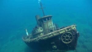
Exploring NOAA’s Digital Coast for Clues to Shipwrecks and Coastal Relics
Exploring NOAAs Digital Coast for Clues to Shipwrecks and Coastal Relics
The National Oceanic and Atmospheric Administration (NOAA) has developed the Digital Coast, a platform rich with data aimed at supporting coastal management and research. This resource plays a pivotal role in uncovering the historical mysteries surrounding shipwrecks and coastal relics. The amalgamation of various datasets–including coastal topography, hydrology, and environmental features–enables researchers to analyze patterns that may indicate the presence of historical maritime artifacts.
The Importance of NOAAs Digital Coast
NOAAs Digital Coast is instrumental in providing a wide array of high-resolution spatial data that is vital for the exploration of coastal regions. This initiative benefits numerous stakeholders, such as state and local agencies, scientists, and even amateur historians. The platform encompasses a variety of tools including:
- Coastal change analysis
- Topographic and bathymetric mapping
- Imagery and land use information
These tools help in honing in on potential shipwreck sites and understanding the historical context of coastal relics, thus significantly aiding research related to underwater archaeology.
Historical Shipwrecks: A Case Study
One notable case study is the wreck of the USS Hatteras, an American Civil War era ship that sank off the Texas coast in 1863. Using NOAAs Digital Coast, researchers were able to analyze coastal bathymetric data that exhibited a sudden drop in depth, indicating a possible shipwreck location. For over a century, the Hatteras lay undiscovered, partly due to shifting sands and tides. But, with the Digital Coast data, the retrieval team pinpointed its location and ultimately confirmed the wreck in 2006.
Identifying Coastal Relics
Coastal relics range from shipwrecks to ancient human settlements and natural artifacts. According to NOAA, data retrieved from the Digital Coast can be analyzed using Geographic Information Systems (GIS) to reveal patterns that suggest areas of archaeological interest. For example, coastal erosion along the Outer Banks of North Carolina has unearthed several artifacts, including the remains of a 19th-century ship.
By layering historical maps with contemporary data from the Digital Coast, researchers can visualize the change over time and make better predictions about where to scout for missing archaeological sites. Studies indicate that over 1,200 shipwrecks exist off the North Carolina coast alone, many of which remain undiscovered.
Collaborative Efforts and Data Sharing
Collaboration is key in utilizing NOAAs Digital Coast effectively. The platform allows for data sharing among various agencies, including state historical societies and universities. For example, the collaboration between the University of North Carolina and NOAA has led to several significant discoveries along the North Carolina coast.
Plus, NOAA encourages citizen science via the Digital Coast, inviting the public to contribute their findings and hypotheses about potential shipwrecks or coastal artifacts. This collective effort fosters a community of enthusiasts and professionals alike, helping democratize the quest for maritime history.
Challenges and Limitations
Despite its benefits, utilizing NOAA’s Digital Coast for shipwreck conservation does come with challenges. The primary concerns include:
- Data fragmentation across various sources
- Environmental changes affecting visibility and accessibility
- Legal and ethical issues relating to artifact recovery
Also, many shipwrecks are located in areas that are ecologically sensitive, raising the question of the balance between historical research and environmental conservation.
Future Directions in Research
Moving forward, advancements in technology such as underwater drones and improved sonar imaging could enhance the capabilities of researchers using NOAAs Digital Coast. As data accuracy improves, the potential for discovering previously hidden shipwrecks will grow exponentially. For example, researchers are already employing machine learning algorithms to analyze satellite imagery for signs of submerged artifacts.
Conclusion: Actionable Takeaways
Utilizing NOAAs Digital Coast provides valuable insights into maritime history through the examination of shipwrecks and coastal relics. Key takeaways from this research include:
- Emphasizing interagency collaboration to enhance research efforts.
- Leveraging modern technology for better data collection and analysis.
- Engaging the public in citizen science initiatives to bolster grassroots research efforts.
The integration of rich datasets and community involvement symbolizes a transformative approach to maritime archaeology, opening doors to future discoveries that could reshape our understanding of coastal heritage.


