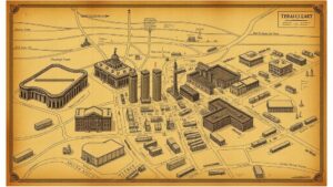
Exploring Early Fire Tower Maps for Forest Service Artifact Leads
Exploring Early Fire Tower Maps for Forest Service Artifact Leads
The history of forest management in the United States is deeply intertwined with the establishment of fire towers, which serve as crucial points for early detection and monitoring of wildfires. This research article explores how early fire tower maps can be utilized as artifact leads for the U.S. Forest Service. By examining historical cartography, administrative documents, and geographical data, the article aims to uncover valuable insights related to forest management practices in the early 20th century.
The Historical Context of Fire Towers in the United States
Throughout the early 1900s, the United States faced increasing challenges with destructive wildfires, prompting the establishment of lookout towers. The first fire towers were constructed in the Northern Rockies around 1900, becoming a cornerstone of wildfire detection and prevention strategies. According to the National Park Service, by 1930, over 5,000 fire towers were in operation across the U.S.
The maps created for these towers not only indicated locations but also provided insights into forest cover, topographical features, and areas of high wildfire risk. For example, the 1914 maps of the Wenatchee National Forest highlight the strategic placement of fire lookouts based on visibility and accessibility to surrounding areas.
Analyzing Early Fire Tower Maps
Early fire tower maps serve as fundamental documents for understanding forest management trends and strategies. These maps included not only the location of fire towers but also detailed information about the surrounding environments, including terrain types, forest density, and access roads. Analyzing these maps reveals significant patterns in how forest resources were allocated and monitored.
A notable example is the 1929 fire tower map from the White Mountain National Forest in New Hampshire. It shows not just the physical location of fire towers but also the forested areas deemed critical for timber resources and fire prevention. This dual-functionality of maps underscores the Forest Services efforts in both resource management and fire control.
Documenting Artifact Leads Through Cartography
Fire tower maps can facilitate the discovery of relevant historical artifacts related to forest service operations and community interactions with forest resources. Quantitative analysis of mapped locations may provide leads to physical remnants of past fire tower structures and associated operational equipment. Using geographic information systems (GIS), researchers can overlay current maps with historical fire tower sites to investigate their remaining artifacts over time.
- Analysis of existing structures to identify potential restoration projects based on historical significance.
- Incorporating local historical societies in the quest for artifacts related to early fire management activities.
Real-World Applications of Early Fire Tower Research
Researching early fire tower maps not only preserves the history of forest management but also informs contemporary practices. The data recovered can contribute to better understanding ecological patterns and improving wildfire management strategies in the face of climate change. For example, in California, the California Department of Forestry and Fire Protection has begun integrating historical data from fire tower maps into current wildfire risk assessments, effectively creating a bridge between historical knowledge and modern application.
Future Implications of Fire Tower Map Analysis
The ongoing examination of early fire tower maps has considerable implications for both historical study and practical implementation in current forest management strategies. By understanding the decisions made in the past, modern forest services can optimize their approaches to managing the intricate ecosystems. Also, documenting artifacts related to early fire management enhances the cultural heritage linked to these regions.
Conclusion and Actionable Takeaways
To wrap up, early fire tower maps are invaluable artifacts that provide both historical insights and practical leads for artifact documentation in forest management. They reveal patterns of resource management and serve as a database for investigating the past and its relationship with contemporary practices. As fire management continues to evolve, integrating these historical perspectives will be critical in informing sustainable practices.
- Collaborate with historical societies to gather artifacts and historical data.
- Use GIS technology to manage and analyze spatial data for restoration projects.
By applying a multifaceted approach that integrates historical research with modern technological tools, the potential exists for significant advancements in forest management and cultural preservation.


