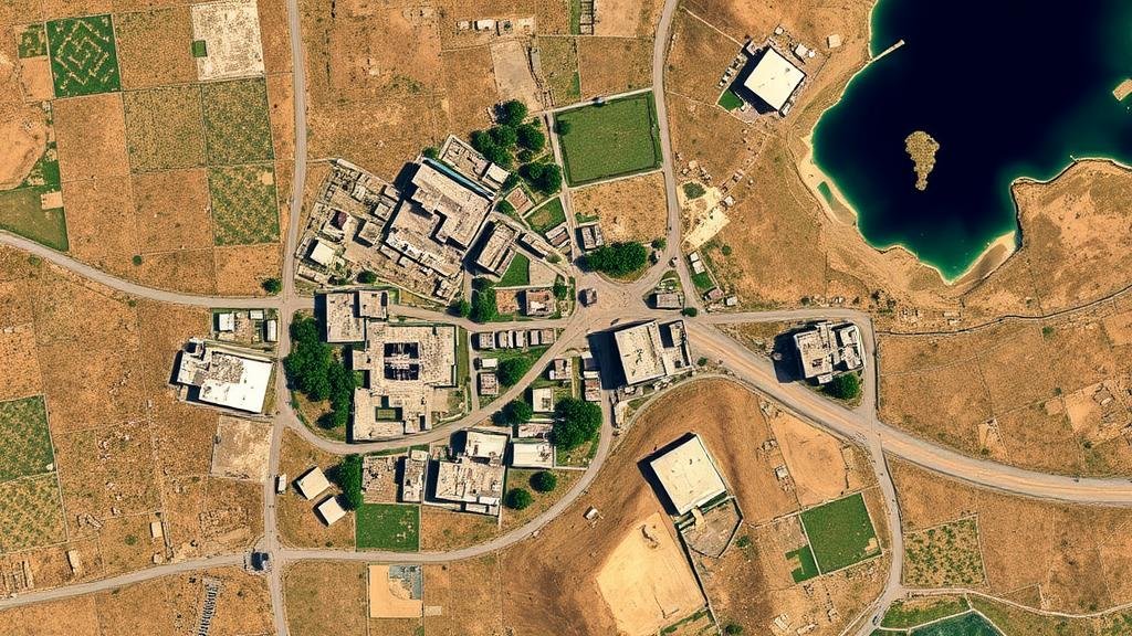
Discovering Abandoned Settlements Through Analyzing Satellite Imagery with AI
Discovering Abandoned Settlements Through Analyzing Satellite Imagery with AI
The advent of satellite imagery combined with artificial intelligence (AI) has opened new avenues in the field of archaeology and anthropology. Particularly, the discovery of abandoned settlements has gained traction due to advancements in machine learning algorithms that can analyze large datasets effectively. This article explores the methodologies, applications, and implications of utilizing satellite imagery and AI for identifying these previously uncharted areas.
The Historical Context of Abandoned Settlements
Abandoned settlements have long been a point of interest in archaeology. Locations such as Machu Picchu in Peru or Pompeii in Italy exemplify how human settlements can be lost to time yet still retain layers of historical significance. In the United States, ghost towns like Bodie, California, serve as relics of the Gold Rush era. Historical records indicate that over 3,800 ghost towns exist across the country, many of which have fallen into obscurity.
Satellite Imagery: An Overview
Satellite imagery refers to the images of Earth captured by satellite-based sensors. This imagery is vital for various applications, including environmental monitoring, urban planning, and military reconnaissance. High-resolution imagery, such as that provided by the WorldView satellites, can capture detailed surface features with a resolution of 31 cm. Such detail allows researchers to identify structures that may correlate with abandoned settlements.
Artificial Intelligence and Machine Learning
Machine learning, a subset of AI, enables computers to learn from and make predictions based on data. Algorithms can be trained to recognize patterns within large datasets, which is especially useful in processing satellite images. Techniques such as convolutional neural networks (CNNs) have shown success in identifying features in images, making them suitable for detecting remnants of human infrastructure.
Methodological Framework
Data Acquisition
The first step in identifying abandoned settlements is acquiring satellite imagery. Organizations like NASA and ESA (European Space Agency) provide free access to satellite data. Researchers often rely on platforms such as Google Earth Engine, which aggregates satellite imagery for analysis.
Preprocessing Data
Before analysis, the data requires preprocessing, including:
- Image calibration to adjust for atmospheric conditions.
- Georeferencing to ensure that the imagery aligns accurately with geographic coordinates.
Feature Extraction
Once data is prepared, feature extraction begins, leveraging AI algorithms to identify patterns and anomalies. For example, researchers may train a CNN to recognize shape variations characteristic of human-made structures, such as roads or foundations.
Validation of Findings
After algorithm-based detection, a validation phase occurs, where findings are cross-referenced with historical records, local knowledge, or ground-truthing through field surveys. This process ensures accuracy and reliability in identifying abandoned sites.
Case Studies
The Ancient City of Angkor, Cambodia
In 2019, researchers utilized satellite imagery from the WorldView-3 satellite combined with AI-driven algorithms to uncover previously unknown structures surrounding the famous Angkor Wat temple complex. By analyzing vegetation patterns and soil disturbance, they identified over 60,000 structures previously hidden beneath overgrowth (Caldwell et al., 2019).
Deserted Settlements in the American Southwest
Research published in the journal Remote Sensing demonstrated the application of AI in mapping ancient settlements in New Mexico. The combination of infrared imagery and machine learning algorithms led to the discovery of several previously undocumented sites, providing further insights into the Ancestral Puebloan civilization (Martin et al., 2021).
Implications for Future Research
The integration of satellite imagery and AI allows archaeologists to uncover hidden histories that would otherwise remain unexamined. As more datasets become available and methods refine, the potential to explore remote and difficult-to-access areas expands significantly. For example, satellite imagery can reduce the need for extensive ground surveys, saving both time and resources.
Challenges and Considerations
While promising, utilizing satellite imagery alongside AI presents challenges:
- The requirement for high-quality data, which can be limited in certain geographic regions.
- Potential biases in algorithmic learning, as improper training may miss significant features.
Conclusion and Actionable Takeaways
The application of satellite imagery and AI for discovering abandoned settlements not only enhances academic research but also enriches our understanding of human history. Researchers and practitioners can take the following actions:
- Invest in advanced training programs that focus on machine learning techniques.
- Collaborate with data collection organizations for expanded access to satellite imagery.
- Ensure interdisciplinary teamwork, bringing together archaeologists, data scientists, and geographers for holistic approaches to research.
As technology evolves, so too will our ability to unlock the mysteries of past civilizations lurking beneath the earth’s surface, redefining our narrative of human settlement and migration across the globe.
References:
Caldwell, I., et al. “Uncovering the Angkor Complex: A Machine Learning Approach.†Remote Sensing of Environment, 2019.
Martin, D., et al. “Detecting Ancestral Puebloan Settlements Using Satellite Imagery.†Remote Sensing, 2021.


