Detecting in Rocky Outcrops for Clues to Historic Campsites
Detecting in Rocky Outcrops for Clues to Historic Campsites
The study of historic campsites, particularly those situated in rocky outcrops, is an essential aspect of archaeological research. By utilizing various detection methods and analyzing geological formations, researchers can glean invaluable evidence about past human activity. This article explores the techniques used in detecting clues to historic campsites, the significance of rocky outcrops, and case studies that highlight successful findings.
Understanding Rocky Outcrops
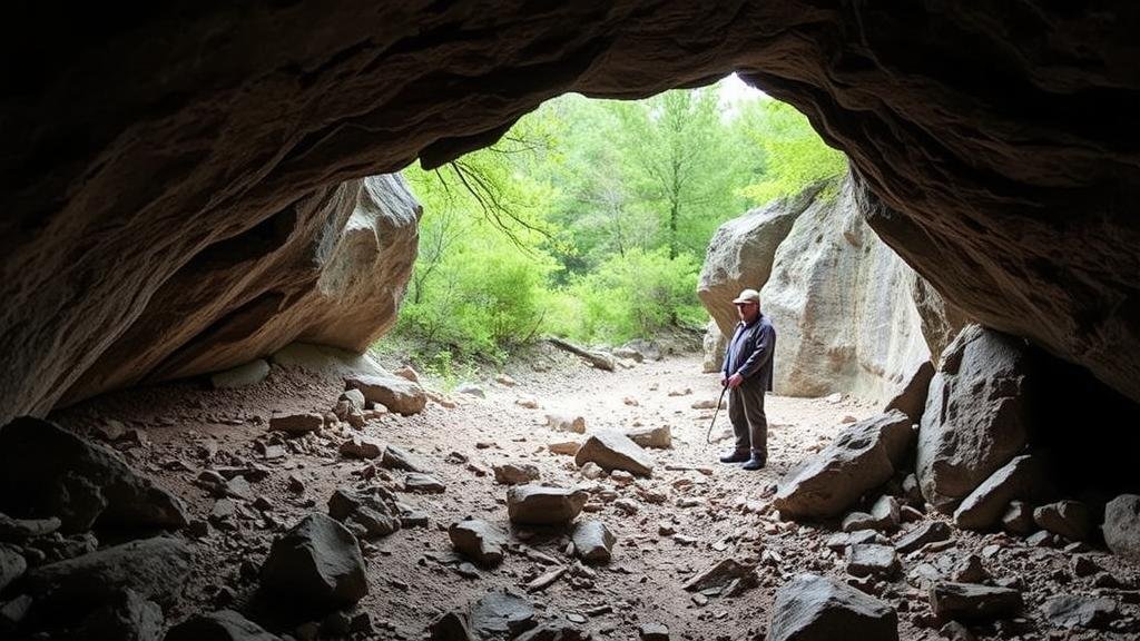
Rocky outcrops, which are areas where bedrock is exposed at the surface, serve as a crucial feature in different landscapes. can be found in diverse environments, from mountainous regions to coastal areas. These geological formations often provide ideal locations for campsites due to their natural shelter and proximity to water sources. The strategic location of these formations has resulted in prolonged human habitation throughout history.
Detection Techniques
Detecting historic campsites within rocky outcrops requires a multifaceted approach that combines traditional archaeological methods with modern technological advancements. e methods include:
- Surface Surveying: This involves a systematic examination of the ground surface for artifacts, hearths, and other indicators of human activity. Archaeologists often utilize grid systems to ensure thorough coverage.
- Geophysical Surveys: Techniques such as ground-penetrating radar (GPR) and magnetic surveys allow researchers to detect sub-surface features without excavating. These methods can reveal buried remains of structures or artifacts.
- Remote Sensing: Drones equipped with multispectral cameras can map and analyze large areas of rocky outcrops, identifying potential archaeological sites based on vegetation patterns and landscape features.
- Soil Analysis: Soil samples can reveal anomalies that indicate past human activity, such as changes in soil composition or the presence of burned materials.
The integration of these methods enhances the likelihood of successfully identifying and interpreting potential campsite locations.
Significance of Artifact Analysis
Once potential sites are identified, the collection and analysis of artifacts become pivotal. Artifacts such as stone tools, remnants of food preparation, and charcoal from hearths provide context for the sites historical significance. For example, the study of lithic materials can inform researchers about the technological skills and resource utilization of past peoples.
Also, radiocarbon dating of charcoal samples can offer insights into the timeline of occupation. According to a study published in the Journal of Archaeological Science, radiocarbon dating methods can yield dates with an accuracy of ±40 years, which is key in constructing an accurate historical narrative.
Case Studies
Several notable case studies illustrate successful detection of historic campsites within rocky outcrops. One prominent example is the archaeological work conducted at the Chiricahua Mountains in Arizona. Here, teams employed a combination of surface surveying and geophysical surveys, successfully locating a campsite used by the Apache during the 19th century. Analysis of artifacts collected from the site, including projectile points and pottery shards, provided insights into the seasonal movements of the Apache people.
Another remarkable case occurred in the Quabbin Reservoir area of Massachusetts, where researchers uncovered several Native American campsites in rocky outcrops. Using drones and GPR, they identified subsurface features consistent with habitation structures. The subsequent excavation and artifact analysis revealed a rich cultural history connected to the areas geology and ecology.
Challenges and Considerations
Detecting historic campsites in rocky outcrops presents several challenges. The rugged terrain can hinder access, and weather conditions might limit the ability to carry out surveys. Also, there is the potential for site disturbance due to modern activities such as construction or tourism.
Also, researchers must navigate the ethical implications of excavating historical sites. Engaging with indigenous communities and obtaining appropriate permits are essential steps in the archaeological process, ensuring respect for cultural heritage and knowledge.
Actionable Takeaways
For researchers and enthusiasts interested in detecting historic campsites in rocky outcrops, consider the following actionable strategies:
- Use a combination of detection techniques to enhance the chances of locating artifacts and features.
- Engage with local communities and stakeholders to ensure ethical archaeological practices.
- Stay abreast of technological advancements in remote sensing and geophysical methods to improve site assessments.
- Document findings comprehensively to contribute to the broader knowledge of human activity in these unique geological contexts.
To wrap up, the detection of historic campsites in rocky outcrops is a rich field of study that combines traditional archaeological techniques with modern technology. By leveraging these tools, researchers can uncover significant insights into the lives of those who inhabited these landscapes long ago.


