Detecting in Rocky Desert Landscapes: Tools for Uneven Ground
Detecting in Rocky Desert Landscapes: Tools for Uneven Ground
The unique challenges posed by rocky desert landscapes require specialized tools and techniques for detection activities, such as geological surveys, archaeological excavations, and environmental assessments. This article will explore the various methods and equipment available to professionals operating in these rugged terrains, along with real-world applications and case studies to illustrate their effectiveness.
The Unique Challenges of Rocky Desert Landscapes
Rocky desert landscapes present particular difficulties related to their uneven surface, sparse vegetation, and extreme weather conditions. The rugged terrain can conceal important features or artifacts, making detection a complex task. Also, the harsh climate–characterized by temperature fluctuations and limited rainfall–can impact the durability and functionality of detection equipment.
Key Detection Methods and Tools
Detecting in rocky desert landscapes typically employs a combination of methods and tools. The choice of tools depends on the nature of the materials being detected, the landscape features, and the specific goals of the investigation.
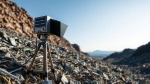
- Geophysical Surveying Equipment: Techniques such as ground-penetrating radar (GPR) and resistivity imaging are commonly used. GPR employs electromagnetic waves to identify buried objects, while resistivity imaging measures the subsurfaces electrical properties. For example, a geophysical survey conducted in the Arizona desert uncovered an ancient irrigation system by utilizing GPR technology.
- Metal Detectors: These devices are particularly useful for detecting metallic artifacts, including historical relics in archaeological contexts. For example, in a rocky desert area in Israel, metal detectors revealed a cache of Roman coins hidden under layers of soil and rock.
- Remote Sensing: Satellite imagery and aerial photography offer a broader view of the landscape, allowing for the identification of large-scale features or patterns that may indicate human activity or resource distribution. In the Atacama Desert, researchers have utilized remote sensing to identify ancient lines and geoglyphs that were otherwise difficult to locate.
- GIS Mapping: Geographic Information Systems (GIS) combine multiple data sources, including historical maps and environmental data, to aid in identifying areas of interest for further exploration. GIS has proven effective in tracking changes in the desert landscape over time, such as the impact of climate change on vegetation.
Real-World Applications
The application of these detection methods in rocky desert landscapes can yield significant insights across various fields, including archaeology, geology, and environmental science. Case studies highlight the intersection of these domains and illustrate how detection tools lead to transformative discoveries.
- Archaeological Discoveries: In the Moroccan desert, a combination of GPR and metal detection techniques successfully uncovered ancient burial sites, providing information about burial practices in pre-Islamic cultures. The integration of these technologies allowed archaeologists to navigate the challenging terrain effectively.
- Geological Studies: The geological survey of the Mojave Desert employed resistivity imaging to map the subsurface geology. This data informed mineral exploration initiatives by pinpointing areas rich in valuable minerals, such as lithium, crucial for battery production.
- Environmental Monitoring: Remote sensing has been used to track the effects of desertification in the Sahel region. By analyzing satellite imagery over several years, researchers could link land-use changes to environmental degradation, showcasing the power of these tools in conservation efforts.
Best Practices for Detection in Rocky Desert Landscapes
Useing best practices can greatly enhance the effectiveness of detection tools in rocky desert landscapes. These practices should take into account the intricate conditions and the specific goals of the project.
- Conduct Preliminary Surveys: Before deploying advanced detection techniques, practitioners should conduct preliminary surveys to gain a better understanding of the landscape and features that may require further analysis. This step aids in prioritizing areas of greatest interest and reduces wasted effort.
- Use Multi-Method Approaches: Combining multiple detection methods often leads to more comprehensive insights. For example, pairing remote sensing with ground truthing techniques allows archaeologists to verify the findings from satellite imagery on the ground.
- Engage Local Communities: Local knowledge can significantly improve detection efforts. Engaging with local communities can uncover traditionally significant sites that may not be documented in academic literature, thus enriching the detection process.
- Regular Calibration of Equipment: Equipment performance should be routinely evaluated and calibrated to ensure reliability, especially when used in extreme conditions. Proper maintenance extends the life of detection tools and enhances their accuracy.
Conclusion
Detecting in rocky desert landscapes is a multifaceted endeavor that necessitates the integration of specialized tools and methods due to the unique characteristics of these terrains. By employing advanced techniques such as geophysical surveying, metal detection, and remote sensing, professionals can overcome the challenges posed by the environment. Continuous improvement of practices, alongside engagement with local communities, can lead to significant advancements in our understanding of these enigmatic landscapes. As research in this field evolves, the potential for new discoveries remains vast, further emphasizing the importance of investing in effective detection methodologies.


