Detecting in Overgrown Areas: Advanced Techniques for Vegetation Interference
Detecting in Overgrown Areas: Advanced Techniques for Vegetation Interference
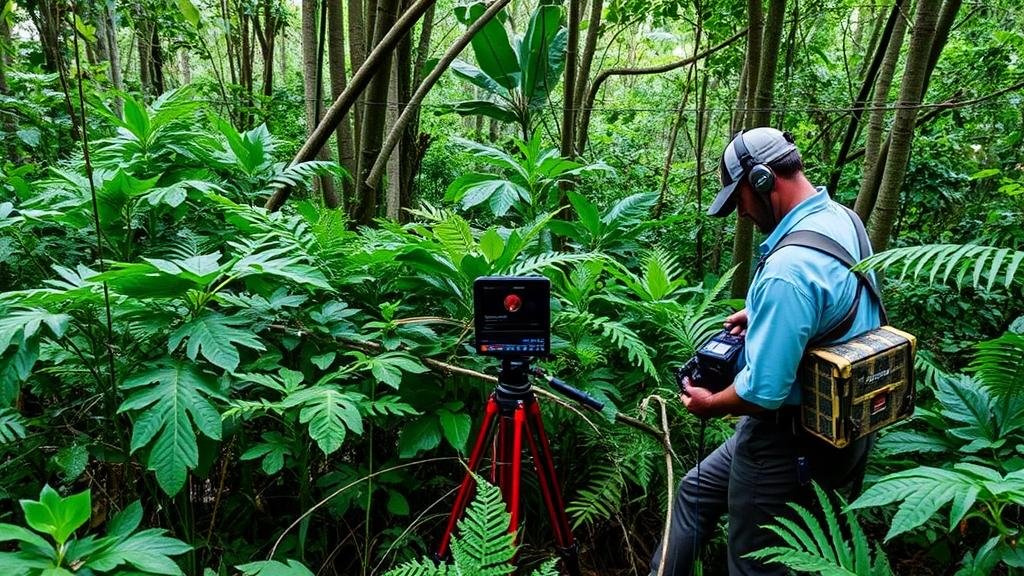
Detecting in overgrown areas poses significant challenges due to vegetation interference, which can hinder the visibility and effectiveness of traditional detection methods. This article explores advanced techniques for detecting features in densely vegetated environments, focusing on the integration of various technologies, methodologies, and case studies to showcase their effectiveness.
The Challenge of Vegetation Interference
Vegetation interference refers to the obstacles presented by plants that can obscure signals and reduce the effectiveness of detection instruments. This can include issues such as:
- Signal Attenuation: Dense foliage can absorb or scatter signals from radar, LiDAR, or other detection systems.
- Visibility Reduction: Tall grasses, thick shrubs, and trees can block the line of sight necessary for imaging or manual inspections.
- Environmental Variability: Changes in moisture, temperature, and light can influence the behavior of both vegetation and detection technology.
These factors necessitate innovative approaches to effectively operate in such challenging conditions.
Advanced Detection Techniques
Advancements in technology have led to numerous techniques that can mitigate vegetation interference. following are some of the most promising approaches:
1. Remote Sensing Technologies
Remote sensing employs the use of satellite and aerial imagery to gather information without direct contact with the ground. Techniques such as multispectral and hyperspectral imaging are particularly useful for distinguishing targets amidst heavy vegetation.
For example, the use of multispectral imaging allows operators to utilize different wavelengths to penetrate vegetation canopies. This approach was demonstrated in a study conducted in Florida’s wetlands, where researchers used UAV-mounted multispectral sensors to successfully identify and map invasive plant species, achieving an accuracy of over 90%.
2. LiDAR (Light Detection and Ranging)
LiDAR technology utilizes laser pulses to measure distances and create detailed three-dimensional models of the terrain. In areas with dense vegetation, LiDAR can capture the height and structure of foliage, revealing underlying objects.
A notable application was in a forest management project in Oregon, where LiDAR was employed to assess forest structure and biomass. results indicated that LiDAR could detect tree height variability even among thick canopies, leading to more effective management strategies.
3. Ground Penetrating Radar (GPR)
GPR is another effective tool that can be used in overgrown areas. It emits radar pulses into the ground and measures the reflected signals to detect subsurface features. GPRs ability to penetrate soil surfaces allows it to be useful in areas with overlying vegetation.
In archaeological contexts, GPR has been utilized to find buried artifacts in dense jungles, demonstrating its utility. A study in Belize successfully located ancient Mayan structures hidden beneath thick vegetation using GPR, illustrating its capacity to operate where conventional methods would fail.
Data Fusion and Analytics
Combining multiple sources of data can significantly enhance the detection process. This practice, known as data fusion, integrates various technological inputs to provide a comprehensive view of the sensing environment. Techniques include:
- Combining LiDAR with Optical Imaging: This provides both surface-level detail and vegetation structure analysis.
- Utilizing Machine Learning: Algorithms can analyze patterns in fused data, improving detection accuracy by learning from previous results.
A case study in the ecological monitoring of invasive species in Australia demonstrated that data fusion techniques increased detection rates by 40%, showcasing the importance of integrating various technologies for enhanced performance in overgrown areas.
Field Application and Best Practices
Successfully implementing these advanced detection technologies in the field requires careful planning and adherence to best practices:
- Pre-Deployment Survey: Conduct site surveys to assess the extent of vegetation and select appropriate technologies.
- Calibration of Equipment: Ensure that all equipment is thoroughly calibrated to optimize performance and accuracy.
- Use Local Expertise: Collaboration with local ecologists and area experts can provide invaluable insights into effective detection strategies.
Conclusion
Detecting in overgrown areas presents unique challenges, but advanced techniques such as remote sensing, LiDAR, and GPR provide robust solutions to mitigate vegetation interference. By embracing technology and employing data fusion strategies, practitioners can achieve higher accuracy and efficiency in their detection efforts. As technological capabilities continue to evolve, the potential for improved monitoring and management in dense vegetation environments will expand, paving the way for innovative applications across various fields.
Looking ahead, stakeholders in fields like ecology, archaeology, and civil engineering should consider integrating these advanced techniques into their operations to enhance their detection capabilities and improve outcomes in overgrown areas.


