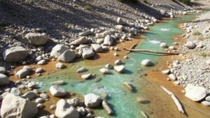
Techniques for Identifying Gold Traps in Narrow River Channels
Techniques for Identifying Gold Traps in Narrow River Channels
The search for gold in rivers has fascinated prospectors for centuries. Understanding how gold traps are formed in narrow river channels is essential for optimizing gold recovery. This article outlines effective techniques for identifying these gold traps, supported by relevant examples and case studies.
The Basics of Gold Trapping Mechanics
Gold is a dense material with a specific gravity ranging between 15 and 19.3, which means it is considerably heavier than most materials found in river substrates. As water flows through narrow channels, the velocity and turbulence of the water impact how sediment, including gold, is deposited.
- Slow Water Zones: Areas where the water velocity decreases allow heavier materials like gold to settle.
- Obstructions in the Flow: Natural barriers such as rocks, tree roots, or human-made structures can create eddies, holding back gold particles.
Identifying Gold Traps: Key Techniques
Identifying gold traps requires an understanding of hydraulic principles and sediment dynamics. Here are some effective techniques:
1. Topographic Surveys
Using topographic maps or Geographic Information Systems (GIS) can help identify potential gold trap locations. By analyzing river channel shapes and elevations, one can spot areas likely to accumulate gold.
2. Current Velocity Measurement
By measuring the velocity of water current at various points in a river, one can locate areas where the speed diminishes. Gold is likely to accumulate where the water slows down due to bends, pools, or debris.
3. Sediment Sampling
Sampling river sediment can provide direct evidence of gold presence. By using a shovel or suction dredge to collect sediment from suspected gold traps, prospectors can analyze the material for gold particles.
4. Observation of River Dynamics
Continuous observation of river behavior, especially during seasonal changes, lets prospectors identify newly formed gold traps caused by changing water levels or storm events. Variations can indicate where gold may have collected.
Determining High-Probability Gold Trap Locations
Several specific locations in a river channel are often conducive to trapping gold:
- Bends and Meanders: Outside bends tend to slow down water velocity, leading to enhanced sediment deposition, including gold.
- Deep Pools: Areas deeper than the surrounding riverbed may hold significant gold due to sediment accumulation.
- Confluences: The joining of two streams often leads to turbulence, which can disrupt flow patterns and create traps.
Case Studies of Successful Gold Trap Identification
Several case studies highlight successful identification techniques. For example, in the Sierra Nevada mountains, prospectors who employed GIS technology paired with sediment sampling discovered a significant gold deposit in an area previously deemed unproductive.
Also, a study of the Colorado River demonstrated that observing sediment movement after seasonal floods allowed prospectors to find new locations for gold recovery in previously overlooked areas.
Conclusion and Actionable Takeaways
Identifying gold traps in narrow river channels requires a multi-faceted approach that combines technology, observation, and traditional methods. Prospectors can improve their chances of finding gold by:
- Conducting thorough topographic surveys to locate potential sites.
- Measuring water velocity to find areas where gold is likely to settle.
- Experimenting with sediment sampling to confirm the presence of gold.
- Observing river behavior across different seasons.
By applying these techniques, prospectors can make informed decisions that enhance their gold recovery efforts and capitalize on the natural mechanics of river systems.


