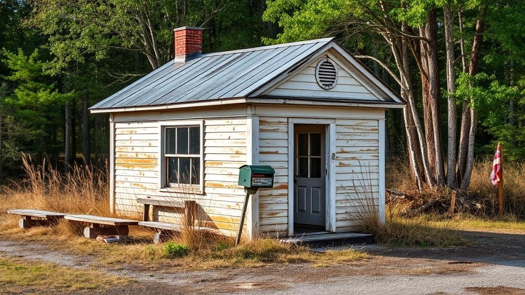
Mapping Abandoned Rural Post Offices for Community Relic Finds
Mapping Abandoned Rural Post Offices for Community Relic Finds
The decline of rural post offices in the United States has had significant socio-economic impacts on local communities. From 1960 to 2023, over 18,000 post offices have been closed, many of which were essential to rural areas. This article explores the mapping of these abandoned post offices to facilitate community relic finds, a practice that can revive community interest in local history and heritage while fostering economic benefit through tourism.
The Historical Context of Rural Post Offices
Established as critical infrastructure in the 19th and early 20th centuries, rural post offices served not only as mail distribution centers but also as community hubs. For example, the construction of the post office in Stetsonville, Wisconsin, in 1892 marked a pivotal moment for the community, providing a reliable communication line that boosted regional commerce. But, shifts in population dynamics and technological evolution have resulted in closures; according to the United States Postal Service (USPS), over 10% of rural post offices were closed between 2000 and 2020 due to declining mail volume and increasing operational costs.
Objectives of Mapping Abandoned Post Offices
The primary objectives of mapping abandoned rural post offices can be categorized as follows:
- Preservation of Community History: By identifying these sites, communities can engage in documentation and preservation efforts that honor their local heritage.
- Cultural Tourism Development: Mapping can promote tourism by attracting visitors interested in historical relics, thereby stimulating local economies.
- Community Engagement: Engaging local residents in mapping efforts fosters a sense of ownership and connection to local history.
Methodology for Mapping
Mapping abandoned rural post offices requires a systematic approach that combines geographic information systems (GIS), community collaboration, and historical research. The following steps outline a comprehensive methodology:
- Data Collection: Use USPS databases, local government archives, and historical societies to compile a list of abandoned post offices.
- Geospatial Analysis: Employ GIS tools to create maps that visualize the locations of these sites. For example, ArcGIS can be used to layer demographic and economic data that can enhance understanding of the regions affected.
- Community Workshops: Hold workshops that allow community members to contribute information and personal anecdotes about the post offices, enriching the data collected.
Case Study: The Abandoned Post Offices of Eastern Kentucky
Eastern Kentucky presents a compelling case study for mapping abandoned rural post offices. The area has experienced significant economic decline, leading to numerous post office closures. In 2022, The Kentucky Heritage Council identified 150 abandoned post office locations, initiating a project to map these sites as part of a heritage tourism initiative.
Community volunteers and local historians collaborated to gather oral histories, resulting in a digital archive that highlights the cultural significance of each site. This mapping project not only brings attention to the rich postal history of Eastern Kentucky but also draws attention from heritage tourism, with local businesses benefiting from increased foot traffic.
Potential Challenges
While mapping abandoned rural post offices has numerous benefits, several challenges may arise:
- Data Accessibility: Some data may not be publicly accessible, hindering comprehensive mapping efforts.
- Community Engagement: Ensuring broad community participation can be difficult, particularly in areas with declining populations.
- Preservation of Sites: Abandoned post offices may suffer from neglect and vandalism, complicating preservation efforts.
Conclusion
Mapping abandoned rural post offices serves a multifaceted purpose, with considerable potential to invigorate community pride and stimulate local economies through heritage tourism. Through a combination of technology, historical research, and community involvement, locals can reconnect with their past and leverage it for future benefits. For communities interested in implementing similar projects, it is critical to engage various stakeholders early in the process, ensuring a collaborative and inclusive approach that honors the local narrative while fostering sustainable development.
Actionable Takeaways
Communities aiming to map their abandoned post offices should consider the following action steps:
- Engage local historians, educators, and community groups to foster participation.
- Use GIS software to visualize post office locations and integrate additional data layers.
- Promote discovered relics through local events and digital platforms to attract heritage tourism.
Overall, community relic finds, facilitated by mapping abandoned rural post offices, can lead to significant cultural revitalization and economic improvement in rural areas.


