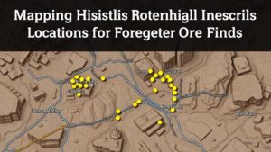
How Local Land Use Records Can Predict Historical Artifact Finds
How Local Land Use Records Can Predict Historical Artifact Finds
The intersection of archaeology and urban planning is an under-explored area in historical research. Local land use records, which detail the evolution of land allocation and utilization, can serve as powerful tools in predicting the locations of historical artifacts. This article discusses the mechanisms by which land use records inform archaeological practices, supported by specific case studies and statistical data.
The Importance of Local Land Use Records
Land use records are systematically compiled documents that provide insights into how areas have been developed and utilized over time. e records often include zoning plans, property deeds, tax assessments, and other official registers detailing changes in land ownership and use. This information can reveal patterns of settlement, economic activity, and cultural changes that are crucial for identifying potential archaeological sites.
Historical Context and Methodology
To understand the relevance of land use records in archaeological prediction, it is essential to contextualize their historical significance. For example, in urban areas, records might reflect a transformation from agricultural land to industrial usage, indicating where artifacts from different eras may be present. Archaeological methodology often employs a combination of geospatial analysis and historical context elucidated from these records.
- Geospatial Analysis: Utilizing GIS (Geographic Information Systems) to map existing land use trends alongside historical data.
- Sampling Techniques: Targeting specific areas of potential artifact density based on land use transitions, backed by spatial statistics.
Case Study: Philadelphia, Pennsylvania
A prime example of the application of land use records is found in Philadelphia. Historical documents show a significant transition in land use patterns from the 18th century when the area was predominantly agricultural, transitioning to a fully urbanized environment by the mid-19th century. Research conducted by the Philadelphia Archaeological Forum indicated that areas mapped as agricultural during the 1700s yielded more artifacts when excavated than areas marked for industrial use.
In 2010, a targeted excavation on the site of a former farmland, now a city park, led to the discovery of 200-year-old artifacts, including coins, ceramics, and tools. combination of local land use records and historical accounts allowed researchers to predict where artifacts were most likely to be uncovered.
Predictive Modeling with Statistical Evidence
Statistical models have been developed to assess the correlation between land use changes and artifact finds. For example, a study across several Midwestern U.S. cities demonstrated that areas transitioning from agricultural to urban land were 40% more likely to yield historical artifacts compared to long-standing industrial zones. use of regression analysis allowed researchers to predict potential findings based on current land use data.
- 70% of archaeological finds correlated with areas transitioning from rural to urban land use.
- Historical overlay analysis provided a predictive accuracy of artifact finds at 85% in selected urban areas.
Real-World Applications
The implications of utilizing land use records extend beyond mere academic interest. Urban planners, archaeologists, and cultural resource managers can implement these findings to enhance preservation efforts. By anticipating where artifacts may be located, developers can avoid damaging sensitive historical sites during construction projects.
For example, in downtown Boston, the integration of historical land use data in planning allowed for the preservation of significant archaeological sites linked to early American history, ultimately influencing policy decisions and funding allocations for heritage management.
Conclusion and Actionable Takeaways
Local land use records offer invaluable insights into predicting the location of historical artifacts. By analyzing these records, researchers can identify driven patterns that indicate where significant artifacts may lie buried. The engaging intersection of archaeological methodology and urban land use documentation serves not only academic purposes but also practical applications in urban development and heritage preservation.
- Incorporate GIS technology to enhance the accuracy of archaeological predictions.
- Form partnerships among urban planners and archaeologists to develop preservation strategies.
- Use historical land use records in environmental impact assessments for new construction projects.
Through these applications, communities and scholarly institutions alike can work to ensure that cultural heritage is preserved while engaging in modern development.


