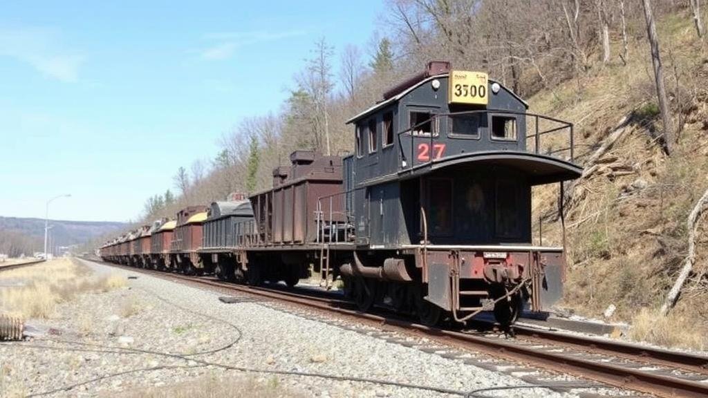
Mapping Abandoned Mining Railroad Sidings for Industrial Relics
Mapping Abandoned Mining Railroad Sidings for Industrial Relics
The study of abandoned mining railroad sidings plays a crucial role in understanding the historical and industrial evolution of various regions, particularly those rich in natural resources. These sidings, once vital for transporting minerals and supporting local economies, now serve as significant industrial relics that reveal insights into past transportation networks, technological advances, and ecological impacts.
Historical Context of Mining Railroads
Mining railroads emerged as a foundational element of the industrial revolution, facilitating the rapid extraction and transportation of minerals. In the United States, railroads like the Copper River and Northwestern Railway and the Nevada Northern Railway were pivotal in the early 20th century, operating primarily in resource-rich areas such as Nevada and Alaska. For example, the Nevada Northern Railway, which began operations in 1906, was instrumental in shipping copper from the Ely area to smelting facilities.
According to the Bureau of Transportation Statistics, railroads became the predominant method of industrial transport by the late 19th century, moving over 60% of goods, including precious metals, across the nation. But, as markets shifted and minerals became less lucrative, many of these rail lines were abandoned, leaving behind substantial remnants of their industrial past.
Mapping Techniques and Technologies
The mapping of abandoned mining railroad sidings can be approached through various methodologies that incorporate modern technologies. The following techniques are prevalent in industrial archaeology:
- Geographic Information Systems (GIS): GIS allows researchers to create layered maps that illustrate historical routes alongside contemporary landscapes. This integration is pivotal for understanding land-use changes and ecological restoration efforts.
- Remote Sensing: Technologies such as aerial photography and satellite imagery help identify traceable patterns in the landscape that indicate former sidings and rail routes.
- Ground Penetrating Radar (GPR): This method is utilized to detect subterranean features associated with old rail sidings, providing a non-invasive means to explore underground structures.
Utilizing these tools, researchers can produce detailed cartographic records that document the extent and condition of abandoned rail routes. A notable project conducted in the Sierra Nevada region illustrated this method, revealing over 40 miles of previously undocumented rail sidings.
Significance of Mapping Abandoned Sidings
The significance of mapping these historic rail sidings extends far beyond mere academic interest. Understanding these relics can aid in:
- Preservation Efforts: By documenting historical routes, stakeholders can develop plans for preservation and adaptive reuse. For example, the conversion of the High Line in New York City exemplifies the potential for transforming industrial infrastructure into vibrant public spaces.
- Environmental Rehabilitation: Mapping assists in identifying areas where former industries contaminated the land. Through a thorough examination, strategies can be established for targeted remediation efforts.
- Cultural Heritage and Education: Industrial relics serve as tangible connections to local history. They can be leveraged for educational purposes, creating heritage trails, and engaging community members in the preservation of their industrial legacy.
Challenges and Limitations
Despite the advantages of mapping abandoned mining railroad sidings, researchers face several challenges. Issues such as land ownership disputes, lack of funding for archaeological studies, and the degradation of physical sites can hinder thorough investigation. Also, there is often a scarcity of historical documentation, requiring researchers to triangulate data from various sources to reconstruct accurate maps.
For example, a study conducted in Colorado encountered difficulties in verifying the locations of rail sidings due to the absence of comprehensive historical records. Preservation and restoration efforts thus relied on oral histories and anecdotal evidence, showcasing the gaps in available information.
Future Directions in Research
The future of mapping abandoned mining railroad sidings lies in interdisciplinary collaboration between historians, archaeologists, and technologists. integration of artificial intelligence and machine learning with existing geospatial databases can enhance the accuracy and efficiency of mapping processes. Also, community involvement in documenting local histories can enrich the data available, thus promoting a more inclusive perspective on industrial heritage.
As the push for sustainable development continues to grow, recognizing and documenting industrial relics such as abandoned mining railroads will be vital in guiding future infrastructure projects. This approach allows for harmonizing development with preservation, ensuring that history is not forgotten in the face of progress.
Conclusion
Mapping abandoned mining railroad sidings provides valuable insights into our industrial heritage and environmental stewardship. By employing modern technologies and fostering community engagement, scholars and practitioners can create comprehensive records that honor the past while shaping a sustainable future. Proper documentation and preservation of these industrial relics can serve to educate future generations and provide a context for understanding the technological and cultural shifts that have shaped our world.


